Category:Bunbury, Cheshire
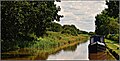
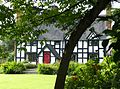
English: Bunbury is a village and civil parish in the unitary authority of Cheshire East and the ceremonial county of Cheshire, England, south of Tarporley, north west of Nantwich, and on the Shropshire Union Canal. According to the 2001 Census, the parish had a population of 1,308.
Galego: Bunbury é unha vila e parroquia civil no condado de Cheshire, Inglaterra, sur de Tarporley, noroeste de Nantwich e na Shropshire Union Canal. Dacordo co censo do 2001, a parroquia tiña unha poboación de 1.308 habitantes.
village and civil parish in Cheshire, UK  | |||||
| Upload media | |||||
| Instance of | |||||
|---|---|---|---|---|---|
| Location | Cheshire East, Cheshire, North West England, England | ||||
 | |||||
Subcategories
This category has the following 6 subcategories, out of 6 total.
B
- St Boniface's Church, Bunbury (34 F)
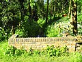
- Bunbury Locks (29 F)
- Bunbury Mill (10 F)
C
- Chantry House, Bunbury (1 F)
D
- Dysart Arms, Bunbury (5 F)
N
- Nags Head, Bunbury (3 F)
Media in category "Bunbury, Cheshire"
The following 129 files are in this category, out of 129 total.
-
 A49 at Bunbury Heath crossroads - geograph.org.uk - 2777073.jpg 640 × 480; 56 KB
-
 A49 entering Bunbury Heath - geograph.org.uk - 2777071.jpg 640 × 480; 77 KB
-
 A49 looking south at Bunbury Heath - geograph.org.uk - 2808898.jpg 640 × 480; 61 KB
-
-
 A49 through Bunbury Heath - geograph.org.uk - 4439791.jpg 640 × 311; 45 KB
-
 A49, Bunbury Heath - geograph.org.uk - 2058471.jpg 640 × 480; 160 KB
-
-
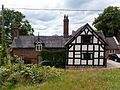
 Birchfield, Bunbury.jpg 1,800 × 1,350; 696 KB
-
 Birds Lane - geograph.org.uk - 2808932.jpg 640 × 480; 100 KB
-
 Birds Lane - geograph.org.uk - 2812088.jpg 640 × 480; 99 KB
-
 Black and White Cottages, Bunbury Lock.jpg 1,800 × 1,350; 671 KB
-
 Brantwood, Bunbury.jpg 1,976 × 1,317; 372 KB
-
 Brook Farmhouse, Bunbury 01.jpg 4,000 × 3,000; 2.61 MB
-
 Brook Farmhouse, Bunbury 02.jpg 4,000 × 3,000; 4.32 MB
-
 Brook House, Bunbury - geograph.org.uk - 5598864.jpg 1,280 × 851; 508 KB
-
 Bunbury - geograph.org.uk - 4299599.jpg 4,320 × 3,240; 2.78 MB
-
 Bunbury Church - geograph.org.uk - 5599180.jpg 851 × 1,280; 403 KB
-
 Bunbury Common - geograph.org.uk - 5598483.jpg 1,280 × 851; 553 KB
-
 Bunbury Cottage and Tudor Cottage, Bunbury.jpg 800 × 600; 200 KB
-
 Bunbury from Beeston Castle (5356) (retouched).jpg 4,288 × 2,848; 4.35 MB
-
 Bunbury from Beeston Castle (5356).jpg 4,288 × 2,848; 4.81 MB
-
 Bunbury Lane, Bunbury - geograph.org.uk - 5598877.jpg 1,280 × 851; 404 KB
-
 Bunbury locks. - geograph.org.uk - 5454624.jpg 640 × 360; 61 KB
-
 Bunbury Mill - geograph.org.uk - 5772728.jpg 1,600 × 1,200; 703 KB
-
 Bunbury Mill, Bunbury - geograph.org.uk - 5540084.jpg 1,500 × 1,000; 1.64 MB
-
 Bunbury Primary School.jpg 2,635 × 1,757; 686 KB
-
 Bunbury School.jpg 4,000 × 3,000; 4.83 MB
-
 Bunbury Village Hall - geograph.org.uk - 2058253.jpg 800 × 600; 254 KB
-
 Bunbury, St. Boniface's Church, Piscina and triple sedilia - geograph.org.uk - 5785226.jpg 5,662 × 3,779; 4.32 MB
-

-

-

-

-

-

-

-
-
 Bunbury, St. Boniface's Church, Roof corbel 1 - geograph.org.uk - 5785329.jpg 7,360 × 4,912; 7.49 MB
-
 Bunbury, St. Boniface's Church, Roof corbel 2 - geograph.org.uk - 5785333.jpg 6,772 × 4,520; 5.84 MB
-

-
-

-

-

-

-

-
 Bunbury, St. Boniface's Church, Stained glass window 1 - geograph.org.uk - 5785291.jpg 4,623 × 6,929; 5.41 MB
-
 Bunbury, St. Boniface's Church, Stained glass window 2 - geograph.org.uk - 5785296.jpg 6,053 × 4,040; 3.33 MB
-
 Bunbury, St. Boniface's Church, Stained glass window 3 - geograph.org.uk - 5785309.jpg 4,438 × 6,649; 5.14 MB
-
 Bunbury, St. Boniface's Church, Stained glass window 4 - geograph.org.uk - 5785311.jpg 5,433 × 3,625; 3.11 MB
-
 Bunbury, St. Boniface's Church, Stained glass window 5 - geograph.org.uk - 5785313.jpg 5,640 × 3,763; 3.01 MB
-
 Bunbury, St. Boniface's Church, Stained glass window 6 - geograph.org.uk - 5785317.jpg 7,116 × 4,750; 6.1 MB
-
 Bunbury, St. Boniface's Church, Stained glass window 7 - geograph.org.uk - 5785319.jpg 6,046 × 4,035; 2.51 MB
-

-

-
 Bunbury, St. Boniface's Church, Stained glass window 9 - geograph.org.uk - 5785323.jpg 4,910 × 7,357; 5.4 MB
-
 Bunbury, St. Boniface's Church, The 'buried statue' - geograph.org.uk - 5785336.jpg 4,329 × 6,487; 6.05 MB
-
 Bunbury, St. Boniface's Church, The font (1663) 1 - geograph.org.uk - 5785193.jpg 7,138 × 4,763; 6.2 MB
-
 Bunbury, St. Boniface's Church, The font (1663) 2 - geograph.org.uk - 5785196.jpg 4,131 × 6,190; 4.81 MB
-

-
 Bunbury, St. Boniface's Church, The nave - geograph.org.uk - 5785184.jpg 7,138 × 4,763; 6.33 MB
-
 Bunbury, St. Boniface's Church, The nave - geograph.org.uk - 5785188.jpg 7,360 × 4,912; 6.3 MB
-
 Bunbury, St. Boniface's Church, The nave - geograph.org.uk - 5785205.jpg 7,172 × 4,786; 7.45 MB
-
 Bunbury, St. Boniface's Church, The nave from the chancel - geograph.org.uk - 5785209.jpg 4,911 × 7,360; 7.46 MB
-
 Bunbury, St. Boniface's Church, The organ - geograph.org.uk - 5785286.jpg 7,360 × 4,912; 7.5 MB
-
 Bunbury, St. Boniface's Church, The pulpit - geograph.org.uk - 5785213.jpg 7,174 × 4,787; 6.01 MB
-
 Bunbury, St. Boniface's Church, Two medieval glass roundels - geograph.org.uk - 5785299.jpg 6,210 × 4,145; 4.43 MB
-

-
 Canal Warehouse - geograph.org.uk - 5772747.jpg 1,600 × 1,200; 386 KB
-
 Chapel Cottage, Bunbury.jpg 4,000 × 3,000; 1.03 MB
-
 Church Bank Cottage, Bunbury.jpg 1,800 × 1,350; 579 KB
-
 Church Cottages, Bunbury - geograph.org.uk - 5599243.jpg 1,280 × 851; 444 KB
-
 Church Cottages, Bunbury.jpg 4,000 × 3,000; 1.38 MB
-
 Church Farmhouse, Bunbury.jpg 1,800 × 1,350; 611 KB
-
 Close up, Elizabeth II postbox on Bunbury Lane, Bunbury - geograph.org.uk - 5251297.jpg 1,043 × 1,965; 373 KB
-
 Close up, Elizabeth II postbox on School Lane, Bunbury - geograph.org.uk - 5251287.jpg 1,079 × 2,115; 459 KB
-
 Co-operative food store and Post Office, Bunbury - geograph.org.uk - 5251312.jpg 2,848 × 2,136; 1.49 MB
-
-
 Darkie Meadow, Bunbury - geograph.org.uk - 5251299.jpg 2,848 × 2,136; 1.39 MB
-
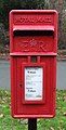
 Elizabeth II postbox on Bunbury Lane, Bunbury - geograph.org.uk - 5251295.jpg 2,848 × 2,136; 1.22 MB
-
 Elizabeth II postbox on School Lane, Bunbury - geograph.org.uk - 5251285.jpg 2,136 × 2,848; 1.38 MB
-
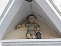 Figure on The Stores, Bunbury, Cheshire.jpg 1,800 × 1,350; 211 KB
-
 Gearing at Bunbury Mill - geograph.org.uk - 5773041.jpg 1,200 × 1,600; 412 KB
-
 Grazing, Tilstone - geograph.org.uk - 5197638.jpg 640 × 431; 40 KB
-
 House at Bunbury Heath - geograph.org.uk - 4885807.jpg 3,749 × 2,761; 1.82 MB
-
 House on School Lane, Bunbury - geograph.org.uk - 5225914.jpg 640 × 480; 102 KB
-
 Houses on School Lane, Bunbury - geograph.org.uk - 5225908.jpg 640 × 480; 65 KB
-
 Internal waterwheel at Bunbury Mill - geograph.org.uk - 5773046.jpg 1,200 × 1,600; 268 KB
-
 Lane and Road Junction at Bunbury Heath - geograph.org.uk - 2858238.jpg 4,000 × 3,000; 2.72 MB
-
 Listed barn at Woodworth Green Farm, Bunbury.jpg 4,000 × 3,000; 5.05 MB
-
 Little Orchard, Bunbury.jpg 1,600 × 1,198; 550 KB
-
 Mill Pond at Bunbury Mill - geograph.org.uk - 5772989.jpg 1,600 × 1,200; 822 KB
-
 Mill stones at Bunbury Mill - geograph.org.uk - 5773028.jpg 1,600 × 1,200; 330 KB
-
 Moss Lane, Bunbury Heath - geograph.org.uk - 2858222.jpg 4,000 × 3,000; 4.02 MB
-
 Old Cottages in Bunbury - geograph.org.uk - 103479.jpg 640 × 435; 144 KB
-
-
 Priestland, Bunbury.jpg 1,800 × 1,350; 689 KB
-
 Row of cottages, Bunbury - geograph.org.uk - 4750128.jpg 640 × 456; 243 KB
-
 Rowton Cottage, Bunbury.jpg 4,000 × 3,000; 1.57 MB
-
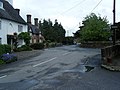
 School Lane, Bunbury - geograph.org.uk - 5225911.jpg 640 × 480; 76 KB
-
 School Lane, Bunbury - geograph.org.uk - 5251289.jpg 2,848 × 2,136; 1.46 MB
-
 School Lane, Bunbury Heath - geograph.org.uk - 2058459.jpg 800 × 480; 211 KB
-
 Sheep at Bunbury - geograph.org.uk - 5598488.jpg 1,280 × 851; 512 KB
-
 Shropshire Union Canal - geograph.org.uk - 5454630.jpg 640 × 325; 92 KB
-
 Signpost in Bunbury - geograph.org.uk - 5598961.jpg 1,280 × 851; 679 KB
-
 St Boniface Church, Bunbury - geograph.org.uk - 5540073.jpg 1,500 × 1,044; 1.14 MB
-
 Tail race from Bunbury Mill - geograph.org.uk - 5773018.jpg 1,600 × 1,200; 849 KB
-
 Thatched cottage and signage at Bunbury - geograph.org.uk - 2390777.jpg 1,600 × 1,198; 388 KB
-
 The Dysart Arms, Bunbury - geograph.org.uk - 5598541.jpg 1,280 × 851; 475 KB
-
 The southern edge of Bunbury Heath - geograph.org.uk - 4271105.jpg 1,024 × 768; 134 KB
-
 Tilstone Bank Lane, Bunbury - geograph.org.uk - 5598096.jpg 1,280 × 851; 568 KB
-
 Tilstone Bank railway bridge - geograph.org.uk - 2864200.jpg 640 × 480; 167 KB
-

-
 Tilstone Fearnall - geograph.org.uk - 5598037.jpg 1,280 × 851; 626 KB
-
 Tilstonebank Cottage.jpg 3,753 × 2,788; 2.37 MB
-
 Track to cricket ground, Bunbury - geograph.org.uk - 5225909.jpg 640 × 480; 67 KB
-
 Trinity Methodist Church, Bunbury - geograph.org.uk - 4299596.jpg 4,320 × 3,240; 2.97 MB
-
 Trinity Methodists Church, Bunbury - geograph.org.uk - 2058267.jpg 800 × 600; 225 KB
-
 Vicarage Lane, Bunbury - geograph.org.uk - 5598880.jpg 1,280 × 851; 458 KB
-
 Victorian postbox, Bunbury Post Office - geograph.org.uk - 5251307.jpg 1,597 × 2,192; 635 KB
-
 Weighing in the grain at Bunbury Mill - geograph.org.uk - 5772786.jpg 1,200 × 1,600; 349 KB
-
 Whitchurch Road, Bunbury Heath - geograph.org.uk - 1914949.jpg 640 × 480; 91 KB
-
 Woodworth Green Farmhouse 01.jpg 4,000 × 3,000; 3.78 MB
-
 Woodworth Green Farmhouse 02.jpg 4,000 × 3,000; 3.18 MB
-
 Ash House Farm, Brindley - geograph.org.uk - 151532.jpg 640 × 480; 135 KB
-
 Lower Spurstow - geograph.org.uk - 221054.jpg 640 × 427; 257 KB
-
 Mere by Woodhey Hall - geograph.org.uk - 214155.jpg 640 × 494; 143 KB
-
 Woodhey Hall - geograph.org.uk - 214158.jpg 640 × 527; 123 KB
-
 Woodworth Green Farm - geograph.org.uk - 220475.jpg 640 × 427; 392 KB


_(retouched).jpg)
.jpg)


_1_-_geograph.org.uk_-_5785236.jpg)
_3_-_geograph.org.uk_-_5785251.jpg)
_4_-_geograph.org.uk_-_5785255.jpg)
_5_-_geograph.org.uk_-_5785263.jpg)
_6_-_geograph.org.uk_-_5785267.jpg)
_7_-_geograph.org.uk_-_5785274.jpg)
_8_-_geograph.org.uk_-_5785279.jpg)
_9_-_geograph.org.uk_-_5785306.jpg)


_1_-_geograph.org.uk_-_5785347.jpg)
_2_-_geograph.org.uk_-_5785350.jpg)
_in_the_centre_of_the_chancel_1_-_geograph.org.uk_-_5785215.jpg)
_in_the_centre_of_the_chancel_2_-_geograph.org.uk_-_5785219.jpg)
_in_the_centre_of_the_chancel_3_-_geograph.org.uk_-_5785222.jpg)
_in_the_centre_of_the_chancel_4_-_geograph.org.uk_-_5785230.jpg)
_-_geograph.org.uk_-_5785295.jpg)


_-_geograph.org.uk_-_5785326.jpg)


_1_-_geograph.org.uk_-_5785193.jpg)
_2_-_geograph.org.uk_-_5785196.jpg)


