Category:Bungalows in the City of Bradford
Media in category "Bungalows in the City of Bradford"
The following 15 files are in this category, out of 15 total.
-
 Armidale Way - Ashbourne Way - geograph.org.uk - 2420595.jpg 640 × 480; 51 KB
-
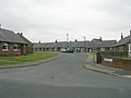
 Ashbourne Crescent - New Park Road - geograph.org.uk - 1497442.jpg 640 × 480; 213 KB
-
 Ashbourne Crescent - New Park Road - geograph.org.uk - 1497447.jpg 640 × 480; 207 KB
-
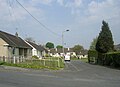
 Bradford Road, Clayton - geograph.org.uk - 392648.jpg 640 × 480; 99 KB
-
 Browcliffe - Breakmoor Avenue - geograph.org.uk - 1514043.jpg 640 × 480; 71 KB
-
 Caythorpe Walk - Park Road - geograph.org.uk - 2373250.jpg 640 × 462; 53 KB
-

-
 Highgate Close - Lingfield Terrace - geograph.org.uk - 2955810.jpg 640 × 480; 56 KB
-
 Jacmil - Tong Lane - geograph.org.uk - 2323865.jpg 640 × 486; 114 KB
-
 Middlebrook Crescent, Bradford - geograph.org.uk - 5092284.jpg 1,600 × 1,067; 574 KB
-
 Middlebrook Drive - geograph.org.uk - 5092264.jpg 1,600 × 1,067; 469 KB
-
 New Bungalow, Knowle Farm - geograph.org.uk - 3009846.jpg 640 × 450; 53 KB
-
 Sayle Avenue - Hambledon Avenue - geograph.org.uk - 1460317.jpg 640 × 480; 191 KB
-
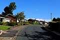
 Snape Drive - Great Horton Road - geograph.org.uk - 1083685.jpg 640 × 446; 179 KB
-
 Southfield Lane, Bradford - geograph.org.uk - 5183248.jpg 1,600 × 1,065; 662 KB


