Category:Burchtstraat 2 (Groningen)
| Object location | | View all coordinates using: OpenStreetMap |
|---|
 | |||||
| Upload media | |||||
| Instance of | |||||
|---|---|---|---|---|---|
| Location | Groningen, Netherlands | ||||
| Heritage designation |
| ||||
 | |||||
|
This is a category about rijksmonument number 18438
|
| Address |
|
Media in category "Burchtstraat 2 (Groningen)"
The following 4 files are in this category, out of 4 total.
-
 Groningen Kleine Gelkingestraat 2.JPG 2,448 × 3,264; 1.51 MB
-
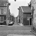 Overzicht Burchtstraat- Kleine Gelkingestr. - Groningen - 20092169 - RCE.jpg 1,193 × 1,200; 303 KB
-
 Overzicht Kleine Gelkingestraat-Zuiderdiep - Groningen - 20092263 - RCE.jpg 1,192 × 1,200; 269 KB
-
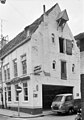 Voor- en zijgevel - Groningen - 20093644 - RCE.jpg 841 × 1,200; 190 KB


