Category:Burgess Shale
English: Burgess Shale Formation is a Middle Cambrian age (505 million years old) geologic formation comprised of a black shale which crops out at a number of localities near the town of Field in the Canadian Rockies in the Yoho National Park of British Columbia, Canada. The formation is famous for the exceptional preservation of the fossils found within it, in which the soft parts are preserved.
fossil-bearing rock formation in the Canadian Rockies  | |||||
| Upload media | |||||
| Instance of | |||||
|---|---|---|---|---|---|
| Named after | |||||
| Made from material | |||||
| Located in protected area | |||||
| Location | |||||
| Heritage designation |
| ||||
 | |||||
Subcategories
This category has the following 15 subcategories, out of 15 total.
*
- Mt. Stephen Trilobite Beds (8 F)
- Ogygopsis Shale (3 F)
- Tulip Beds, Burgess Shale (2 F)
+
- Burgess Shale maps (3 F)
D
F
M
P
~
Media in category "Burgess Shale"
The following 35 files are in this category, out of 35 total.
-
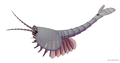 20211025 Waptia fieldensis.png 2,300 × 1,200; 683 KB
-
 Aysheaia pedunculata2021.jpg 4,800 × 2,000; 5.76 MB
-
 Burgess community.gif 675 × 374; 57 KB
-
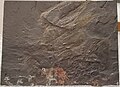
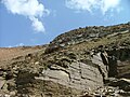
 Burgess Shale detail.jpg 3,000 × 4,000; 8.43 MB
-
 Burgess Shale Fossils.jpg 2,048 × 1,360; 1.66 MB
-
 Burgess Shale from Emerald Lake.jpg 2,048 × 1,536; 793 KB
-
 Burgess Shale poster in Emerald Lake 01.jpg 1,098 × 1,027; 352 KB
-
 Burgess Shale poster in Emerald Lake 03.jpg 2,048 × 1,536; 955 KB
-
 Burgess Shale poster in Emerald Lake 04.jpg 2,048 × 1,536; 880 KB
-
 Burgess Shale poster in Emerald Lake 05.jpg 2,048 × 1,536; 707 KB
-
 Burgess Shale poster in Emerald Lake 06.jpg 2,048 × 1,536; 661 KB
-
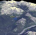 Burgess Shale, Canada (ASTER).jpg 1,489 × 1,459; 288 KB
-
 Burgess Shale, Yoho National Park of Canada (cropped).jpg 519 × 507; 220 KB
-
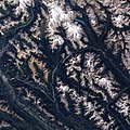 Burgess Shale, Yoho National Park of Canada.jpg 2,400 × 2,400; 3.44 MB
-
 Burgess Shale, Yoho National Park.jpg 4,000 × 3,000; 7.63 MB
-
 Canadaspis perfecta 20221227.jpg 1,180 × 860; 335 KB
-
 Jean-Bernard Caron in the field in at the Burgess Shale.jpeg 1,045 × 994; 1.09 MB
-

-
 EZ and UE.jpg 2,816 × 2,120; 1.47 MB
-
-
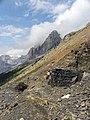
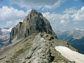 Fossil Ridge.jpg 2,816 × 2,120; 1.5 MB
-
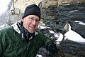 John R Foster paleontologist.jpg 604 × 401; 63 KB
-
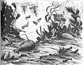
 Knight Burgess Shale 2.jpg 298 × 452; 41 KB
-
 Knight Burgess Shale.jpg 1,600 × 1,238; 504 KB
-
 Marrella splendens 20221227.jpg 1,128 × 1,246; 373 KB
-
 MtStephenAugust2009.JPG 4,000 × 3,000; 1.93 MB
-

-
 Ottoia prolifica 20221227.jpg 1,170 × 792; 363 KB
-
 Pair of Anomalocaris preform a mating ritual in the water column.jpg 1,365 × 604; 281 KB
-
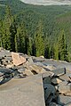
 Raymond quarry.jpg 2,816 × 2,120; 1.5 MB
-
 Scenella amii 20221227.jpg 755 × 567; 241 KB
-
 Trilobite Beds view.jpg 1,820 × 2,711; 1.38 MB
-
 Tulip beds location and exposures PLoS ONE 7(1) e29233 fig 1.TIF 2,068 × 2,137; 8.17 MB
-
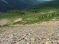 Walcott talus.jpg 2,816 × 2,120; 1.45 MB
-
 WalcottQuarry080509.jpg 3,000 × 4,000; 7.74 MB


.jpg)
.jpg)


,_Sidney_Stevens_Walcott_(1892-1977),_and_Helen_Breese_Walcott_(1894-1965).jpg)


,_Leanchoilia,_Pollinchera,_Canadaspis.jpg)


