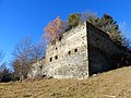
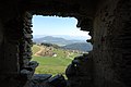
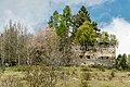
Category:Burgruine Gradenegg, Liebenfels
| This category shows the protected monument with the number 34608 in Austria. (Commons, de, Wikidata) |
| Object location | | View all coordinates using: OpenStreetMap |
|---|
castle ruin  | |||||
| Upload media | |||||
| Instance of | |||||
|---|---|---|---|---|---|
| Location | Liebenfels, Sankt Veit an der Glan District, Carinthia, Austria | ||||
| Street address |
| ||||
| Heritage designation | |||||
 | |||||
Media in category "Burgruine Gradenegg, Liebenfels"
The following 20 files are in this category, out of 20 total.
-
 Burgruine Gradenegg.jpg 4,209 × 2,555; 2.49 MB
-
 Gradenegg Bergfried SW.JPG 3,000 × 4,000; 4.31 MB
-
 Gradenegg Bergfried v NW.JPG 3,000 × 4,000; 4.36 MB
-
 Gradenegg Fenster S.JPG 3,000 × 4,000; 4.22 MB
-
 Gradenegg Fenster Zwinger.JPG 3,000 × 4,000; 4.05 MB
-
 Gradenegg NO Gewölbe.JPG 3,000 × 4,000; 4.01 MB
-
 Gradenegg NO-Ecke.JPG 4,000 × 3,000; 4.94 MB
-
 Gradenegg Palas N.JPG 3,000 × 4,000; 4.09 MB
-
 Gradenegg Palas O.JPG 4,000 × 3,000; 5.14 MB
-
 Gradenegg Palas OS.JPG 3,000 × 4,000; 4.17 MB
-
 Gradenegg Palas SW.JPG 3,000 × 4,000; 4.24 MB
-
 Gradenegg Palas W.JPG 3,000 × 4,000; 4.3 MB
-
 Gradenegg SO.JPG 4,000 × 3,000; 4.96 MB
-
 Gradenegg SW.JPG 4,000 × 3,000; 5.03 MB
-
 Gradenegg südl v Bergfried.JPG 4,000 × 3,000; 5.02 MB
-
 Gradenegg Tor.JPG 4,000 × 3,000; 4.81 MB
-
 Gradenegg Burgruine 15042007 16.jpg 3,872 × 2,592; 820 KB
-
 Liebenfels Gradenegg Burgruine Bergfried 15042007 12.jpg 3,728 × 2,416; 1.89 MB
-
 Liebenfels Gradenegg Burgruine Bergfried 15042007 13.jpg 2,592 × 3,872; 2.2 MB
-
 Liebenfels Gradenegg Burgruine SSO-Ansicht 25042017 5128.jpg 4,928 × 3,280; 13.7 MB


