Category:Burstwick
English: Burstwick is a village and civil parish in the Holderness region of the East Riding of Yorkshire, England. It is situated about 8 miles (13 km) east of Hull city centre. It lies on the B1362 road.
village in the United Kingdom  | |||||
| Upload media | |||||
| Instance of | |||||
|---|---|---|---|---|---|
| Location | East Riding of Yorkshire, Yorkshire and the Humber, England | ||||
 | |||||
Subcategories
This category has the following 7 subcategories, out of 7 total.
A
- All Saints Church, Burstwick (8 F)
B
- Burstwick War Memorial (1 F)
K
- Keyingham Drain in Burstwick (10 F)
S
Media in category "Burstwick"
The following 200 files are in this category, out of 402 total.
(previous page) (next page)-
 "Anybody at home" - geograph.org.uk - 588326.jpg 640 × 480; 78 KB
-
 'Get the fire lit, there's an awful draft from somewhere^' - geograph.org.uk - 3395695.jpg 3,448 × 4,592; 4.24 MB
-
 'Hello, anybody at home^' - geograph.org.uk - 3395675.jpg 3,448 × 4,592; 4.39 MB
-
 'Ridgmont', Burstwick 1865 (archive ref DDX1713-1) (29122663726).jpg 816 × 592; 147 KB
-
 A building at Newbridge fishing lake - geograph.org.uk - 2745908.jpg 800 × 600; 135 KB
-
 A Burstwick Gravel Pond - geograph.org.uk - 1426183.jpg 640 × 480; 120 KB
-
 A Burstwick Pond - geograph.org.uk - 1426867.jpg 640 × 480; 127 KB
-
 A Burstwick Pond at Sunset - geograph.org.uk - 1426188.jpg 528 × 640; 74 KB
-
 A farmhouse - geograph.org.uk - 20951.jpg 640 × 480; 108 KB
-
 A footpath off Newbridge Road - geograph.org.uk - 2745911.jpg 800 × 600; 148 KB
-
 A New Lake - geograph.org.uk - 2515822.jpg 2,886 × 2,520; 1.86 MB
-

-
 A Quick Turnaround - geograph.org.uk - 1414475.jpg 640 × 480; 181 KB
-
 A ruined farmhouse near New York - geograph.org.uk - 2195670.jpg 800 × 600; 296 KB
-
 A rural office - geograph.org.uk - 20946.jpg 640 × 471; 119 KB
-
 A rusting Morris Minor in Burstwick - geograph.org.uk - 4364231.jpg 1,600 × 1,062; 967 KB
-
 All Saints' church - geograph.org.uk - 2308496.jpg 640 × 427; 77 KB
-
 All Saints' church - geograph.org.uk - 2308499.jpg 640 × 427; 92 KB
-
 All Saints' church, Burstwick - geograph.org.uk - 5508889.jpg 1,024 × 768; 165 KB
-
 Allotments off Hariff Lane, Burstwick - geograph.org.uk - 4364272.jpg 1,600 × 1,062; 672 KB
-
 Alongside Hariff Lane - geograph.org.uk - 5697649.jpg 1,024 × 768; 177 KB
-
 Alongside Nuttles Drain - geograph.org.uk - 5623372.jpg 1,024 × 768; 186 KB
-
 Appleby Lane, Burstwick - geograph.org.uk - 2100652.jpg 800 × 600; 335 KB
-
 Arable and Flat Land - geograph.org.uk - 1094122.jpg 640 × 480; 67 KB
-
 Ascend at your Peril^ - geograph.org.uk - 3395682.jpg 3,448 × 4,592; 4.71 MB
-
 Autumnal Trees - geograph.org.uk - 2670191.jpg 4,032 × 3,024; 5.21 MB
-
 B1362 towards Burstwick - geograph.org.uk - 1893881.jpg 640 × 480; 92 KB
-

-
 B1362 towards Withernsea - geograph.org.uk - 1893919.jpg 640 × 480; 96 KB
-
 Backlit Footbridge - geograph.org.uk - 1414500.jpg 640 × 422; 59 KB
-
 Backlit Teasels - geograph.org.uk - 1414496.jpg 640 × 638; 73 KB
-
 Barley on the left, Wheat on the right - geograph.org.uk - 5408650.jpg 4,608 × 3,456; 2.95 MB
-
 Black Bank - geograph.org.uk - 2457253.jpg 3,648 × 2,736; 2.58 MB
-
 Black Bank near Eastholme Bridge - geograph.org.uk - 279008.jpg 473 × 640; 116 KB
-
 Blocked bridge near Totley's Farm - geograph.org.uk - 278995.jpg 479 × 640; 175 KB
-
 Boat on Burstwick Pond - geograph.org.uk - 1821114.jpg 2,852 × 1,928; 1.21 MB
-
 Bridge over the Burstwick Drain - geograph.org.uk - 1993537.jpg 800 × 600; 335 KB
-
 Bridleway alongside Burstwick Drain - geograph.org.uk - 5508913.jpg 1,024 × 768; 197 KB
-
 Bridleway and Halsham Drain - geograph.org.uk - 4331455.jpg 1,024 × 768; 164 KB
-
 Bridleway beside Burstwick Drain - geograph.org.uk - 1893897.jpg 640 × 480; 77 KB
-
 Bridleway beside Burstwick Drain - geograph.org.uk - 1893900.jpg 640 × 480; 72 KB
-

-
 Bridleway near to Nuthill - geograph.org.uk - 2401893.jpg 3,456 × 2,621; 3.61 MB
-
 Bullocks near Burstwick - geograph.org.uk - 5078534.jpg 640 × 529; 183 KB
-
 Bulrush Silhouettes - geograph.org.uk - 1826812.jpg 2,600 × 2,336; 1.18 MB
-
 Bulrushes on Burstwick Pond - geograph.org.uk - 1825597.jpg 1,880 × 1,637; 1.37 MB
-
 Bungalow on Hariff Lane, Burstwick - geograph.org.uk - 4364312.jpg 1,600 × 1,062; 613 KB
-
 Burstwick (Ski) Pond - geograph.org.uk - 1344601.jpg 640 × 480; 126 KB
-
 Burstwick bullocks - geograph.org.uk - 5078504.jpg 640 × 511; 184 KB
-
 Burstwick Castle - geograph.org.uk - 209312.jpg 640 × 395; 114 KB
-
 Burstwick Castle - geograph.org.uk - 209326.jpg 640 × 431; 99 KB
-
 Burstwick Community Primary School - geograph.org.uk - 481296.jpg 640 × 441; 65 KB
-
 Burstwick Country Golf Course - geograph.org.uk - 1893916.jpg 640 × 480; 65 KB
-
 Burstwick Country Golf Course - geograph.org.uk - 329817.jpg 640 × 440; 76 KB
-
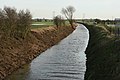 Burstwick Drain - East - geograph.org.uk - 674229.jpg 640 × 427; 75 KB
-
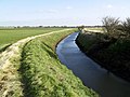
 Burstwick Drain - geograph.org.uk - 1893891.jpg 640 × 480; 85 KB
-
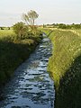
 Burstwick Drain - geograph.org.uk - 408425.jpg 640 × 480; 123 KB
-
 Burstwick Drain - geograph.org.uk - 481305.jpg 640 × 446; 80 KB
-
 Burstwick Drain - geograph.org.uk - 721996.jpg 640 × 480; 91 KB
-
 Burstwick Drain - geograph.org.uk - 722013.jpg 640 × 480; 92 KB
-
 Burstwick Drain - geograph.org.uk - 857618.jpg 480 × 640; 99 KB
-
 Burstwick Drain east of Hedon - geograph.org.uk - 5064161.jpg 1,200 × 799; 577 KB
-
 Burstwick Drain east of Hedon - geograph.org.uk - 5064241.jpg 1,200 × 799; 517 KB
-
 Burstwick Drain east of old railway - geograph.org.uk - 1094009.jpg 640 × 480; 59 KB
-
 Burstwick Drain looking westwards - geograph.org.uk - 721984.jpg 640 × 480; 114 KB
-
 Burstwick Drain near Hall Bridge - geograph.org.uk - 1107104.jpg 640 × 554; 216 KB
-
 Burstwick Drain Railway Bridge - geograph.org.uk - 271804.jpg 477 × 640; 109 KB
-
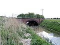 Burstwick Drain Railway Bridge - geograph.org.uk - 407232.jpg 640 × 480; 99 KB
-
 Burstwick Drain railway bridge. - geograph.org.uk - 11949.jpg 640 × 480; 155 KB
-
 Burstwick Drain toward Hedon - geograph.org.uk - 1094007.jpg 640 × 480; 60 KB
-
 Burstwick Drain, east of Hedon - geograph.org.uk - 1107142.jpg 640 × 426; 187 KB
-
 Burstwick Drain, Hedon - geograph.org.uk - 481346.jpg 433 × 640; 128 KB
-
 Burstwick Fishing Pond - geograph.org.uk - 2474672.jpg 4,032 × 3,024; 3.97 MB
-
 Burstwick Golf Course - geograph.org.uk - 722028.jpg 640 × 386; 46 KB
-
 Burstwick House above the nettles - geograph.org.uk - 5508901.jpg 1,024 × 768; 250 KB
-
 Burstwick Industrial Estate - geograph.org.uk - 2738188.jpg 640 × 480; 62 KB
-
 Burstwick Main Pond - geograph.org.uk - 2474667.jpg 3,673 × 2,777; 3.12 MB
-
 Burstwick Main Pond at Sunset - geograph.org.uk - 2389136.jpg 3,648 × 2,736; 2.27 MB
-
 Burstwick Pond's Headquarters - geograph.org.uk - 1426857.jpg 640 × 406; 124 KB
-
 Burstwick service Station - geograph.org.uk - 11938.jpg 640 × 480; 94 KB
-
 Burstwick UK parish locator map.svg 1,425 × 1,107; 1.68 MB
-
 Burstwick Village Hall - geograph.org.uk - 11934.jpg 640 × 480; 78 KB
-
 Burstwick Village Hall - geograph.org.uk - 5508893.jpg 1,024 × 768; 172 KB
-
 Burstwick War Memorial - geograph.org.uk - 6240482.jpg 3,456 × 4,608; 4.35 MB
-
 Camerton and Burstwick, aerial 2014 - geograph.org.uk - 3874151.jpg 1,024 × 683; 118 KB
-
 Church Lane, Burstwick - geograph.org.uk - 765452.jpg 640 × 475; 111 KB
-
 Church Row, Church Lane - geograph.org.uk - 2738186.jpg 640 × 480; 70 KB
-

-

-
 Cottage on Hariff Lane, Burstwick - geograph.org.uk - 4364259.jpg 1,600 × 1,062; 700 KB
-
 Cottages in Burstwick - geograph.org.uk - 1094082.jpg 640 × 480; 58 KB
-
 Cows and Fields - geograph.org.uk - 674256.jpg 640 × 427; 70 KB
-
 Crossed Off - geograph.org.uk - 1344582.jpg 640 × 514; 109 KB
-
 Crumbling Brickwork - geograph.org.uk - 2515800.jpg 2,588 × 3,403; 1.81 MB
-
 Curved Ditch - geograph.org.uk - 588297.jpg 640 × 480; 128 KB
-
 Cycle route near Hedon - geograph.org.uk - 1930583.jpg 640 × 480; 57 KB
-
 Dairy House Lane - geograph.org.uk - 5656427.jpg 1,024 × 768; 183 KB
-
 Deep ploughed field - geograph.org.uk - 5508921.jpg 1,024 × 768; 214 KB
-
 Demolition is Due - geograph.org.uk - 4114170.jpg 3,648 × 2,736; 2.16 MB
-
 Derelict Farmhouse - geograph.org.uk - 588332.jpg 640 × 480; 106 KB
-
 Derelict Farmhouse - geograph.org.uk - 588334.jpg 640 × 480; 103 KB
-
 Derelict house on Hariff Lane, Burstwick - geograph.org.uk - 4364216.jpg 1,600 × 1,062; 594 KB
-
 Distant Burstwick Bungalows - geograph.org.uk - 5478996.jpg 4,032 × 3,024; 3.84 MB
-
 Disused farm buildings near Burstwick - geograph.org.uk - 4364634.jpg 1,600 × 1,062; 843 KB
-
 Ditch south of East Carr Bridge - geograph.org.uk - 5364961.jpg 4,608 × 3,456; 4.34 MB
-
 Ditch south of East Carr Bridge - geograph.org.uk - 5364966.jpg 4,436 × 3,328; 3.06 MB
-
 Drain near Weghill - geograph.org.uk - 5832318.jpg 1,024 × 768; 183 KB
-
 Drain next to East Carr Road - geograph.org.uk - 1426886.jpg 480 × 640; 116 KB
-
 Dried up Pond - geograph.org.uk - 2415229.jpg 4,032 × 3,024; 5.03 MB
-
 Dyke and trees, Nuthill - geograph.org.uk - 3869582.jpg 640 × 426; 212 KB
-
 East Carr Bridge, Burstwick - geograph.org.uk - 278992.jpg 640 × 480; 112 KB
-
 East Carr Road - geograph.org.uk - 1426840.jpg 480 × 640; 169 KB
-
 East Carr Road, Burstwick - geograph.org.uk - 251340.jpg 640 × 480; 87 KB
-
 East End Road, Burstwick, Yorkshire - geograph.org.uk - 4172695.jpg 3,090 × 2,264; 2.58 MB
-
 Eastholme Bridge - geograph.org.uk - 4331448.jpg 1,024 × 768; 204 KB
-
 Eastholme Bridge - geograph.org.uk - 717825.jpg 640 × 459; 97 KB
-

-
 Eastholme Lane, near Halsham - geograph.org.uk - 5078330.jpg 640 × 442; 206 KB
-
 Eastholme, Burstwick - geograph.org.uk - 973918.jpg 640 × 407; 43 KB
-
 Edge of plantation from farm track - geograph.org.uk - 6239636.jpg 4,608 × 3,456; 5.17 MB
-
 Electricity pole and stubble field - geograph.org.uk - 5508929.jpg 1,024 × 768; 148 KB
-
 Ellifoot Bridge, Burstwick - geograph.org.uk - 269591.jpg 480 × 640; 127 KB
-
 Ellifoot Lane into Burstwick - geograph.org.uk - 2100647.jpg 800 × 600; 294 KB
-
 Ellifoot Lane, Burstwick - geograph.org.uk - 1107131.jpg 640 × 459; 206 KB
-
 Entrance road to Kelsey Gardens - geograph.org.uk - 4364373.jpg 1,600 × 1,062; 787 KB
-
 Entrance road to Kelsey Gardens - geograph.org.uk - 4364638.jpg 1,600 × 1,062; 770 KB
-
 Entrance road to Kelsey Gardens - geograph.org.uk - 4364640.jpg 1,600 × 1,062; 719 KB
-
 Entrance road to Kelsey Gardens - geograph.org.uk - 4364653.jpg 1,600 × 1,062; 910 KB
-
 Excavator in a Field - geograph.org.uk - 2457260.jpg 2,736 × 3,648; 2.62 MB
-
 Farm at Nut Hill - geograph.org.uk - 1094100.jpg 640 × 480; 56 KB
-
 Farm at Winter Hill - geograph.org.uk - 1094107.jpg 640 × 480; 62 KB
-
 Farm building, South Park Farm - geograph.org.uk - 1893890.jpg 640 × 480; 76 KB
-
 Farm track near Burstwick - geograph.org.uk - 5078507.jpg 513 × 640; 199 KB
-
 Farm track near Wadworth Hill - geograph.org.uk - 1893925.jpg 640 × 480; 71 KB
-
 Farm track toward South Park Farm - geograph.org.uk - 6239632.jpg 4,608 × 3,456; 3.91 MB
-
 Farmland near Eastholme Farm - geograph.org.uk - 1894657.jpg 640 × 480; 99 KB
-
 Farmland near Eastholme Farm - geograph.org.uk - 1894663.jpg 640 × 480; 64 KB
-
 Farmland near Forkerleys Farm - geograph.org.uk - 1893879.jpg 640 × 480; 60 KB
-
 Farmland near Hedon - geograph.org.uk - 1930588.jpg 640 × 480; 74 KB
-
 Farmland near Nuthill Farm - geograph.org.uk - 1893888.jpg 640 × 480; 58 KB
-
 Farmland near Wadworth Hill - geograph.org.uk - 1893931.jpg 640 × 480; 55 KB
-
 Farmland west of Burstwick - geograph.org.uk - 1893905.jpg 640 × 480; 56 KB
-

-
 Field boundary - geograph.org.uk - 588314.jpg 640 × 480; 116 KB
-
 Field edge path - geograph.org.uk - 588322.jpg 640 × 480; 139 KB
-
 Field edge path - geograph.org.uk - 588323.jpg 640 × 480; 143 KB
-
 Field edge track toward Burstwick Drain - geograph.org.uk - 6239642.jpg 4,608 × 3,456; 4.52 MB
-
 Field near to Nuthill Farm - geograph.org.uk - 2401890.jpg 3,648 × 2,736; 3.48 MB
-
 Field side path - geograph.org.uk - 588304.jpg 640 × 480; 133 KB
-
 Field View - geograph.org.uk - 1426900.jpg 480 × 640; 105 KB
-
 Finger post at Kelsey Gardens, Burstwick - geograph.org.uk - 4364660.jpg 1,600 × 1,074; 1.28 MB
-

-
 Flooded Field - geograph.org.uk - 1072626.jpg 480 × 640; 174 KB
-
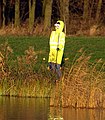 Fluorescent Forlorn Fake Fisherman - geograph.org.uk - 1072597.jpg 561 × 640; 149 KB
-
 Footbridge and field side path - geograph.org.uk - 588311.jpg 640 × 480; 102 KB
-
 Footbridge on the Lelley to Preston Path - geograph.org.uk - 514797.jpg 640 × 480; 101 KB
-
 Footbridge over Burstwick Drain - geograph.org.uk - 1893896.jpg 640 × 480; 80 KB
-
 Footbridge over Keyingham Drain - geograph.org.uk - 5064359.jpg 1,200 × 799; 454 KB
-
 Footpath along a drain - geograph.org.uk - 1979823.jpg 800 × 600; 180 KB
-
 Footpath and line of trees - geograph.org.uk - 5832337.jpg 1,024 × 768; 208 KB
-
 Footpath and Trees north of Nuthill Farm - geograph.org.uk - 5408654.jpg 4,608 × 3,456; 3.3 MB
-
 Footpath Bridge - geograph.org.uk - 2415264.jpg 3,024 × 4,032; 3.6 MB
-
 Footpath on the path to Weghill - geograph.org.uk - 5832315.jpg 1,024 × 768; 211 KB
-
 Footpath to Burstwick - geograph.org.uk - 1414492.jpg 480 × 640; 114 KB
-
 Footpath to Lelley - geograph.org.uk - 2421264.jpg 4,032 × 3,024; 4.14 MB
-
 Footpath to Lelley - geograph.org.uk - 514783.jpg 640 × 480; 123 KB
-
 Footpath to North Park farm - geograph.org.uk - 6240475.jpg 4,608 × 3,456; 5.21 MB
-
 Gas Pipeline - geograph.org.uk - 588298.jpg 640 × 409; 96 KB
-

-
 Gated bridleway, near Burstwick - geograph.org.uk - 5078506.jpg 640 × 480; 172 KB
-
 Gates across a farm track - geograph.org.uk - 5508861.jpg 1,024 × 768; 259 KB
-
 Golfers at Burstwick - geograph.org.uk - 5078533.jpg 640 × 435; 190 KB
-
 Golfers' Bridge - geograph.org.uk - 721991.jpg 640 × 480; 98 KB
-
 Grain store at New York Farm - geograph.org.uk - 5832305.jpg 1,024 × 768; 111 KB
-
 Grassy track near Old Hall Farm - geograph.org.uk - 5656358.jpg 1,024 × 768; 224 KB
-
 Gravel ponds - geograph.org.uk - 1979837.jpg 800 × 600; 173 KB
-
 Gravelpit Drain - geograph.org.uk - 278989.jpg 640 × 476; 81 KB
-
 Gravelpit Drain, Burstwick - geograph.org.uk - 973929.jpg 640 × 462; 109 KB
-
 Green - geograph.org.uk - 264545.jpg 640 × 456; 66 KB
-
 Greens Lane, Burstwick - geograph.org.uk - 269586.jpg 480 × 640; 102 KB
-
 Hallfield, Burstwick - geograph.org.uk - 298228.jpg 640 × 479; 93 KB
-
 Halsham Drain - geograph.org.uk - 4331456.jpg 1,024 × 768; 168 KB
-
 Halsham Drain - geograph.org.uk - 5078386.jpg 640 × 509; 176 KB
-
 Halsham Drain from the B1362 - geograph.org.uk - 2213166.jpg 800 × 600; 177 KB
-
 Halsham to Burstwick Road. - geograph.org.uk - 23552.jpg 640 × 480; 114 KB
-
 Hariff Lane Farm - geograph.org.uk - 1930603.jpg 640 × 480; 55 KB
-
 Hariff Lane Farm - geograph.org.uk - 5697647.jpg 1,024 × 768; 165 KB
-
 Hariff Lane Farm - geograph.org.uk - 765440.jpg 470 × 640; 138 KB
-
 Hariff Lane towards Burstwick - geograph.org.uk - 1930606.jpg 640 × 480; 66 KB
-
 Harvested Field south of Newbridge Road - geograph.org.uk - 1426164.jpg 640 × 480; 141 KB
-
 Harvested wheat field and Forkerleys Farm - geograph.org.uk - 5508931.jpg 1,024 × 768; 198 KB
-
 Hedon Salads - geograph.org.uk - 269598.jpg 640 × 405; 51 KB
-
 Hill north of Burstwick - geograph.org.uk - 4666235.jpg 640 × 498; 361 KB
-
 Hinderset Hill, Burstwick - geograph.org.uk - 319601.jpg 640 × 519; 105 KB
-
 Houses on Hariff Lane, Burstwick - geograph.org.uk - 4364187.jpg 1,600 × 1,062; 711 KB
-
 Imminent Collapse - geograph.org.uk - 2415277.jpg 480 × 640; 108 KB
-
 Ings Drain - geograph.org.uk - 298071.jpg 640 × 477; 131 KB
-
 Inquisitive Observer - geograph.org.uk - 893528.jpg 640 × 519; 99 KB
-
 Keldy Hill Wind Turbines - geograph.org.uk - 5364956.jpg 4,179 × 3,118; 3.4 MB
-
 Kelsey Hill Gravel Pit, Burstwick - geograph.org.uk - 216050.jpg 640 × 480; 105 KB


_(29122663726).jpg)


_Pond_-_geograph.org.uk_-_1344601.jpg)


