Category:Burtholme
English: Burtholme is a hamlet and civil parish in the City of Carlisle in Cumbria, England, and a family name originally linked to the place. At the 2001 census it had a population of 184. Burtholme Beck is a significant point on Hadrian's Wall.
hamlet and civil parish in Cumbria, England, United Kingdom .jpg) | |||||
| Upload media | |||||
| Instance of | |||||
|---|---|---|---|---|---|
| Location | Carlisle, Cumbria, North West England, England | ||||
| Population |
| ||||
 | |||||
Subcategories
This category has the following 2 subcategories, out of 2 total.
B
L
Media in category "Burtholme"
The following 200 files are in this category, out of 274 total.
(previous page) (next page)-

-

-

-

-

-

-

-

-

-

-

-

-

-

-

-
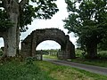
 A view through the arch - geograph.org.uk - 3476503.jpg 640 × 480; 94 KB
-
 Abbey Farm with Priory beyond - geograph.org.uk - 3477432.jpg 640 × 453; 59 KB
-
 Banks Foot - geograph.org.uk - 1835514.jpg 600 × 450; 214 KB
-
 Banks Turret (Hadrian's Wall 52a) - geograph.org.uk - 6446121.jpg 2,000 × 1,396; 3.01 MB
-
 Bridge over the River Irthing - geograph.org.uk - 3190985.jpg 640 × 480; 600 KB
-
 Building at Haytongate - geograph.org.uk - 2886853.jpg 800 × 600; 143 KB
-
 Buildings at Haytongate - geograph.org.uk - 4115585.jpg 4,396 × 3,272; 6.21 MB
-
 Bullocks in dappled shade - geograph.org.uk - 269414.jpg 640 × 480; 242 KB
-
 Burthinghurst - geograph.org.uk - 4609294.jpg 640 × 427; 329 KB
-
 Burtholme Beck (geograph 3588398).jpg 1,280 × 853; 278 KB
-
 Burtholme Beck (geograph 3588407).jpg 1,280 × 853; 185 KB
-
 Burtholme Beck (geograph 3778530).jpg 640 × 480; 95 KB
-
 Burtholme Beck (geograph 3778536).jpg 640 × 480; 97 KB
-
 Bus stop and entrance to Priory - geograph.org.uk - 3478061.jpg 640 × 374; 52 KB
-
 By The Wayside - geograph.org.uk - 3190998.jpg 640 × 481; 792 KB
-
 Carling Gill near Crookstown - geograph.org.uk - 1835471.jpg 600 × 450; 435 KB
-
 Cattle on the line of Hadrian's Wall - geograph.org.uk - 3588455.jpg 1,280 × 853; 288 KB
-
 Child's Tomb, Lanercost Priory - geograph.org.uk - 3190932.jpg 640 × 480; 428 KB
-
 Church Entrance - geograph.org.uk - 3183993.jpg 768 × 1,024; 256 KB
-
 Church of St Mary Magdalene - geograph.org.uk - 3183970.jpg 1,024 × 768; 227 KB
-
 Contorted willow tree on Burtholme Beck (geograph 3778274).jpg 480 × 640; 115 KB
-
 Cottages at Banks - geograph.org.uk - 1835524.jpg 600 × 450; 245 KB
-
 Crookstown - geograph.org.uk - 1835467.jpg 600 × 450; 283 KB
-
 Crookstown - geograph.org.uk - 1835468.jpg 600 × 450; 289 KB
-
 Dacre Hall - August 2016 - geograph.org.uk - 5069744.jpg 821 × 1,250; 878 KB
-
 DIY tearoom at Haytongate Farm - geograph.org.uk - 983230.jpg 480 × 640; 96 KB
-
 DIY tearoom at Haytongate Farm - geograph.org.uk - 983231.jpg 480 × 640; 86 KB
-
 Entering Banks on Hadrian's Wall Path - geograph.org.uk - 4115487.jpg 4,608 × 3,456; 6.12 MB
-
 Entering Lanercost from the south - geograph.org.uk - 3477430.jpg 640 × 376; 53 KB
-
 Farm at Burtholme (geograph 3588413).jpg 1,280 × 853; 226 KB
-
 Field below Howgill - geograph.org.uk - 3588429.jpg 1,280 × 853; 192 KB
-
 Fields at Walton Woodhead - geograph.org.uk - 6197538.jpg 2,592 × 1,944; 1.25 MB
-
 Fields near Banks - geograph.org.uk - 3501280.jpg 2,592 × 1,944; 1.36 MB
-
 Fields south-east of Burtholme (geograph 3493991).jpg 2,592 × 1,944; 1.81 MB
-
 Fine trees near Crookstown Farm - geograph.org.uk - 3492303.jpg 2,592 × 1,944; 1.94 MB
-

-
 Friar Waingate Bridge - geograph.org.uk - 3312800.jpg 1,024 × 642; 381 KB
-
 From Banks East Turret, 1969 - geograph.org.uk - 3330156.jpg 640 × 325; 44 KB
-
 Gateway and Drive, Lanercost Priory - geograph.org.uk - 3190649.jpg 640 × 480; 597 KB
-
 Good advice - geograph.org.uk - 3184021.jpg 2,448 × 3,264; 1.09 MB
-
 Graveyard at Lanercost Priory - geograph.org.uk - 3778558.jpg 640 × 480; 97 KB
-
 Graveyard, Lanercost Priory Church - geograph.org.uk - 3190960.jpg 640 × 481; 567 KB
-
 Guinea Fowl On Patrol New Elwood H.L.S. - geograph.org.uk - 1747294.jpg 2,048 × 1,536; 139 KB
-
 Hadrian's Wall at Hare Hill - geograph.org.uk - 6446118.jpg 1,333 × 2,000; 2.96 MB
-
 Hadrian's Wall at Hare Hill - geograph.org.uk - 6747342.jpg 1,600 × 1,014; 1 MB
-
 Hadrian's Wall at Turret 52A, east of Banks - geograph.org.uk - 3501287.jpg 2,592 × 1,944; 1.47 MB
-
 Hadrian's Wall Path at Hare Hill - geograph.org.uk - 4115559.jpg 4,608 × 3,456; 6.48 MB
-
 Hadrian's Wall Path sign near Garthside - geograph.org.uk - 3588467.jpg 853 × 1,280; 232 KB
-
 Hadrian's Wall remains - geograph.org.uk - 3588503.jpg 1,280 × 853; 338 KB
-
 Hadrian's Wall south-east of Garthside.jpg 3,456 × 2,304; 4.74 MB
-
 Hare Hill Farm - geograph.org.uk - 2886869.jpg 800 × 600; 101 KB
-
 Hare Hill Farm - geograph.org.uk - 2886876.jpg 800 × 600; 173 KB
-
 Heading east towards Banks - geograph.org.uk - 2886867.jpg 800 × 600; 82 KB
-
 Holly Bush Cottage - geograph.org.uk - 2886770.jpg 800 × 600; 98 KB
-
 Holly Bush Cottage - geograph.org.uk - 4115616.jpg 4,220 × 2,463; 3.84 MB
-
 Holme Head HLS - geograph.org.uk - 1587610.jpg 640 × 480; 85 KB
-
 Holme Head Steading Free Ranging Guinea Fowl - geograph.org.uk - 2403037.jpg 1,024 × 768; 174 KB
-
 Holme Head Steading H.L.S - geograph.org.uk - 1587622.jpg 640 × 480; 69 KB
-

-
 Holme Head Steading H.L.S. - geograph.org.uk - 1587585.jpg 640 × 480; 78 KB
-
 Holme Head Steading H.L.S. - geograph.org.uk - 1587596.jpg 640 × 480; 78 KB
-
 Holme Head Steading H.L.S. - geograph.org.uk - 1587605.jpg 640 × 480; 93 KB
-
 Holme Head Steading H.L.S. - geograph.org.uk - 1587628.jpg 640 × 480; 81 KB
-
 Holme Head Steading H.L.S. - geograph.org.uk - 1587630.jpg 640 × 480; 68 KB
-
 Holme Head Steading H.L.S. - geograph.org.uk - 1587634.jpg 640 × 480; 81 KB
-
 Holmehaed - geograph.org.uk - 1492373.jpg 640 × 365; 81 KB
-
 Holmehead - geograph.org.uk - 1485489.jpg 640 × 419; 94 KB
-
 Holmehead farmhouse, near Lanercost - geograph.org.uk - 3492320.jpg 2,592 × 1,944; 1.4 MB
-
 I'm glad this big beast wasn't directly in my way^ - geograph.org.uk - 4115602.jpg 4,185 × 3,029; 5.6 MB
-

-

-

-

-

-

-

-

-

-

-
 Kissing Gate - Hadrians wall path - geograph.org.uk - 789922.jpg 450 × 600; 94 KB
-
 Lancercost Bridge - geograph.org.uk - 3184715.jpg 932 × 1,024; 327 KB
-
 Lane entering Banks - geograph.org.uk - 3478072.jpg 640 × 444; 106 KB
-
 Lane west of Burtholme - geograph.org.uk - 3588419.jpg 853 × 1,280; 267 KB
-
 Lanercost - geograph.org.uk - 3190614.jpg 640 × 481; 616 KB
-
 Lanercost - geograph.org.uk - 3190840.jpg 480 × 640; 727 KB
-
 Lanercost Bridge - geograph.org.uk - 3585345.jpg 1,280 × 853; 315 KB
-
 Lanercost Bridge - geograph.org.uk - 5690298.jpg 4,383 × 3,287; 3.14 MB
-
 Lanercost Bridge(s) - geograph.org.uk - 3585346.jpg 1,800 × 1,200; 531 KB
-
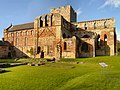
 Lanercost Priory - geograph.org.uk - 2901613.jpg 811 × 594; 142 KB
-
 Lanercost Priory - geograph.org.uk - 3190823.jpg 480 × 640; 591 KB
-
 Lanercost Priory - geograph.org.uk - 3190831.jpg 480 × 640; 591 KB
-
 Lanercost Priory - geograph.org.uk - 4318815.jpg 1,600 × 1,064; 507 KB
-
 Lanercost Priory - geograph.org.uk - 4517065.jpg 640 × 425; 183 KB
-
 Lanercost Priory - geograph.org.uk - 4517082.jpg 640 × 451; 227 KB
-
 Lanercost Priory - geograph.org.uk - 4517088.jpg 640 × 425; 160 KB
-
 Lanercost Priory - geograph.org.uk - 5254190.jpg 3,392 × 2,224; 2.37 MB
-
 Lanercost Priory - geograph.org.uk - 5254193.jpg 2,190 × 3,174; 1.76 MB
-
 Lanercost Priory - geograph.org.uk - 5367573.jpg 640 × 480; 69 KB
-
 Lanercost Priory - geograph.org.uk - 6218292.jpg 960 × 540; 62 KB
-
 Lanercost Priory - geograph.org.uk - 6467112.jpg 1,799 × 1,199; 381 KB
-
 Lanercost Priory - March 2016 (1) - geograph.org.uk - 4888227.jpg 1,250 × 830; 1.37 MB
-
 Lanercost Priory - March 2016 (11) - geograph.org.uk - 4888323.jpg 1,250 × 869; 1.02 MB
-
 Lanercost Priory - March 2016 (12) - geograph.org.uk - 4888337.jpg 1,250 × 898; 1.03 MB
-
 Lanercost Priory - March 2016 (13) - geograph.org.uk - 4888348.jpg 1,250 × 829; 1.04 MB
-
 Lanercost Priory - March 2016 (14) - geograph.org.uk - 4888356.jpg 1,250 × 848; 1,016 KB
-
 Lanercost Priory - March 2016 (15) - geograph.org.uk - 4888363.jpg 1,250 × 1,182; 1.89 MB
-
 Lanercost Priory - March 2016 (16) - geograph.org.uk - 4888369.jpg 1,250 × 834; 943 KB
-
 Lanercost Priory - March 2016 (17) - geograph.org.uk - 4888390.jpg 918 × 1,250; 1.1 MB
-
 Lanercost Priory - March 2016 (18) - geograph.org.uk - 4888400.jpg 389 × 1,250; 632 KB
-
 Lanercost Priory - March 2016 (19) - geograph.org.uk - 4888408.jpg 373 × 1,250; 715 KB
-
 Lanercost Priory - March 2016 (2) - geograph.org.uk - 4888251.jpg 1,250 × 728; 924 KB
-
 Lanercost Priory - March 2016 (20) - geograph.org.uk - 4888437.jpg 415 × 1,250; 578 KB
-
 Lanercost Priory - March 2016 (21) - geograph.org.uk - 4888461.jpg 931 × 1,250; 1.1 MB
-
 Lanercost Priory - March 2016 (22) - geograph.org.uk - 4888516.jpg 1,250 × 822; 930 KB
-
 Lanercost Priory - March 2016 (23) - geograph.org.uk - 4888525.jpg 887 × 1,250; 894 KB
-
 Lanercost Priory - March 2016 (24) - geograph.org.uk - 4888540.jpg 1,250 × 1,012; 1.04 MB
-
 Lanercost Priory - March 2016 (25) - geograph.org.uk - 4888560.jpg 1,102 × 1,250; 1.02 MB
-
 Lanercost Priory - March 2016 (3) - geograph.org.uk - 4888260.jpg 803 × 1,250; 981 KB
-
 Lanercost Priory - March 2016 (4) - geograph.org.uk - 4888266.jpg 793 × 1,250; 977 KB
-
 Lanercost Priory - March 2016 (5) - geograph.org.uk - 4888274.jpg 1,250 × 711; 951 KB
-
 Lanercost Priory - March 2016 (6) - geograph.org.uk - 4888280.jpg 1,250 × 838; 1.1 MB
-
 Lanercost Priory - March 2016 (7) - geograph.org.uk - 4888289.jpg 1,250 × 1,194; 1.19 MB
-
 Lanercost Priory - March 2016 (8) - geograph.org.uk - 4888298.jpg 1,056 × 1,250; 1.33 MB
-
 Lanercost Priory - March 2016 (9) - geograph.org.uk - 4888305.jpg 1,250 × 825; 899 KB
-

-
 Lanercost Priory Church - geograph.org.uk - 3190714.jpg 640 × 640; 632 KB
-
-

-

-

-

-

-
 Lanercost Priory Crossing Tower - geograph.org.uk - 3190843.jpg 480 × 640; 418 KB
-
 Lanercost Priory from the south-west - geograph.org.uk - 3494007.jpg 2,592 × 1,944; 1.51 MB
-
 Lanercost Priory Gateway - geograph.org.uk - 6467110.jpg 1,799 × 1,199; 555 KB
-
 Lanercost Priory Gateway, from the east - geograph.org.uk - 6191282.jpg 1,600 × 1,199; 514 KB
-
 Lanercost Priory Presbytery - geograph.org.uk - 3190841.jpg 640 × 481; 426 KB
-
 Lanercost Priory Refectory Undercroft - geograph.org.uk - 3190829.jpg 640 × 480; 508 KB
-
 Lanercost Priory, gateway - geograph.org.uk - 4318808.jpg 1,600 × 1,064; 485 KB
-

-
 Lanercost Priory, North Cloister - geograph.org.uk - 3190955.jpg 480 × 640; 624 KB
-

-
 Lanercost priory. - geograph.org.uk - 4152037.jpg 640 × 394; 75 KB
-
 Lanercoste Priory - geograph.org.uk - 3919511.jpg 1,800 × 1,197; 589 KB
-
 Line of Hadrian's Wall at NY540644.jpg 3,456 × 2,304; 3.71 MB
-
 Looking South from Banks East Turret - geograph.org.uk - 4315986.jpg 3,264 × 2,448; 3.13 MB
-
 Ministry of Works Sign, Lanercost Priory - geograph.org.uk - 3190948.jpg 640 × 481; 511 KB
-
 Modern Barn at Holmehead - geograph.org.uk - 1835479.jpg 600 × 450; 262 KB
-
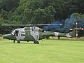
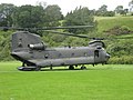
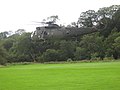
 New Elwood Helicopter Landing Site - Helipad - geograph.org.uk - 2688130.jpg 2,048 × 1,536; 1.4 MB
-
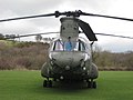
 New Elwood Heliport - HLS A-G 123.175 Mhz - geograph.org.uk - 2688131.jpg 2,048 × 1,536; 1.01 MB
-
 New Elwood Heliport - HLS A-G 123.175 Mhz - geograph.org.uk - 2688132.jpg 2,048 × 1,536; 1,001 KB
-
 New Elwood Heliport - HLS A-G 123.175 Mhz - geograph.org.uk - 2688133.jpg 2,048 × 1,536; 1.76 MB
-
 New Elwood Heliport - HLS A-G 123.175 Mhz - geograph.org.uk - 2688134.jpg 2,048 × 1,536; 1.36 MB
-
 New Elwood Heliport - HLS A-G 123.175 Mhz - geograph.org.uk - 2688136.jpg 2,048 × 1,536; 1.55 MB
-
 New Elwood Heliport - HLS A-G 123.175 Mhz - geograph.org.uk - 2688140.jpg 2,048 × 1,536; 1.65 MB
-
 New Elwood Heliport - HLS A-G 123.175 Mhz - geograph.org.uk - 2688144.jpg 2,048 × 1,536; 2.15 MB
-
 New Elwood HLS - geograph.org.uk - 2090446.jpg 1,024 × 768; 216 KB
-
 New Elwood HLS - geograph.org.uk - 2090463.jpg 1,024 × 768; 194 KB
-
 New Elwood HLS - geograph.org.uk - 2090505.jpg 1,024 × 768; 216 KB
-
 New Elwood HLS - geograph.org.uk - 2688113.jpg 2,048 × 1,536; 1.65 MB
-
 New Elwood HLS - geograph.org.uk - 2688116.jpg 2,048 × 1,536; 1.54 MB
-
 New Elwood HLS - geograph.org.uk - 2688119.jpg 2,048 × 1,536; 1.11 MB
-
 New Elwood HLS - geograph.org.uk - 2688120.jpg 2,048 × 1,536; 1.6 MB
-
 New Elwood HLS - geograph.org.uk - 2688123.jpg 2,048 × 1,536; 1.52 MB
-
 New Elwood HLS - geograph.org.uk - 2688124.jpg 2,048 × 1,536; 1.64 MB
-
 New Elwood HLS - geograph.org.uk - 2688125.jpg 2,048 × 1,536; 1.63 MB
-
 New Elwood HLS - geograph.org.uk - 2688126.jpg 2,048 × 1,536; 1.19 MB
-
 New Elwood HLS - geograph.org.uk - 2688127.jpg 2,048 × 1,536; 1.28 MB
-
 New Elwood HLS - geograph.org.uk - 2688128.jpg 2,048 × 1,536; 1.6 MB
-
 New Elwood HLS - geograph.org.uk - 2688129.jpg 2,048 × 1,536; 1.64 MB
-
 New Elwood HLS - geograph.org.uk - 2688135.jpg 2,048 × 1,536; 1.21 MB
-
 New Elwood HLS - geograph.org.uk - 2688137.jpg 2,048 × 1,536; 1.41 MB
-
 New Elwood HLS - geograph.org.uk - 2688138.jpg 2,048 × 1,536; 1.69 MB
-
 New Elwood HLS - geograph.org.uk - 2688139.jpg 2,048 × 1,536; 1.73 MB
-
 New Elwood HLS - geograph.org.uk - 2688141.jpg 2,048 × 1,536; 1.33 MB
-
 New Elwood HLS A-G 123.175 Mhz - geograph.org.uk - 2402904.jpg 1,024 × 768; 171 KB
-
 New Elwood HLS A-G 123.175 Mhz - geograph.org.uk - 2402921.jpg 1,024 × 768; 201 KB
-
 New Elwood HLS A-G 123.175 Mhz - geograph.org.uk - 2402946.jpg 1,024 × 768; 127 KB
-
 New Elwood HLS A-G 123.175 Mhz - geograph.org.uk - 2402958.jpg 1,024 × 768; 132 KB
-
 New Elwood HLS A-G 123.175 Mhz - geograph.org.uk - 2402966.jpg 1,024 × 768; 132 KB
-
 New Elwood HLS A-G 123.175 Mhz - geograph.org.uk - 2402978.jpg 1,024 × 768; 200 KB
-
 New Elwood HLS A-G 123.175 Mhz - geograph.org.uk - 2402990.jpg 1,024 × 768; 211 KB
-
 New Elwood HLS A-G 123.175 Mhz - geograph.org.uk - 2403024.jpg 1,024 × 768; 137 KB
-

-
 New Elwood HLS A-G Elwood Radio 123.175 Mhz - geograph.org.uk - 2090478.jpg 1,024 × 768; 227 KB
_-_geograph.org.uk_-_5722727.jpg)
_-_geograph.org.uk_-_5732211.jpg)
_-_geograph.org.uk_-_5732213.jpg)
_-_geograph.org.uk_-_5732215.jpg)
_-_geograph.org.uk_-_5732217.jpg)
_-_geograph.org.uk_-_5732218.jpg)
_-_geograph.org.uk_-_5732223.jpg)
_-_geograph.org.uk_-_5732179.jpg)
_-_geograph.org.uk_-_5732194.jpg)
_-_geograph.org.uk_-_5732196.jpg)
_-_geograph.org.uk_-_5732203.jpg)
_-_geograph.org.uk_-_5732205.jpg)
_-_geograph.org.uk_-_5732206.jpg)
_-_geograph.org.uk_-_5732207.jpg)
_-_geograph.org.uk_-_5732210.jpg)


_-_geograph.org.uk_-_6446121.jpg)


.jpg)
.jpg)
.jpg)


.jpg)


.jpg)


.jpg)


_-_geograph.org.uk_-_1587637.jpg)


_-_geograph.org.uk_-_5732311.jpg)
_-_geograph.org.uk_-_5732312.jpg)
_-_geograph.org.uk_-_5732315.jpg)
_-_geograph.org.uk_-_5732317.jpg)
_-_geograph.org.uk_-_5732320.jpg)
_-_geograph.org.uk_-_5732322.jpg)
_-_geograph.org.uk_-_5732325.jpg)
_-_geograph.org.uk_-_5732327.jpg)
_-_geograph.org.uk_-_5732328.jpg)
_-_geograph.org.uk_-_5732330.jpg)


_-_geograph.org.uk_-_3585346.jpg)


_-_geograph.org.uk_-_4888227.jpg)
_-_geograph.org.uk_-_4888323.jpg)
_-_geograph.org.uk_-_4888337.jpg)
_-_geograph.org.uk_-_4888348.jpg)
_-_geograph.org.uk_-_4888356.jpg)
_-_geograph.org.uk_-_4888363.jpg)
_-_geograph.org.uk_-_4888369.jpg)
_-_geograph.org.uk_-_4888390.jpg)
_-_geograph.org.uk_-_4888251.jpg)
_-_geograph.org.uk_-_4888461.jpg)
_-_geograph.org.uk_-_4888516.jpg)
_-_geograph.org.uk_-_4888525.jpg)
_-_geograph.org.uk_-_4888540.jpg)
_-_geograph.org.uk_-_4888560.jpg)
_-_geograph.org.uk_-_4888260.jpg)
_-_geograph.org.uk_-_4888266.jpg)
_-_geograph.org.uk_-_4888274.jpg)
_-_geograph.org.uk_-_4888280.jpg)
_-_geograph.org.uk_-_4888289.jpg)
_-_geograph.org.uk_-_4888298.jpg)
_-_geograph.org.uk_-_4888305.jpg)
_-_geograph.org.uk_-_3190753.jpg)


_-_geograph.org.uk_-_4888400.jpg)
_-_geograph.org.uk_-_4888408.jpg)
_-_geograph.org.uk_-_4888437.jpg)