Category:Burton-cum-Walden
civil parish in North Yorkshire, England, UK | |||||
| Upload media | |||||
| Instance of | |||||
|---|---|---|---|---|---|
| Location | Richmondshire, North Yorkshire, Yorkshire and the Humber, England | ||||
 | |||||
English: Burton-cum-Walden is a civil parish in the Richmondshire district of North Yorkshire, England, in the Yorkshire Dales National Park. It had a population of 312 according to the 2001 census.
Subcategories
This category has the following 6 subcategories, out of 6 total.
Media in category "Burton-cum-Walden"
The following 200 files are in this category, out of 326 total.
(previous page) (next page)-
 'Bomb alley' - geograph.org.uk - 3494017.jpg 3,240 × 4,320; 3.6 MB
-
 1950s-style AA Box on the A684 - geograph.org.uk - 4972472.jpg 5,184 × 3,888; 5.05 MB
-
 A 684 at Hestholme Bridge - geograph.org.uk - 6350755.jpg 3,293 × 2,255; 1.43 MB
-
 A 684 near Hestholme Bridge - geograph.org.uk - 6350683.jpg 3,796 × 2,249; 1.06 MB
-
 A free (cold) shower - geograph.org.uk - 5865597.jpg 3,240 × 4,319; 4.22 MB
-
 A House called Uncles - geograph.org.uk - 2002011.jpg 2,816 × 2,112; 1.9 MB
-
 A View down Waldendale - geograph.org.uk - 1999258.jpg 2,816 × 2,112; 2.13 MB
-
 A View Of Walden Dale - geograph.org.uk - 287887.jpg 640 × 480; 82 KB
-
 A View South from Brown Haw - geograph.org.uk - 3935934.jpg 1,600 × 1,200; 472 KB
-
 A Wensleydale wall - geograph.org.uk - 883849.jpg 640 × 365; 95 KB
-
 A684 (Heads Bank) opposite Nellholme House - geograph.org.uk - 3785560.jpg 1,024 × 683; 241 KB
-
 A684 at the Aysgarth AA Box - geograph.org.uk - 3587196.jpg 640 × 481; 81 KB
-
 A684 near Hestholme Farm - geograph.org.uk - 1962396.jpg 640 × 480; 87 KB
-
 A684 towards Leyburn - geograph.org.uk - 5413874.jpg 640 × 480; 73 KB
-
 AA Box no 442 on A684 - geograph.org.uk - 1962404.jpg 480 × 640; 78 KB
-
 AA box No442 on the A684 - geograph.org.uk - 2007246.jpg 640 × 480; 110 KB
-
 AA phone box near Hestholme Bridge - geograph.org.uk - 2150925.jpg 640 × 481; 79 KB
-
 AA phone box, Aysgarth box 442 - geograph.org.uk - 4929344.jpg 2,374 × 1,335; 964 KB
-
 AA restored phone box on A684 - geograph.org.uk - 1962395.jpg 640 × 480; 78 KB
-
 Across Bishopdale Beck - geograph.org.uk - 883037.jpg 491 × 640; 91 KB
-
 Across lower Bishopdale - geograph.org.uk - 3493998.jpg 3,240 × 4,320; 2.71 MB
-
 Ancient Track below Morpeth Scar - geograph.org.uk - 4116826.jpg 5,184 × 3,456; 6.07 MB
-
 Approaching the Shooting Box - geograph.org.uk - 2295771.jpg 2,560 × 1,920; 1.86 MB
-
 Approaching Walden Head - geograph.org.uk - 2001985.jpg 2,816 × 2,112; 2.25 MB
-
 Ashington Farm near West Burton - geograph.org.uk - 3201846.jpg 1,500 × 1,000; 171 KB
-
 Aysgarth and River Ure, aerial 2018 - geograph.org.uk - 5897513.jpg 800 × 533; 114 KB
-
 Aysgarth Box, Hestholme Bridge - geograph.org.uk - 2150933.jpg 480 × 640; 92 KB
-
 B6160 junction with A684 - geograph.org.uk - 1962389.jpg 640 × 480; 74 KB
-
 Back Nook, West Burton - geograph.org.uk - 6424045.jpg 1,024 × 768; 621 KB
-
 Barn above Sorrelsykes Park - geograph.org.uk - 1962517.jpg 640 × 480; 73 KB
-
 Barn by the Aysgarth to West Burton footpath - geograph.org.uk - 5059317.jpg 5,184 × 3,888; 4.09 MB
-
 Barn in dry stone wall, Waldendale - geograph.org.uk - 4207074.jpg 1,500 × 918; 1.74 MB
-
 Barn in need of repair - geograph.org.uk - 1924351.jpg 2,048 × 1,536; 1.34 MB
-
 Barn near Morpeth Gate - geograph.org.uk - 1962507.jpg 640 × 480; 88 KB
-
 Barn on Hestholme Farm - geograph.org.uk - 1962398.jpg 640 × 480; 77 KB
-
 Barn on north road to Walden - geograph.org.uk - 3064149.jpg 1,024 × 683; 218 KB
-
 Barn, Hestholme Farm - geograph.org.uk - 2150910.jpg 640 × 441; 74 KB
-
 Bench mark, Eshington Bridge - geograph.org.uk - 2243458.jpg 640 × 480; 139 KB
-
 Benchmark on barn near 'Howraine' - geograph.org.uk - 3027201.jpg 1,024 × 683; 235 KB
-
 Benchmark on barn on north road to Walden - geograph.org.uk - 3064090.jpg 683 × 1,024; 282 KB
-
 Benchmark on Burton Bridge over Walden Beck - geograph.org.uk - 3027144.jpg 683 × 1,024; 333 KB
-

-

-
 Benchmark on parapet of Cote Bridge - geograph.org.uk - 3064319.jpg 683 × 1,024; 345 KB
-
 Benchmark on rock under Morpeth Scar - geograph.org.uk - 3240975.jpg 683 × 1,024; 316 KB
-
 Benchmark on rockface on SE side of Ellers Lane - geograph.org.uk - 3786924.jpg 683 × 1,024; 258 KB
-

-
 Benchmark on stone in wall of Morpeth Gate - geograph.org.uk - 3240436.jpg 683 × 1,024; 257 KB
-

-
 Benchmark on the wall of Whiterow Road - geograph.org.uk - 3064218.jpg 683 × 1,024; 216 KB
-

-
 Benchmark on wall pier of Morpeth Gate gateway - geograph.org.uk - 3240266.jpg 683 × 1,024; 294 KB
-

-
 Bend in the A684, Hestholme Bridge - geograph.org.uk - 5413880.jpg 640 × 480; 67 KB
-
 Bend on B6160 south of West Burton - geograph.org.uk - 3081943.jpg 640 × 417; 69 KB
-
 Bent by the wind - geograph.org.uk - 6139941.jpg 1,600 × 1,063; 449 KB
-
 Birkham Well (spring) - geograph.org.uk - 2246248.jpg 640 × 480; 129 KB
-
 Bishopdale - geograph.org.uk - 6161181.jpg 2,048 × 1,536; 951 KB
-
 Bishopdale Beck - geograph.org.uk - 2151052.jpg 640 × 480; 90 KB
-
 Bishopdale Beck - geograph.org.uk - 3338209.jpg 2,048 × 1,536; 1.59 MB
-
 Bishopdale Beck - geograph.org.uk - 6424032.jpg 1,024 × 768; 792 KB
-
 Bishopdale Beck, Eshington Bridge - geograph.org.uk - 6424030.jpg 1,024 × 768; 730 KB
-
 Bog on Buckden Pike - geograph.org.uk - 4639490.jpg 6,000 × 4,000; 7.38 MB
-
 Boundary stone, Fleensop Moor - geograph.org.uk - 2244996.jpg 480 × 640; 163 KB
-
 Boundary wall near Burton Outstray - geograph.org.uk - 1925223.jpg 2,048 × 1,536; 1.46 MB
-
 Boundary wall near Height of Hazely - geograph.org.uk - 1927175.jpg 2,048 × 1,536; 1.13 MB
-
 Braithwaite lead smelt mill - geograph.org.uk - 4390051.jpg 3,776 × 2,520; 4.15 MB
-

-
 Braithwaite Lead Smelt Mill chimney - geograph.org.uk - 3064529.jpg 683 × 1,024; 290 KB
-
 Bridleway leading towards the River Ure - geograph.org.uk - 4117469.jpg 5,184 × 3,456; 7.02 MB
-
 Bridleway on Walden Moor - geograph.org.uk - 4049560.jpg 4,320 × 3,240; 4.66 MB
-
 Buckden out Moor - panoramio (3).jpg 2,816 × 1,584; 595 KB
-
 Buckden Pike - geograph.org.uk - 4717029.jpg 4,176 × 2,784; 5.17 MB
-
 Buildings from the past - geograph.org.uk - 5865534.jpg 2,725 × 3,613; 2.15 MB
-
 Burton Bridge - geograph.org.uk - 3111144.jpg 640 × 480; 118 KB
-
 Burton Bridge - geograph.org.uk - 6424041.jpg 1,024 × 768; 745 KB
-
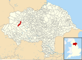 Burton-cum-Walden UK parish locator map.svg 1,425 × 1,037; 4.3 MB
-
 By Bishopsdale Beck - geograph.org.uk - 6350675.jpg 4,023 × 2,264; 699 KB
-
 Cauldron Force, West Burton - geograph.org.uk - 6434045.jpg 4,032 × 1,960; 3.58 MB
-
 Climbing above West Burton - geograph.org.uk - 2510552.jpg 800 × 600; 216 KB
-
 Confluence of Valleys - geograph.org.uk - 4264984.jpg 640 × 480; 36 KB
-
 Corrugated Metal Structure near Cote Bridge - geograph.org.uk - 2004209.jpg 2,816 × 2,112; 2.06 MB
-
 Cote Bridge - geograph.org.uk - 1925200.jpg 2,048 × 1,536; 1.62 MB
-
 Cote Bridge - geograph.org.uk - 3064367.jpg 1,024 × 683; 246 KB
-
 Cotton Grass on Deepdale Head - geograph.org.uk - 3548499.jpg 1,600 × 1,200; 564 KB
-
 Cotton Grass on Harland Hill - geograph.org.uk - 1925216.jpg 2,048 × 1,536; 1.28 MB
-
 Crossing Fosse Gill - geograph.org.uk - 2295792.jpg 1,920 × 2,560; 1.91 MB
-
 Crossing the stepping stones - geograph.org.uk - 5865618.jpg 4,320 × 2,826; 4.96 MB
-
 Daleside barn near Aysgarth - geograph.org.uk - 883093.jpg 640 × 480; 71 KB
-
 Derelict barn - geograph.org.uk - 5059328.jpg 5,184 × 3,888; 4.09 MB
-
 Descending to Walden Beck, West Burton - geograph.org.uk - 6140154.jpg 1,600 × 1,063; 877 KB
-
 Descent from Buckden Pike - geograph.org.uk - 4264407.jpg 640 × 480; 45 KB
-
 Disused tips on NW slope of Harland Hill - geograph.org.uk - 477846.jpg 640 × 480; 106 KB
-
 Dry Stone Wall at the base of Harland Hill - geograph.org.uk - 4159204.jpg 5,184 × 3,456; 7.31 MB
-
 Dry stone wall beside track over Burton Moor - geograph.org.uk - 3064512.jpg 1,024 × 683; 195 KB
-
 Dry stone wall rising to Height of Hazely - geograph.org.uk - 4207177.jpg 1,500 × 979; 1.57 MB
-
 Ellers Lane north of West Burton - geograph.org.uk - 3081927.jpg 640 × 388; 70 KB
-
 End of the Road - geograph.org.uk - 2001986.jpg 2,816 × 2,112; 2.04 MB
-
 Entering West Burton from Waldendale - geograph.org.uk - 2004223.jpg 2,816 × 2,112; 1.96 MB
-
 Entrance to Pasture beside Cowstone Gill House - geograph.org.uk - 2004132.jpg 2,816 × 2,112; 1.87 MB
-

-
 Eshington Bridge - geograph.org.uk - 3072382.jpg 1,024 × 683; 206 KB
-
 Eshington Bridge - geograph.org.uk - 6424035.jpg 1,024 × 768; 621 KB
-
 Eshington Bridge - geograph.org.uk - 824821.jpg 640 × 480; 115 KB
-
 Estate road and bridleway above Waldendale - geograph.org.uk - 4207112.jpg 1,500 × 921; 1.43 MB
-
 Falls on Walden Beck at West Burton - geograph.org.uk - 6424046.jpg 1,024 × 768; 603 KB
-
 Farm Building in Walden Valley - geograph.org.uk - 1513540.jpg 640 × 480; 70 KB
-
 Farm buildings at Edgley Farm - geograph.org.uk - 6360393.jpg 800 × 533; 120 KB
-
 Farmland off the A684, Heads Bank - geograph.org.uk - 5413868.jpg 640 × 480; 57 KB
-
 Field above Thupton Gill - geograph.org.uk - 103671.jpg 640 × 480; 131 KB
-
 Field barn by the footpath - geograph.org.uk - 5865588.jpg 4,319 × 2,732; 3.01 MB
-
 Field barn West Burton - geograph.org.uk - 5865602.jpg 4,320 × 3,240; 3.46 MB
-
 Field below Morpeth Gate, Wensleydale - geograph.org.uk - 6140140.jpg 1,600 × 900; 518 KB
-
 Field entrance off the A684 - geograph.org.uk - 5413871.jpg 640 × 480; 62 KB
-
 Footbridge over Walden Beck - geograph.org.uk - 1833943.jpg 2,932 × 2,196; 2.44 MB
-
 Footpath above Walden Beck - geograph.org.uk - 2004159.jpg 2,816 × 2,112; 2.34 MB
-
 Footpath beside Walden Beck - geograph.org.uk - 2002017.jpg 2,816 × 2,112; 1.98 MB
-
 Footpath by Bishopdale Beck - geograph.org.uk - 6424023.jpg 1,024 × 768; 836 KB
-
 Footpath descending to West Burton - geograph.org.uk - 4375759.jpg 5,184 × 3,456; 6.98 MB
-
 Footpath in Barrack Wood - geograph.org.uk - 2969262.jpg 3,072 × 2,304; 1.8 MB
-
 Footpath in Waldendale - geograph.org.uk - 2004171.jpg 2,816 × 2,112; 2.02 MB
-
 Footpath near Long Bank Wood - geograph.org.uk - 1924325.jpg 2,048 × 1,536; 1.21 MB
-
 Footpath sign - geograph.org.uk - 4553177.jpg 1,024 × 683; 171 KB
-
 Footpath to Aysgarth from Eshington Bridge - geograph.org.uk - 4299360.jpg 5,400 × 3,600; 5.42 MB
-
 Footpath towards Barrack Wood - geograph.org.uk - 2969259.jpg 3,072 × 2,304; 1.31 MB
-
 Fosse Pike Gill - geograph.org.uk - 4264402.jpg 640 × 480; 47 KB
-

-
 Front Nook from Back Nook - geograph.org.uk - 3207273.jpg 2,110 × 1,415; 997 KB
-
 Gate between Height of Hazely and Harland Hill - geograph.org.uk - 4159801.jpg 4,992 × 2,993; 6.72 MB
-
 Gate in fence on Naughtberry Hill - geograph.org.uk - 3548501.jpg 1,600 × 1,200; 471 KB
-
 Gate on White Hill - geograph.org.uk - 4157543.jpg 4,955 × 2,998; 7.38 MB
-
 Gateway from field onto Morpeth Gate - geograph.org.uk - 3240272.jpg 1,024 × 683; 307 KB
-
 Gateway on NW side of Morpeth Gate - geograph.org.uk - 3240458.jpg 1,024 × 683; 214 KB
-
 Gateway on track above Thupton Gill - geograph.org.uk - 4136641.jpg 4,000 × 3,000; 2.75 MB
-
 Grassy hill slope with rushes below Harland Hill - geograph.org.uk - 4207133.jpg 1,500 × 921; 1.41 MB
-
 Grassy Track on Western Flanks of Height of Hazely - geograph.org.uk - 4375756.jpg 5,102 × 2,759; 7.4 MB
-
 Grazing, Heads Bank - geograph.org.uk - 5413864.jpg 640 × 480; 78 KB
-
 Grouse butt beneath Naughtberry Hill - geograph.org.uk - 3548505.jpg 1,600 × 1,200; 467 KB
-
 Grouse Butts - geograph.org.uk - 4264398.jpg 640 × 480; 47 KB
-
 Hayfield, Bishopdale - geograph.org.uk - 883063.jpg 640 × 335; 49 KB
-
 Head of Thupton Gill - geograph.org.uk - 888946.jpg 640 × 415; 60 KB
-
 High Lane below Oswald Pasture - geograph.org.uk - 2969342.jpg 3,072 × 2,304; 1.32 MB
-
 Hillside Barn (2) - geograph.org.uk - 5865567.jpg 3,239 × 4,319; 4.26 MB
-
 Hillside barn - geograph.org.uk - 891351.jpg 480 × 640; 78 KB
-
 Houses in West Burton - geograph.org.uk - 5490009.jpg 1,024 × 667; 230 KB
-
 Hudson Quarry Lane - geograph.org.uk - 3035359.jpg 640 × 480; 58 KB
-
 Hudson Quarry Lane above Morpeth Scar - geograph.org.uk - 3978078.jpg 800 × 600; 118 KB
-
 Hut circle, Burton Moor - geograph.org.uk - 4617382.jpg 640 × 480; 62 KB
-

-
 Junction of Dame Lane and track to Riddings - geograph.org.uk - 3064013.jpg 1,024 × 683; 268 KB
-
 Junction of footpath and Morpeth Gate - geograph.org.uk - 3240734.jpg 1,024 × 683; 188 KB
-

-
 Laithe at Town Head - geograph.org.uk - 2004241.jpg 2,816 × 2,112; 2.01 MB
-
 Lambing time - geograph.org.uk - 2337849.jpg 2,821 × 3,038; 1.66 MB
-
 Lane leading to Morpeth Scar - geograph.org.uk - 6139947.jpg 1,600 × 1,063; 539 KB
-
 Lane outside Grange Farm - geograph.org.uk - 4048843.jpg 4,320 × 3,240; 4.98 MB
-
 Lone walker on Track - geograph.org.uk - 4264417.jpg 640 × 480; 64 KB
-
 Lone walker on Track - geograph.org.uk - 4264431.jpg 640 × 480; 48 KB
-
 Looking down Thupton Gill - geograph.org.uk - 2243993.jpg 800 × 600; 107 KB
-
 Looking for lunch - geograph.org.uk - 824835.jpg 480 × 640; 119 KB
-
 Looking north east down the valley of Walden Beck - geograph.org.uk - 2193825.jpg 1,600 × 1,200; 383 KB
-
 Looking North East over Flat Moss - geograph.org.uk - 3935656.jpg 4,320 × 3,240; 4.35 MB
-
 Looking South West over Flat Moss - geograph.org.uk - 3935659.jpg 4,320 × 3,240; 3.66 MB
-
 Looking towards the Memorial Cross - geograph.org.uk - 1527781.jpg 640 × 426; 53 KB
-
 Looking up Harland Hill - geograph.org.uk - 3064497.jpg 1,024 × 683; 231 KB
-
 Looking up Walden - geograph.org.uk - 2244963.jpg 640 × 480; 88 KB
-
 Looking up Walden - geograph.org.uk - 2244974.jpg 640 × 480; 88 KB
-
 Low water on the Ure - geograph.org.uk - 5865610.jpg 4,319 × 2,998; 2.95 MB
-
 Lush Pasture in Waldendale - geograph.org.uk - 2004185.jpg 2,816 × 2,112; 2 MB
-
 Memorial Cross - geograph.org.uk - 4023896.jpg 4,320 × 3,240; 4.91 MB
-
 Memorial Cross on Buckden Pike - geograph.org.uk - 5196192.jpg 480 × 640; 51 KB
-
 Memorial cross on Buckden Pike - geograph.org.uk - 5631602.jpg 1,500 × 945; 675 KB
-
 Methodist Chapel, West Burton - geograph.org.uk - 4390033.jpg 3,776 × 2,520; 4.1 MB
-
 Molly's Farm - geograph.org.uk - 6161186.jpg 2,048 × 1,536; 1.36 MB
-
 Morpeth Gate - geograph.org.uk - 2969271.jpg 3,072 × 2,304; 1.67 MB
-
 Morpeth Gate - geograph.org.uk - 4116817.jpg 4,371 × 2,966; 7.41 MB
-
 Morpeth Gate - geograph.org.uk - 824893.jpg 480 × 640; 144 KB
-
 Morpeth Gate 2 - geograph.org.uk - 6161180.jpg 2,048 × 1,536; 1.72 MB
-
 Morpeth Gate under Morpeth Scar - geograph.org.uk - 3240983.jpg 683 × 1,024; 203 KB
-
 Morpeth Scar above West Burton - geograph.org.uk - 6139953.jpg 1,600 × 1,063; 607 KB
-
 Morpeth Scar, Wensleydale - geograph.org.uk - 4553175.jpg 1,024 × 683; 163 KB
-
 Mown pastures above Sorrelsykes Park - geograph.org.uk - 1962527.jpg 640 × 480; 73 KB
-
 Mystery stone 1 - geograph.org.uk - 2337858.jpg 2,004 × 2,668; 1.72 MB
-
 Near Aysgarth - geograph.org.uk - 6161254.jpg 2,048 × 1,536; 1.62 MB
-
 New Bridge West Burton from the north - geograph.org.uk - 3081929.jpg 640 × 420; 125 KB
-
 New fishing hut by the Ure - geograph.org.uk - 4170856.jpg 659 × 480; 114 KB
-
 Old Boundary Marker (geograph 6464929).jpg 480 × 640; 259 KB
-

-
 On Dovescar Moss - geograph.org.uk - 4157474.jpg 5,088 × 3,196; 6.99 MB
-
 On Morpeth Gate - geograph.org.uk - 6140145.jpg 1,600 × 1,063; 936 KB
-
 On North Tarn Hills - geograph.org.uk - 4157563.jpg 4,955 × 2,998; 5.14 MB
-
 On the Eastern Flanks of Brown Haw - geograph.org.uk - 3935961.jpg 4,320 × 3,240; 4.97 MB
-
 On the flanks of Brown Haw - geograph.org.uk - 3935930.jpg 4,320 × 3,240; 4.14 MB
-
 On the Moors above Walden - geograph.org.uk - 4157469.jpg 5,184 × 3,456; 6.06 MB
-
 On Walden Moor - geograph.org.uk - 2295742.jpg 2,560 × 1,920; 1.75 MB
-
 On Windle Side - geograph.org.uk - 3935089.jpg 4,320 × 3,240; 3.93 MB
-
 Open Moorland on Naughtberry Hill - geograph.org.uk - 4264983.jpg 640 × 480; 63 KB
-
 Ordnance Survey Cut Mark - geograph.org.uk - 3439800.jpg 4,000 × 3,000; 4.26 MB
-
 Pasture beside Cowstone Gill - geograph.org.uk - 2004144.jpg 2,816 × 2,112; 1.98 MB
-
 Pasture off Eshington Lane - geograph.org.uk - 4116657.jpg 4,960 × 3,340; 7.64 MB


_shower_-_geograph.org.uk_-_5865597.jpg)


_opposite_Nellholme_House_-_geograph.org.uk_-_3785560.jpg)


_-_geograph.org.uk_-_2246248.jpg)


.jpg)


_-_geograph.org.uk_-_5865567.jpg)


_with_B6160_(Ellers_Lane)_-_geograph.org.uk_-_3786947.jpg)


.jpg)


