Category:Burton Lazars
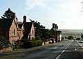
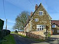
English: Burton Lazars is a small village two miles south-east of Melton Mowbray in Leicestershire. The name originates from Burton Saint Lazarus after Lord Roger de Mowbray opened a leper hospital to take advantage of the natural spring water in the 12th century.

village in United Kingdom  | |||||
| Upload media | |||||
| Instance of | |||||
|---|---|---|---|---|---|
| Location | Burton and Dalby, Melton, Leicestershire, East Midlands, England | ||||
| official website | |||||
 | |||||
Subcategories
This category has the following 2 subcategories, out of 2 total.
Media in category "Burton Lazars"
The following 117 files are in this category, out of 117 total.
-
 A606 at Burton Lazars - geograph.org.uk - 5274558.jpg 1,280 × 910; 268 KB
-
 A606 Melton Road in Burton Lazars - geograph.org.uk - 5612280.jpg 800 × 544; 113 KB
-
 A606 towards Burton Lazars - geograph.org.uk - 149185.jpg 640 × 480; 96 KB
-
 A606 towards Melton - geograph.org.uk - 149074.jpg 640 × 352; 46 KB
-
 A606-Whissendine Road Junction - geograph.org.uk - 149121.jpg 640 × 369; 40 KB
-
 Bench mark, Lynne Cottage, Burton Lazars - geograph.org.uk - 5274673.jpg 960 × 1,280; 383 KB
-
 Benchmark on Burton Lazars trig point - geograph.org.uk - 4683586.jpg 683 × 1,024; 303 KB
-
 Benchmark on Lynne Cottage - geograph.org.uk - 5249161.jpg 683 × 1,024; 208 KB
-
 Burton Lazars sewage treatment works - geograph.org.uk - 2624453.jpg 640 × 440; 61 KB
-
 Burton Lazars sewage treatment works - geograph.org.uk - 2624454.jpg 640 × 366; 43 KB
-
 Burton Lazars trig point - geograph.org.uk - 4683933.jpg 1,024 × 683; 312 KB
-
 Chestnut farmhouse, Burton Lazars - geograph.org.uk - 5274683.jpg 1,280 × 918; 317 KB
-
 Chuff chuff running east to Oakham - geograph.org.uk - 379696.jpg 640 × 480; 74 KB
-

-
 Cross Lane in Burton Lazars - geograph.org.uk - 3952907.jpg 1,600 × 1,160; 464 KB
-
 East Farm, Burton Lazars - geograph.org.uk - 5274576.jpg 1,280 × 960; 378 KB
-
 End of Lime Street, Burton Lazars - geograph.org.uk - 77227.jpg 640 × 480; 82 KB
-
 Entering Burton Lazars - geograph.org.uk - 3109186.jpg 2,408 × 1,658; 1.18 MB
-
 Ewes and lambs in Burton Lazars - geograph.org.uk - 3952924.jpg 1,600 × 1,342; 672 KB
-
 Farmland near Jericho Lodge - geograph.org.uk - 789892.jpg 640 × 612; 83 KB
-
 Field of clover - geograph.org.uk - 566593.jpg 640 × 480; 81 KB
-
 Fields towards Melton Mowbray - geograph.org.uk - 299396.jpg 358 × 640; 56 KB
-
 Footpath sign towards Burton Lazars - geograph.org.uk - 5518900.jpg 640 × 566; 138 KB
-
 Footpath towards Burton Lazars - geograph.org.uk - 5518901.jpg 640 × 534; 144 KB
-
 Former farm cottages, Lime Street, Burton Lazars - geograph.org.uk - 5274680.jpg 1,280 × 960; 394 KB
-
 Former farm cottages, Lime Street, Burton Lazars - geograph.org.uk - 5274684.jpg 1,280 × 960; 424 KB
-
 Green lane at Burton Lazars - geograph.org.uk - 5274562.jpg 1,280 × 960; 644 KB
-
 Jericho Farm, Burton Lazars 01.jpg 4,000 × 3,000; 3.77 MB
-
 Jericho Farm, Burton Lazars 02.jpg 4,000 × 3,000; 3.94 MB
-
 Jericho Farm, Burton Lazars 03.jpg 4,000 × 3,000; 3.03 MB
-
 Jericho Farm, Burton Lazars 04.jpg 4,000 × 3,000; 3.02 MB
-
 Lag Lane, Burton Lazars - geograph.org.uk - 5274571.jpg 1,280 × 905; 288 KB
-
 Lynne Cottage, Burton Lazars - geograph.org.uk - 5274676.jpg 960 × 1,280; 399 KB
-
 Lynne Cottage, ^39 New Road - geograph.org.uk - 5249167.jpg 683 × 1,024; 167 KB
-
 Melton Mowbray Airfield - geograph.org.uk - 35659.jpg 640 × 480; 135 KB
-
 New Road, Burton Lazars - geograph.org.uk - 1055419.jpg 640 × 480; 58 KB
-
 New Road, Burton Lazars - geograph.org.uk - 5274677.jpg 1,280 × 956; 331 KB
-
 Old Hall, Burton Lazars - geograph.org.uk - 3264123.jpg 4,320 × 3,240; 3.31 MB
-
 Path to Burton Lazars - geograph.org.uk - 964865.jpg 640 × 420; 77 KB
-
 Pill box near Bickfield Farm - geograph.org.uk - 153468.jpg 640 × 480; 105 KB
-
 Sandy Lane towards Melton Mowbray - geograph.org.uk - 351698.jpg 640 × 480; 62 KB
-
 Sawgate Road III - geograph.org.uk - 77123.jpg 640 × 480; 69 KB
-
 Sawgate Road in Burton Lazars - geograph.org.uk - 3952938.jpg 1,600 × 1,200; 537 KB
-
 Sawgate Road towards Burton Lazars - geograph.org.uk - 776212.jpg 640 × 434; 69 KB
-
 Sawgate Road towards Burton Lazars - geograph.org.uk - 779616.jpg 640 × 467; 57 KB
-
 Sheep Dip on Lag Lane, near Melton Mowbray - geograph.org.uk - 68402.jpg 640 × 480; 177 KB
-
 Site of medieval leper hospital, Burton Lazars - geograph.org.uk - 5274688.jpg 1,280 × 960; 311 KB
-
 Site of medieval leper hospital, Burton Lazars - geograph.org.uk - 5274690.jpg 1,280 × 960; 372 KB
-
 Spot that train^ - geograph.org.uk - 379698.jpg 640 × 480; 94 KB
-
 Stile to the road - geograph.org.uk - 715774.jpg 470 × 640; 120 KB
-
 The bottom of Hollow Lane, Burton Lazars - geograph.org.uk - 5274575.jpg 1,280 × 960; 489 KB
-
 The Grange, Burton Lazars 1995 - geograph.org.uk - 5049305.jpg 2,353 × 1,249; 3.09 MB
-
 The Old Hall, Burton Lazars - geograph.org.uk - 5274579.jpg 1,280 × 960; 385 KB
-
 Track north of Burton Lazars - geograph.org.uk - 779608.jpg 640 × 449; 66 KB
-
 View north from Burton Lazars - geograph.org.uk - 779599.jpg 640 × 457; 64 KB
-
 Whissendine Road in Leicestershire - geograph.org.uk - 778932.jpg 640 × 476; 103 KB
-
 Whissendine Road in Leicestershire - geograph.org.uk - 778941.jpg 640 × 521; 78 KB
-
 Wilds Lodge farm buildings - geograph.org.uk - 149194.jpg 640 × 480; 105 KB
-

-

-

-
 A606 Melton Road in Burton Lazars - geograph.org.uk - 779591.jpg 640 × 496; 92 KB
-
-
 Bottom of Hollow Lane, Burton Lazars - geograph.org.uk - 179274.jpg 640 × 480; 79 KB
-
 Bottom of Peppers Lane, Burton Lazars - geograph.org.uk - 179259.jpg 640 × 480; 126 KB
-
 Bridge over Burton Brook - geograph.org.uk - 252529.jpg 640 × 480; 92 KB
-
 Burnt out car on Sandy Lane - geograph.org.uk - 451905.jpg 640 × 480; 65 KB
-
 Burton Bridge - geograph.org.uk - 778948.jpg 640 × 480; 115 KB
-
 Burton Brook - geograph.org.uk - 252567.jpg 640 × 480; 94 KB
-
 Burton Lodge Cottage - geograph.org.uk - 776215.jpg 640 × 410; 75 KB
-
 Burton Lodge Farm - geograph.org.uk - 776228.jpg 640 × 472; 59 KB
-
 Cross Lane - geograph.org.uk - 295405.jpg 640 × 480; 73 KB
-
 Cross Lane - geograph.org.uk - 295774.jpg 640 × 480; 82 KB
-

-
 Farmland off Lag Lane, near Burton Lazars - geograph.org.uk - 68407.jpg 640 × 480; 171 KB
-
 Farmland south of Burton Lazars - geograph.org.uk - 779484.jpg 640 × 410; 56 KB
-
 Farmland south of Burton Lazars - geograph.org.uk - 779490.jpg 640 × 472; 65 KB
-
 Farmland south of Melton Mowbray - geograph.org.uk - 35666.jpg 640 × 480; 111 KB
-
 Fields - geograph.org.uk - 148707.jpg 640 × 259; 34 KB
-
 Flood barrier on River Eye - geograph.org.uk - 96062.jpg 640 × 480; 93 KB
-
-

-
 Footbridge over Burton Beck - geograph.org.uk - 77553.jpg 640 × 480; 154 KB
-
 Footpath near Burton Lazars - geograph.org.uk - 779634.jpg 515 × 640; 129 KB
-
 Footpath to poplar copse - geograph.org.uk - 566585.jpg 640 × 480; 67 KB
-
 Hedge and woodland near Burton Lazars - geograph.org.uk - 779471.jpg 491 × 640; 94 KB
-
 Jubilee Way crossing Sawgate Lane - geograph.org.uk - 292127.jpg 640 × 480; 96 KB
-
 Lag Lane leading to Burton Lazars - geograph.org.uk - 68420.jpg 640 × 480; 121 KB
-
 Lag Lane towards Burton Lazars - geograph.org.uk - 379699.jpg 640 × 480; 84 KB
-
 Lag Lane, view north - geograph.org.uk - 292133.jpg 640 × 480; 48 KB
-

-
 Melton Mowbray Airfield Runway - geograph.org.uk - 116270.jpg 640 × 480; 87 KB
-
 New Road - geograph.org.uk - 295788.jpg 640 × 480; 82 KB
-
 Pond at site of St Lazarus Hospital - geograph.org.uk - 77207.jpg 640 × 480; 71 KB
-

-
 RAF Melton Mowbray accommodation - geograph.org.uk - 132493.jpg 640 × 480; 86 KB
-
 Road bridge over Burton Brook - geograph.org.uk - 149181.jpg 640 × 480; 118 KB
-
 Sandy Lane towards Burrough Hill - geograph.org.uk - 146241.jpg 640 × 426; 86 KB
-
 Sandy Lane towards Burrough Hill - geograph.org.uk - 351697.jpg 640 × 480; 48 KB
-
 Sandy Lane towards Melton Mowbray - geograph.org.uk - 146243.jpg 640 × 480; 81 KB
-
 Sawgate Lane - geograph.org.uk - 77086.jpg 640 × 480; 76 KB
-
 Sawgate Road - geograph.org.uk - 296237.jpg 640 × 480; 118 KB
-
 Sawgate Road I - geograph.org.uk - 77542.jpg 640 × 480; 104 KB
-
 Sawgate Road II - geograph.org.uk - 77112.jpg 640 × 480; 60 KB
-

-
 Stile and triangulation pillar - geograph.org.uk - 351696.jpg 640 × 480; 122 KB
-
 Sunset over Whissendine Road - geograph.org.uk - 279548.jpg 640 × 480; 45 KB
-
 The bottom of Racecourse Lane - geograph.org.uk - 297580.jpg 640 × 480; 101 KB
-
 The field behind Cross Lane - geograph.org.uk - 297629.jpg 640 × 480; 78 KB
-

-
 The Grange Country House Hotel - geograph.org.uk - 297208.jpg 640 × 628; 91 KB
-
 Track and Fields - geograph.org.uk - 351699.jpg 640 × 480; 57 KB
-
 View from Lag Lane, near Burton Lazars - geograph.org.uk - 68427.jpg 640 × 480; 130 KB
-

-
 View of Burton Lazars from Sandy Lane - geograph.org.uk - 291378.jpg 2,048 × 1,536; 1.1 MB
-
 View to Highfields Spinney - geograph.org.uk - 77546.jpg 640 × 480; 92 KB
-
 ^8 Hollow Lane, 'Cottesmore Cottage' - geograph.org.uk - 5249343.jpg 1,024 × 683; 234 KB


,_Burton_Lazars_-_geograph.org.uk_-_77071.jpg)


