Category:Bus lanes in the London Borough of Southwark
Media in category "Bus lanes in the London Borough of Southwark"
The following 22 files are in this category, out of 22 total.
-
 A200, Jamaica Road - geograph.org.uk - 2128810.jpg 1,600 × 1,069; 648 KB
-
 A300 Southwark Bridge Road - geograph.org.uk - 1022932.jpg 640 × 480; 81 KB
-
 Bermondsey Jamaica Road geograph-3936184-by-Ben-Brooksbank.jpg 2,395 × 1,444; 4.48 MB
-
 Bermondsey Underground Station - geograph.org.uk - 1402245.jpg 640 × 480; 47 KB
-
 Blue cold skies.jpg 3,096 × 4,128; 1.86 MB
-
 British School of Osteopathy.jpg 6,000 × 4,000; 8.28 MB
-
 Camberwell Road, SE5 - geograph.org.uk - 182789.jpg 640 × 480; 96 KB
-
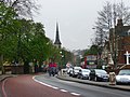
 Direction sign on Denmark Hill - geograph.org.uk - 1542639.jpg 640 × 501; 75 KB
-
 Dog Kennel Hill flats - geograph.org.uk - 1751740.jpg 640 × 480; 99 KB
-
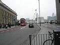
 London bridge southern end.JPG 768 × 862; 192 KB
-
 London Road, London SE1.JPG 1,600 × 1,200; 628 KB
-
-
 Lordship Lane - geograph.org.uk - 1255702.jpg 640 × 480; 106 KB
-
 Lordship Lane, London SE22 - geograph.org.uk - 1336629.jpg 640 × 480; 78 KB
-
 Newington Butts 2008 07 09.jpg 2,719 × 1,795; 1.26 MB
-
 Southwark Bridge Road - geograph.org.uk - 617800.jpg 483 × 640; 72 KB
-
 Walworth Road SE17 (3) - geograph.org.uk - 182797.jpg 640 × 480; 102 KB
-
 Walworth Road, SE17 (4) - geograph.org.uk - 314524.jpg 640 × 480; 104 KB
-
 Walworth Road, Walworth - geograph.org.uk - 949083.jpg 480 × 640; 98 KB
-
 Walworth Road, Walworth - geograph.org.uk - 949123.jpg 640 × 480; 120 KB
-
 Walworth road.jpg 640 × 480; 125 KB
-
 Waterloo Road, SE1 (2) - geograph.org.uk - 423871.jpg 640 × 480; 153 KB


_-_geograph.org.uk_-_182797.jpg)
_-_geograph.org.uk_-_314524.jpg)


_-_geograph.org.uk_-_423871.jpg)