Category:Bus stops in the Metropolitan Borough of Kirklees
Subcategories
This category has the following 2 subcategories, out of 2 total.
S
- St John's Church, Newsome (5 F)
T
Media in category "Bus stops in the Metropolitan Borough of Kirklees"
The following 68 files are in this category, out of 68 total.
-
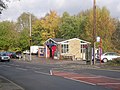
 A substantial bus shelter - geograph.org.uk - 4844373.jpg 1,024 × 768; 127 KB
-
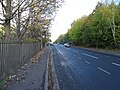
 A58 Whitehall Road, Hunsworth - geograph.org.uk - 5157569.jpg 640 × 479; 51 KB
-
 A629 Halifax Road at Edgerton - geograph.org.uk - 5607233.jpg 640 × 480; 113 KB
-

-
 Avanti Pizza on Lockwood Road, Huddersfield - geograph.org.uk - 4467300.jpg 2,448 × 1,624; 1.33 MB
-
 Back-to-back houses at Outlane - geograph.org.uk - 3552668.jpg 3,872 × 2,592; 3.58 MB
-
 Bath Hotel, Halifax Road - geograph.org.uk - 5928847.jpg 1,024 × 683; 161 KB
-
 Big Valley Garage - Meltham Road - geograph.org.uk - 2141417.jpg 640 × 480; 93 KB
-

-
 Bridge MVL3-82 - Church Street, Paddock - geograph.org.uk - 921666.jpg 640 × 466; 217 KB
-
 Bridge MVL3-90 - Trinity Street - geograph.org.uk - 929751.jpg 640 × 464; 192 KB
-

-
 Broad Lane, Huddersfield - geograph.org.uk - 3074605.jpg 640 × 480; 100 KB
-
 Brooks Arms - Brook Street - geograph.org.uk - 4853979.jpg 640 × 480; 80 KB
-

-
 Bus stop - geograph.org.uk - 5586404.jpg 6,000 × 4,000; 4.75 MB
-

-

-

-

-

-

-

-
 Bus stop by the A640 - geograph.org.uk - 3552652.jpg 3,872 × 2,592; 3.55 MB
-
 Bus stop on Birkby Hall Road - geograph.org.uk - 4391282.jpg 640 × 480; 86 KB
-
 Bus Stop on Hunsworth Lane - geograph.org.uk - 5114494.jpg 1,024 × 682; 187 KB
-
 Bus stop on Lockwood Scar - geograph.org.uk - 5973445.jpg 640 × 480; 79 KB
-
 Bus stop on Manchester Road (A62) - geograph.org.uk - 5971232.jpg 640 × 416; 41 KB
-
 Bus stop on Manchester Road (A62) - geograph.org.uk - 5971242.jpg 640 × 480; 59 KB
-
 Bus stop on Manchester Road (A62) - geograph.org.uk - 5971473.jpg 640 × 468; 105 KB
-
 Bus stop on Manchester Road (A62) - geograph.org.uk - 5971482.jpg 640 × 480; 54 KB
-
 Bus stop on Manchester Road (A62) - geograph.org.uk - 5971485.jpg 640 × 480; 70 KB
-
-

-
 Bus stop on Moor Lane, Netherton - geograph.org.uk - 5980000.jpg 640 × 480; 83 KB
-
 Bus stop on New Hey Road (A640) - geograph.org.uk - 4391333.jpg 640 × 480; 55 KB
-
 Bus stop on New Hey Road (A640) - geograph.org.uk - 5966101.jpg 640 × 426; 65 KB
-
 Bus stop on New Hey Road - geograph.org.uk - 4391319.jpg 640 × 480; 48 KB
-
 Bus stop on Trinity Street (A640) - geograph.org.uk - 4391365.jpg 640 × 480; 73 KB
-
 Bus stop on White Rose Avenue - geograph.org.uk - 4794184.jpg 1,024 × 768; 126 KB
-

-
 Bus Stop, Gelderd Road - geograph.org.uk - 5071391.jpg 1,024 × 682; 187 KB
-
 Bus stop, Whitley Road, Whitley Lower - geograph.org.uk - 5259825.jpg 1,024 × 768; 135 KB
-
 Bus Stops on Railway Street - geograph.org.uk - 4302586.jpg 640 × 427; 234 KB
-

-
 Carr Lane, Slaithwaite - geograph.org.uk - 57425.jpg 640 × 407; 67 KB
-
 Craven Heifer - Blackmoorfoot Road - geograph.org.uk - 1949872.jpg 640 × 495; 79 KB
-
 Dewsbury Central railway station (geograph 6014303).jpg 4,000 × 3,000; 2.54 MB
-

-
 Gate and bus stop Wilshaw Road - geograph.org.uk - 1516286.jpg 640 × 480; 104 KB
-
 George and Dragon, Flockton Green (geograph 2446615).jpg 640 × 426; 75 KB
-
 Green Lane - Staincliffe Road - geograph.org.uk - 3612000.jpg 640 × 480; 90 KB
-

-

-
 Keldregate, off Bradley Road - geograph.org.uk - 490365.jpg 640 × 480; 98 KB
-
 New Mill bus stop - geograph.org.uk - 1103854.jpg 640 × 480; 97 KB
-

-
 Paddock Railway Bridge MVL3-82, Church Street - geograph.org.uk - 5608741.jpg 1,600 × 1,200; 505 KB
-

-

-
 Soothill Lane with bus stops - geograph.org.uk - 6261724.jpg 1,024 × 768; 134 KB
-
 Swan Lane at North House - geograph.org.uk - 4392318.jpg 2,000 × 1,384; 864 KB
-
 The Pear Tree Inn Battyeford - geograph.org.uk - 737857.jpg 640 × 480; 72 KB
-

-
 Top end of Station Road, Golcar - geograph.org.uk - 408467.jpg 640 × 480; 110 KB
-
 Varley Road Slaithwaite - geograph.org.uk - 99567.jpg 640 × 480; 98 KB
-
 View down Chapel Hill, Huddersfield - geograph.org.uk - 1454146.jpg 640 × 478; 304 KB
-
 Waingate, Armitage Bridge - geograph.org.uk - 5148214.jpg 1,600 × 1,065; 672 KB


,_Slaithwaite_-_geograph.org.uk_-_5972330.jpg)

_-_geograph.org.uk_-_4391314.jpg)
_-_geograph.org.uk_-_4391344.jpg)


_-_geograph.org.uk_-_5971232.jpg)
_-_geograph.org.uk_-_5971242.jpg)
_-_geograph.org.uk_-_5971473.jpg)
_-_geograph.org.uk_-_5971482.jpg)
_-_geograph.org.uk_-_5971485.jpg)
,_Huddersfield_-_geograph.org.uk_-_5964915.jpg)
,_Netherton_-_geograph.org.uk_-_5979988.jpg)

_-_geograph.org.uk_-_4391333.jpg)
_-_geograph.org.uk_-_5966101.jpg)

_-_geograph.org.uk_-_4391365.jpg)


.jpg)


.jpg)


.jpg)


