Category:Byland with Wass
civil parish in North Yorkshire, England | |||||
| Upload media | |||||
| Instance of | |||||
|---|---|---|---|---|---|
| Location | Ryedale, North Yorkshire, Yorkshire and the Humber, England | ||||
 | |||||
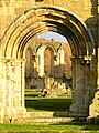
English: Byland with Wass is a civil parish in the Ryedale district of North Yorkshire, England. According to the 2001 census it had a population of 120. It covers Byland and Wass, in the North Yorks Moors.
Subcategories
This category has the following 2 subcategories, out of 2 total.
B
W
Media in category "Byland with Wass"
The following 133 files are in this category, out of 133 total.
-
 A footpath leading to Abbey House - geograph.org.uk - 3524448.jpg 1,024 × 768; 266 KB
-
 A footpath leading to Abbey House - geograph.org.uk - 3524450.jpg 1,024 × 768; 237 KB
-
 A track off Wass Bank Road - geograph.org.uk - 3523514.jpg 1,024 × 768; 210 KB
-

-
 A170 towards Thirsk - geograph.org.uk - 2718541.jpg 640 × 387; 27 KB
-
 Abbey at Byland - geograph.org.uk - 5764836.jpg 640 × 427; 219 KB
-
 Abbey Bank Wood - geograph.org.uk - 6251352.jpg 640 × 480; 102 KB
-
 Abbey House - geograph.org.uk - 6251358.jpg 640 × 480; 104 KB
-
 Along the road to Byland - geograph.org.uk - 5764829.jpg 640 × 427; 208 KB
-
 Approaching Byland - geograph.org.uk - 5764830.jpg 640 × 427; 250 KB
-
 Approaching Byland Abbey - geograph.org.uk - 5062449.jpg 1,600 × 1,067; 360 KB
-
 Approaching Byland Abbey - geograph.org.uk - 6243808.jpg 5,184 × 3,456; 6.88 MB
-
 Archway at Byland Abbey - geograph.org.uk - 5062442.jpg 1,600 × 1,067; 339 KB
-
 Byland Abbey - geograph.org.uk - 4377332.jpg 640 × 480; 50 KB
-
 Byland Abbey - geograph.org.uk - 4767038.jpg 1,024 × 683; 153 KB
-
 Byland Abbey - geograph.org.uk - 5061741.jpg 640 × 427; 62 KB
-
 Byland Abbey - geograph.org.uk - 5209047.jpg 4,000 × 2,597; 1.97 MB
-
 Byland Abbey - geograph.org.uk - 5630777.jpg 3,000 × 4,000; 2.53 MB
-
 Byland Abbey - geograph.org.uk - 5637501.jpg 1,600 × 1,028; 307 KB
-
 Byland Abbey - geograph.org.uk - 5637539.jpg 1,600 × 1,036; 263 KB
-
 Byland Abbey - geograph.org.uk - 5764834.jpg 640 × 427; 216 KB
-
 Byland Abbey - geograph.org.uk - 5961350.jpg 7,296 × 4,864; 7.51 MB
-
 Byland Abbey Inn - geograph.org.uk - 5938649.jpg 5,784 × 3,855; 4.74 MB
-
 Byland Abbey ruins - geograph.org.uk - 6251340.jpg 640 × 480; 89 KB
-
 Byland Abbey ruins - geograph.org.uk - 6251343.jpg 640 × 480; 101 KB
-
 Byland Abbey, Flooring in the retrochoir - geograph.org.uk - 5961449.jpg 5,713 × 3,807; 6.71 MB
-
 Byland Abbey, From north transept to south transept - geograph.org.uk - 5961399.jpg 4,678 × 7,017; 6.98 MB
-
 Byland Abbey, North transept - geograph.org.uk - 5961408.jpg 6,791 × 4,528; 7.02 MB
-

-

-

-
 Byland Abbey, The Cellarers Yard - geograph.org.uk - 5961381.jpg 6,754 × 4,502; 4.64 MB
-
 Byland Abbey, The cloister from the church - geograph.org.uk - 5961442.jpg 6,389 × 4,259; 7.64 MB
-
 Byland Abbey, The west front - geograph.org.uk - 5961390.jpg 6,831 × 4,554; 4.66 MB
-

-
 Byland Abbey, West front from the retrochoir - geograph.org.uk - 5961456.jpg 6,478 × 4,319; 7.35 MB
-
 Byland Abbey, Yorkshire - geograph.org.uk - 4118012.jpg 1,024 × 768; 106 KB
-
 Byland Moor Plantation - geograph.org.uk - 6033113.jpg 2,048 × 1,536; 1.61 MB
-
 Cams Head Farm - geograph.org.uk - 2974039.jpg 3,264 × 2,448; 1.51 MB
-
 Check point 1 on the Sterne Encounter - geograph.org.uk - 3018153.jpg 800 × 600; 207 KB
-
 College Moor Plantation - geograph.org.uk - 2647501.jpg 600 × 800; 173 KB
-
 Disused quarry at top of Wass Bank - geograph.org.uk - 6176047.jpg 4,320 × 3,240; 3.08 MB
-
 Eastern end of Byland Abbey grounds - geograph.org.uk - 6251361.jpg 640 × 480; 101 KB
-
 Edge of the woods - geograph.org.uk - 6033116.jpg 2,048 × 1,536; 1.55 MB
-
 Entering Byland - geograph.org.uk - 5764833.jpg 640 × 427; 214 KB
-
 Field below Oldstead Grange - geograph.org.uk - 4257370.jpg 640 × 480; 103 KB
-
 Field, Brink Hill - geograph.org.uk - 4257368.jpg 640 × 480; 98 KB
-
 Foot of Wass Bank - geograph.org.uk - 3527847.jpg 4,608 × 3,456; 6.31 MB
-
 Footbridge over stream - geograph.org.uk - 2974048.jpg 3,264 × 2,448; 3.11 MB
-
 Footpath Crossing a Pasture towards Byland Abbey - geograph.org.uk - 6243806.jpg 5,184 × 3,456; 5.41 MB
-
 Footpath heading down to Thorpe Spring - geograph.org.uk - 6243707.jpg 5,184 × 3,456; 6.46 MB
-
 Footpath heading for Wass Grange - geograph.org.uk - 6243631.jpg 5,184 × 3,456; 6.83 MB
-
 Footpath over Byland Moor - geograph.org.uk - 4257765.jpg 640 × 480; 87 KB
-
 Footpath SSW, footpath ESE - geograph.org.uk - 3527670.jpg 4,538 × 3,360; 5.84 MB
-
 Footpath to Cam Farm - geograph.org.uk - 2972721.jpg 3,264 × 2,448; 1.33 MB
-
 Footpath to Wass - geograph.org.uk - 3527614.jpg 3,930 × 2,939; 4.3 MB
-
 Footpath to Wass Grange - geograph.org.uk - 2972701.jpg 3,264 × 2,448; 1.33 MB
-
 Footpath up Blind Side Gill - geograph.org.uk - 4257761.jpg 640 × 480; 115 KB
-
 Forest track above Crief Gill - geograph.org.uk - 2328160.jpg 2,448 × 3,264; 2.47 MB
-
 Forest track, Wass Bank - geograph.org.uk - 5859328.jpg 3,239 × 3,852; 5.15 MB
-
 Forest track, Wass Moor - geograph.org.uk - 2328170.jpg 2,448 × 3,264; 3.13 MB
-
 Gate House Remains - geograph.org.uk - 4767027.jpg 683 × 1,024; 198 KB
-
 Gates near Wass Bank Road - geograph.org.uk - 5691015.jpg 3,264 × 2,448; 4.06 MB
-
 Grass Track below Hessle Hill - geograph.org.uk - 6243736.jpg 5,184 × 3,456; 5.87 MB
-
 Hambleton Lane, Wass - geograph.org.uk - 5062461.jpg 1,600 × 1,067; 655 KB
-
 Hawthorn Hedge near Cams Head - geograph.org.uk - 2109883.jpg 640 × 427; 299 KB
-
 Heading up hill towards Cam Farm - geograph.org.uk - 2616396.jpg 800 × 600; 190 KB
-
 Heading up Wass Bank towards the A170 - geograph.org.uk - 2467378.jpg 800 × 600; 330 KB
-
 Humps and bumps at Byland - geograph.org.uk - 2386281.jpg 3,264 × 2,448; 1.91 MB
-
 Lane to Blind Side Gill - geograph.org.uk - 4258956.jpg 640 × 480; 99 KB
-
 Larches, little and large - geograph.org.uk - 3261604.jpg 4,051 × 2,440; 1.56 MB
-
 Log Pile, Wass Moor - geograph.org.uk - 2328164.jpg 3,264 × 2,448; 2.16 MB
-
 Looking southward down Wass Bank - geograph.org.uk - 3527918.jpg 4,608 × 3,456; 6.37 MB
-
 Low Pasture Farm - geograph.org.uk - 2616095.jpg 800 × 600; 273 KB
-
 Lumps and Bumps in a Field - geograph.org.uk - 4257759.jpg 640 × 480; 72 KB
-
 Medieval tiled floor at Byland Abbey - geograph.org.uk - 6251347.jpg 640 × 480; 120 KB
-
 Minor Road - geograph.org.uk - 4767045.jpg 683 × 1,024; 254 KB
-
 Minor road to Stanbrook Abbey and Crief Lodges - geograph.org.uk - 3527953.jpg 4,556 × 3,386; 5 MB
-
 Museum, Byland Abbey - geograph.org.uk - 5653236.jpg 1,600 × 956; 251 KB
-
 Near the top of Wass Bank - geograph.org.uk - 3527978.jpg 4,608 × 3,456; 6.86 MB
-
 Newstead - geograph.org.uk - 6243718.jpg 5,184 × 3,456; 6.41 MB
-
 North of Old Pilfit - geograph.org.uk - 3348782.jpg 1,600 × 1,200; 686 KB
-
 Old Gatehouse Remains, Byland Abbey - geograph.org.uk - 5062466.jpg 1,600 × 1,067; 626 KB
-
 Old Gatehouse, Byland Abbey - geograph.org.uk - 5062592.jpg 1,600 × 1,067; 684 KB
-
 Piratical flowerpot men in Wass - geograph.org.uk - 3527777.jpg 3,350 × 2,704; 3.91 MB
-
 Postbox near Byland Abbey, Yorkshire - geograph.org.uk - 4118320.jpg 768 × 1,024; 298 KB
-
 Postbox near Byland Abbey, Yorkshire - geograph.org.uk - 4118323.jpg 768 × 1,024; 200 KB
-
 Public Footpath leading towards Wass Grange - geograph.org.uk - 6243703.jpg 5,170 × 3,408; 5.71 MB
-
 Quarrying on Wass Bank - geograph.org.uk - 5859332.jpg 4,320 × 2,923; 5.85 MB
-

-
 Recently felled area, Wass Moor - geograph.org.uk - 2328162.jpg 3,264 × 2,448; 1.85 MB
-

-
 Road leading to Coxwold - geograph.org.uk - 5764838.jpg 640 × 427; 196 KB
-
 Road to Byland Abbey - geograph.org.uk - 3527456.jpg 4,608 × 3,456; 6.53 MB
-
 Road to Wass - geograph.org.uk - 5062453.jpg 1,600 × 1,067; 396 KB
-
 Ruin above Low Pasture House - geograph.org.uk - 6243804.jpg 5,184 × 3,456; 5.67 MB
-
 Scawton Moor 2 - geograph.org.uk - 6033112.jpg 2,048 × 1,536; 980 KB
-
 Seat with Signpost near Byland Abbey, Yorkshire - geograph.org.uk - 4118304.jpg 768 × 1,024; 218 KB
-
 Sheep grazing below Elm Hag - geograph.org.uk - 1963507.jpg 1,024 × 768; 112 KB
-
 Sheep Pasture Near Cams Head - geograph.org.uk - 2109876.jpg 640 × 427; 281 KB
-
 Shorn sheep - geograph.org.uk - 1963517.jpg 1,024 × 768; 134 KB
-
 Stile, Blind Side Gill - geograph.org.uk - 2109942.jpg 640 × 427; 314 KB
-
 Strip of Pasture beside Craykeland Wood - geograph.org.uk - 6243741.jpg 5,184 × 3,456; 6.06 MB
-
 The Abbey Inn - geograph.org.uk - 4767035.jpg 1,024 × 683; 147 KB
-
 The bit with the black arrow - geograph.org.uk - 3527937.jpg 4,608 × 3,456; 6.3 MB
-
 The Remains of Byland Abbey - geograph.org.uk - 6243810.jpg 5,055 × 3,442; 7.51 MB
-
 The Remains of the Church at Byland Abbey - geograph.org.uk - 6243814.jpg 5,184 × 3,456; 5.56 MB
-
 The road from Oldstead to Byland Abbey - geograph.org.uk - 2467326.jpg 800 × 600; 299 KB
-
 The Secret Policeman's Pole - geograph.org.uk - 3527738.jpg 3,072 × 2,304; 3.66 MB
-
 The Stapylton Arms, Wass - geograph.org.uk - 5062459.jpg 1,600 × 1,067; 371 KB
-
 The Sweepers thinking about moving on - geograph.org.uk - 3018166.jpg 800 × 600; 171 KB
-
 The village of Wass. - geograph.org.uk - 4377335.jpg 640 × 383; 42 KB
-
 Through the south portal of Byland Abbey - geograph.org.uk - 5209068.jpg 3,000 × 4,000; 2.97 MB
-
 Through the west door at Byland Abbey - geograph.org.uk - 5209061.jpg 3,000 × 3,552; 2.71 MB
-
 Track from Long Grain - geograph.org.uk - 5691018.jpg 5,472 × 3,648; 7.4 MB
-
 Track into Burtis Wood off Wass Bank - geograph.org.uk - 3527906.jpg 3,072 × 2,304; 3.05 MB
-
 Track to Cam Farm - geograph.org.uk - 1158852.jpg 640 × 256; 33 KB
-
 Tree near A170 - geograph.org.uk - 1848072.jpg 800 × 600; 69 KB
-

-
 Walking near Blind Site Gill - geograph.org.uk - 2616387.jpg 800 × 600; 346 KB
-
 Walking towards Coxwold - geograph.org.uk - 2616451.jpg 800 × 600; 320 KB
-

-
 Warning^ A narrow and low lane - geograph.org.uk - 1963501.jpg 1,024 × 768; 152 KB
-
 Wass Bank Road - geograph.org.uk - 1630789.jpg 640 × 480; 78 KB
-
 Wass Bank Road, north towards the A170 - geograph.org.uk - 2467579.jpg 800 × 600; 237 KB
-
 Wass Grange - geograph.org.uk - 6243721.jpg 5,184 × 3,456; 4.05 MB
-
 Wass village - geograph.org.uk - 6251363.jpg 640 × 480; 92 KB
-
 Water trough on Wass Bank - geograph.org.uk - 3527887.jpg 4,608 × 3,456; 6.26 MB
-
 Western facade of Byland Abbey - geograph.org.uk - 6251336.jpg 480 × 640; 74 KB
-
 Winter afternoon in the woods - geograph.org.uk - 3261611.jpg 3,240 × 4,320; 2.95 MB
-
 Woodland Edge, Mount Snever - geograph.org.uk - 2109951.jpg 640 × 427; 270 KB
-

-
 Woods near Thorpe Lane - geograph.org.uk - 6243635.jpg 5,184 × 3,456; 5.81 MB


