Category:CIA World Factbook maps of Cook Islands
Media in category "CIA World Factbook maps of Cook Islands"
The following 11 files are in this category, out of 11 total.
-
 Cook Islands (New Zealand) map.png 324 × 348; 15 KB
-
 Cook Islands Map.png 330 × 355; 5 KB
-
 Cook Islands-CIA WFB Map.png 325 × 350; 5 KB
-
 Cook-Islands-map.gif 325 × 350; 5 KB
-
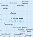
 Cook-lang-ru.png 789 × 896; 23 KB
-
 Cook-wiki.png 789 × 896; 14 KB
-
 Cw-map.png 330 × 355; 5 KB
-
 KukiAiraniCIA.png 330 × 355; 6 KB
-
 Map of Cook Islands.png 330 × 355; 11 KB
-
 World Factbook (1982) Cook Islands.jpg 758 × 589; 95 KB
-
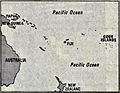
 World Factbook (1990) Cook Islands.jpg 524 × 561; 35 KB
_map.png)


_Cook_Islands.jpg)
_Cook_Islands.jpg)