Category:CIA World Factbook maps of Ireland
Media in category "CIA World Factbook maps of Ireland"
The following 16 files are in this category, out of 16 total.
-
 000 Irlanda harta.PNG 330 × 355; 9 KB
-
 Aierlan-ditu-zh.png 1,086 × 1,257; 259 KB
-
 Ei-map (Lithuanian).png 649 × 754; 82 KB
-
 Ei-map (Lithuanian).svg 649 × 754; 214 KB
-
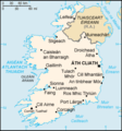
 Ei-map - 2.png 330 × 355; 14 KB
-
 Ei-map-es.png 330 × 355; 20 KB
-
 Ei-map-fr.png 330 × 355; 39 KB
-
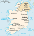
 Ei-map.png 330 × 355; 11 KB
-
 Ei-map.svg 652 × 756; 115 KB
-
 Ei-mapCS.PNG 330 × 355; 11 KB
-
 Ireland – U.S. area comparison.jpg 701 × 851; 401 KB
-
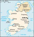
 Ireland-CIA WFB Map.png 330 × 355; 12 KB
-
 Mapa-Irlandii-Ukra.png 250 × 268; 31 KB
-
 World Factbook (1982) Ireland.jpg 587 × 588; 88 KB
-
 World Factbook (1990) Ireland.jpg 558 × 551; 120 KB
-
 Éire léarscáil.png 330 × 355; 17 KB


.png)
.svg)


_Ireland.jpg)
_Ireland.jpg)
