Category:CIA World Factbook maps of South America
Media in category "CIA World Factbook maps of South America"
The following 19 files are in this category, out of 19 total.
-
 "Political Central America" CIA World Factbook.jpg 851 × 660; 156 KB
-
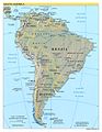
 "Political South America" CIA World Factbook.jpg 455 × 600; 240 KB
-
 "Political South America" CIA World Factbook.svg 631 × 833; 5.73 MB
-
 America.png 379 × 552; 64 KB
-
 Kaart Zuid Amerika.jpg 1,401 × 1,838; 851 KB
-
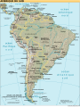
 Map of South America.jpg 1,125 × 1,448; 323 KB
-
 Mapa político América do Sul (english).svg 1,133 × 1,310; 2.75 MB
-
 Mapa político América do Sul.svg 1,133 × 1,310; 2.74 MB
-
 N&SAmerica-pol.jpg 964 × 1,455; 1.32 MB
-
 Political Map of the Americas.jpg 960 × 1,449; 399 KB
-
 South america es.svg 505 × 670; 558 KB
-
 South america fr cadre Uruguay Argentine.svg 505 × 670; 562 KB
-
 South america fr.svg 505 × 670; 565 KB
-
 South america la.svg 505 × 670; 559 KB
-
 South america mk.svg 505 × 670; 543 KB
-
 South america sv.svg 505 × 670; 560 KB
-
 South america tr.jpg 1,556 × 2,000; 1.23 MB
-
 South america.jpg 1,556 × 2,000; 434 KB
-
 South america.svg 505 × 670; 560 KB


.svg)


