Category:CIA maps of the Soviet Union
Media in category "CIA maps of the Soviet Union"
The following 106 files are in this category, out of 106 total.
-
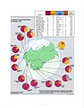
 1955 USSR GDP (30583518000).jpg 1,939 × 1,538; 2.05 MB
-
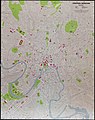 1980 Central Moscow (30849056096).jpg 7,200 × 9,085; 41.81 MB
-
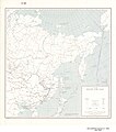
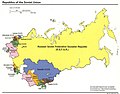 1991 Republic of Soviet Union (30849143016).jpg 1,212 × 953; 448 KB
-

-
 Approximate Soviet Theaters of Military Operations (TVDs).png 955 × 734; 337 KB
-
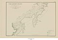
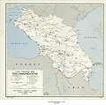
 Armenian S.S.R. LOC 89693147.jpg 4,179 × 3,154; 1.45 MB
-

-
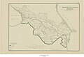
 Belorussian S.S.R. LOC 89690354.jpg 4,161 × 3,174; 1.43 MB
-
 Caucasus - DPLA - 2d3b14fc4f2c1624b173a215d423e59e.jpg 9,620 × 8,460; 5.67 MB
-
 Central and Eastern Siberia - DPLA - 34d38984bdeb3a1776ed349595af62ce.jpg 12,018 × 8,146; 8.42 MB
-
 Central and Eastern Siberia - DPLA - 4549b096fc221ed075833197eb85b5bb.jpg 11,935 × 8,035; 6.62 MB
-
 Central and Eastern Siberia - DPLA - 98d32c47dac90d16e64c8065396a5f61.jpg 11,950 × 8,211; 6.05 MB
-
 Central and Eastern Siberia - DPLA - bae9683659556c1ae945041a96aeb1ec.jpg 11,980 × 8,253; 6.84 MB
-
-

-

-
-
-
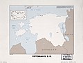 Estonian S.S.R. LOC 89693246.jpg 4,184 × 3,208; 1.16 MB
-
 Ethnic Groups in the Soviet Union - DPLA - d7a6475bd436c74e2b67e621a6b2afad.jpg 2,558 × 3,276; 3.45 MB
-
 European Russia Malaria Morbidity 1902-1911 - DPLA - d77145b38a34c36dc6cce62046fad9ef.jpg 2,752 × 4,414; 1.62 MB
-
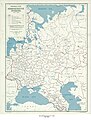
 European U.S.S.R. administrative divisions - July 1, 1946 LOC 2014585445.jpg 5,259 × 6,556; 4.11 MB
-
-
-

-
-

-

-

-

-
 Latvian S.S.R. Administrative Centers (1950) - DPLA - 3279f9c56163c55a45c8709e83a28dee.jpg 5,448 × 3,314; 1.83 MB
-
 Leningrad. LOC 79690374.jpg 10,844 × 15,396; 18.07 MB
-
 MANCHURIA-U.S.S.R BOUNDARY Ct002999.jpg 4,167 × 3,185; 4.25 MB
-
 Outline map of a portion of Asia - DPLA - cbe5190c113c01dd953af79567eeec09.jpg 7,572 × 5,630; 4.91 MB
-
 Permafrost Regions in the Soviet Union - DPLA - 584242333d15cc804d3d59af7833c422.jpg 3,282 × 2,554; 1.45 MB
-

-
-
-
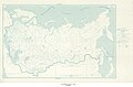
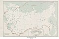
 Republics of the Soviet Union. LOC 2005626536.jpg 2,461 × 3,275; 374 KB
-
 Sakhalin - DPLA - 2b5063acccfa055710df6f0d1d613bc0.jpg 4,896 × 12,580; 6.33 MB
-
 Sakhalin - DPLA - 498e95be8f16e1f1048628626f7e6b72.jpg 3,456 × 8,365; 2.62 MB
-

-
 Soviet Central Asia. 5-60. LOC 75694101.jpg 11,184 × 5,153; 5.49 MB
-
 Soviet ethnic95.jpg 1,062 × 1,376; 192 KB
-
 Soviet union admin 1974.jpg 1,574 × 1,095; 459 KB
-
 Soviet union admin 1981.jpg 1,937 × 1,408; 384 KB
-
 Soviet Union administrative divisions, 1983. LOC 2005626378.jpg 4,373 × 3,218; 1.44 MB
-
 Soviet Union Coal and Major Minerals - DPLA - 91b6b1f32dea04093e955b54e27a9374.jpg 3,282 × 2,550; 769 KB
-
 Soviet Union Muslim Population 1979.jpg 1,035 × 1,238; 179 KB
-
 Soviet union rel 1986.jpg 1,887 × 1,318; 337 KB
-
 Soviet Union Republics, September 1991 - DPLA - e968bcde0c9fb13dfa1d8700d0d3bc05.jpg 3,276 × 2,552; 1.16 MB
-
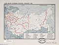
 Soviet union western economic regions 1986.jpg 1,341 × 1,581; 304 KB
-

-
 Street map of central Kiev. LOC 79693429.jpg 12,912 × 10,463; 9.9 MB
-
-
 Town Plan Volgograd - DPLA - ae3ffb1a86bbfeb654de6b1bbc97c49f.jpg 9,360 × 11,504; 9.4 MB
-

-

-
 U.S. S.R. - Ethnic Compositions - DPLA - 754227d4ec980a6b169104b656de499a.jpg 9,226 × 6,397; 8.72 MB
-
 U.S.S.R - Major Religious Groups - DPLA - 80f687c97c6fa7e2cde35db5d6f3240a.jpg 5,742 × 3,869; 2.88 MB
-
 U.S.S.R. - Areas Closed to Foreigners - DPLA - 0d8523f18e458b8687d08b3d628afaa7.jpg 6,576 × 4,410; 5.04 MB
-

-
-
 U.S.S.R. - Machine-Tool Producing Plants - DPLA - 7fd40b11ab91eb550a6a1eeb6e6b4c55.jpg 4,806 × 3,314; 2.05 MB
-
 U.S.S.R. - Reported Shipbuilding Activities - DPLA - 8e1207aceef27c32c62b4af244fa51cf.jpg 4,314 × 5,469; 2.98 MB
-
 U.S.S.R. Caucasus - DPLA - 9e96355e019ba37a2bad8a3659411846.jpg 2,476 × 3,126; 5.92 MB
-
 U.S.S.R. Soviet Far East - DPLA - 8207f931cb9d418da8325cf303869dbf.jpg 6,600 × 7,467; 4.19 MB
-
 U.S.S.R. Soviet North - DPLA - f9e35b9c9def8ef40a4709f7795b569d.jpg 9,312 × 4,967; 4.28 MB
-

-
 U.S.S.R., economic regions, 1971. 7-71. LOC 75694088.jpg 11,672 × 7,351; 9.46 MB
-
 U.S.S.R.; major terrain features. 5-69. LOC gm70004100.jpg 8,340 × 6,417; 4.74 MB
-
-

-

-

-

-

-
-
 Union of Soviet Socialist Republics (USSR) - DPLA - 22b0d2ee5c984c252ebab646df0bbf7f.jpg 5,271 × 4,047; 2.58 MB
-
 Union of Soviet Socialist Republics (USSR) - DPLA - 4d2ad3ad015be49afe23aca06d389e76.jpg 8,772 × 6,321; 5.8 MB
-
 Union of Soviet Socialist Republics (USSR) - DPLA - 6ca05c5cf1a4decca87a271c2917d6c8.jpg 5,280 × 4,056; 2.37 MB
-
 Union of Soviet Socialist Republics (USSR) - DPLA - 778805023c408b0c6db7c3ac43a1439a.jpg 6,072 × 4,024; 2.31 MB
-
 Union of Soviet Socialist Republics (USSR) - DPLA - 9ac41a430d48f94ad123d6c24b1704e9.jpg 6,056 × 3,989; 2.36 MB
-
 Union of Soviet Socialist Republics (USSR) - DPLA - ca1c68ba11e091acb18b4434f2ea2db8.jpg 11,897 × 7,560; 6.84 MB
-
 Union of Soviet Socialist Republics (USSR) - DPLA - df1bc7c60d953f205e67088f6bdf0de2.jpg 11,768 × 7,599; 9.1 MB
-
 Union of Soviet Socialist Republics (USSR) - DPLA - ed57f7419241e7ddb374f3c262adb321.jpg 11,980 × 7,904; 5.43 MB
-
 Union of Soviet Socialist Republics (USSR) - DPLA - f3437494803a8ee0c81fdfd506d42300.jpg 11,960 × 7,909; 8.98 MB
-
 Union of Soviet Socialist Republics (USSR) - DPLA - f717516914e191c5d479a29b9e9da411.jpg 11,898 × 7,560; 6.66 MB
-

-

-

-

-

-

-

-
 Union of Soviet Socialist Republics (USSR) Terrain - DPLA - 116dd2aff646f903c40bf75b47caafab.jpg 15,321 × 10,752; 18.03 MB
-

-
-

-
-

-
 USSR, major economic regions, February 1962. LOC 78694965.jpg 4,170 × 3,199; 1.46 MB
-
 USSR- Karst and mining areas. 1-62. LOC 75694094.jpg 9,467 × 6,362; 6.79 MB
-
-

-
 Истоки территориальных претензий КНР к РФ.jpg 2,084 × 1,593; 415 KB
.jpg)
.jpg)
.jpg)
_in_Europe_-_DPLA_-_34cf0d9ff0d9bad43fd36b1200bf9aa0.jpg)
.png)


_-_DPLA_-_f05befee5f1255e61972940f094ae9c2_(page_2).jpg)
-_Central_Asiatic_Region_-_DPLA_-_108a3b275d7b2be59e6835550486e368.jpg)
-_Far_Eastern_Region_-_DPLA_-_5384e5483e75bc614eef23f4d1bec295.jpg)


_Administrative_Divisions_-_DPLA_-_d9816a9214e6fc77edab07c90fa19451.jpg)
_Ethnic_Groups_(Before_1939)_-_DPLA_-_9820cc06b72e7b131366b861f5ee351a.jpg)
_Malaria_Morbidity_and_Control_stations-1929_-_DPLA_-_8025789e38ab9373feb543ddaf29a74a.jpg)
_Physiographic_Diagram_-_DPLA_-_a1d2fdebb0e50cc19ccf63bc96466e8a.jpg)
_Population_Density_-_DPLA_-_25e3cd2509c8892ac222ec596224e90f_(page_1).jpg)
_Population_Density_-_DPLA_-_25e3cd2509c8892ac222ec596224e90f_(page_2).jpg)


_-_DPLA_-_3279f9c56163c55a45c8709e83a28dee.jpg)


_-_DPLA_-_167d6a800dd1caf6fd4ddf60b110ced6.jpg)
_-_DPLA_-_46f58d0b813f254daf1f790439ef53da.jpg)


_-_DPLA_-_2262b48447b55b514678155fa4c51e6d.jpg)


_Nationality_Units_of_the_Territorial-Administrative_System_-_DPLA_-_348719fd24b82a77a52eb1d808ac173b.jpg)


_-_DPLA_-_ba2a342764d23b704082069eabde53d5.jpg)


_(Including_Latvia,_Lithuania,_Estonia,_Tannu_Tuva,_and_island_possessions)_-_DPLA_-_256095d73dd58f23dbe265a0cb4802a0.jpg)
_(Including_Latvia,_Lithuania,_Estonia,_Tannu_Tuva,_and_island_possessions)_-_DPLA_-_d082856f8a57457a71f971b6a987518f.jpg)
_(Including_Latvia,_Lithuania,_Estonia,_Tannu_Tuva,_and_island_possessions)_Index_of_Oil_and_Gas_Field_Maps,_Petroleum_Prospects_and_Facili_-_DPLA_-_73bac090e09662851e7e041b22f97dd6.jpg)
_(Including_Latvia,_Lithuania,_Estonia,_Tannu_Tuva,_and_island_possessions)_Radio_Stations_Associated_with_Basic_Telephone_and_Telegraph_Ne_-_DPLA_-_141f902fedabe5ddff8aa373023ac0df.jpg)
_-_Caucasus_Area_Administrative_Divisions_-_DPLA_-_caa9f67f23903dd8f48f9804a81932fc.jpg)
_-_Caucasus_Area_Population_Density_-_DPLA_-_30e071c292fb37298d8dc9840f8ee606.jpg)
_-_Caucasus_Area_Telecommunications_-_DPLA_-_05f05db24ceedda1998cf488e947abe9.jpg)
_-_DPLA_-_22b0d2ee5c984c252ebab646df0bbf7f.jpg)
_-_DPLA_-_4d2ad3ad015be49afe23aca06d389e76.jpg)
_-_DPLA_-_6ca05c5cf1a4decca87a271c2917d6c8.jpg)
_-_DPLA_-_778805023c408b0c6db7c3ac43a1439a.jpg)
_-_DPLA_-_9ac41a430d48f94ad123d6c24b1704e9.jpg)
_-_DPLA_-_ca1c68ba11e091acb18b4434f2ea2db8.jpg)
_-_DPLA_-_df1bc7c60d953f205e67088f6bdf0de2.jpg)
_-_DPLA_-_ed57f7419241e7ddb374f3c262adb321.jpg)
_-_DPLA_-_f3437494803a8ee0c81fdfd506d42300.jpg)
_-_DPLA_-_f717516914e191c5d479a29b9e9da411.jpg)
_Administrative_Divisions_1946_-_DPLA_-_55ac899d975b61069872d3a0b468de81.jpg)
_Administrative_Divisions_1946_-_DPLA_-_64bddb6b155e7464d0ee8382fdf14c6e.jpg)
_Administrative_Divisions_1946_-_DPLA_-_8c82af77b7446ccf578f7fe9a0e127dc.jpg)
_Area_Maps_of_Oil_and_Gas_fields,_Prospects,_Structural_Axes,_and_Petroleum_Facilities_--_1951_-_DPLA_-_bfbf332b09ce6186590cf6158a869bab.jpg)
_Areas_Closed_to_Foreigners_-_DPLA_-_f9c4fa48840729be8e1d6af7f5cf8627.jpg)
_Distribution_of_Timber_Volume_-_1950_-_DPLA_-_40ea1dee18f77b7295abe4f800e0c58e.jpg)
_Principal_Roads_-_DPLA_-_01e24fff3e539b661a2be42d0ef0ac51.jpg)
_Terrain_-_DPLA_-_116dd2aff646f903c40bf75b47caafab.jpg)
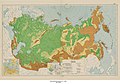
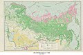
_Vegetation_Zones_-_DPLA_-_358cd5b9881571ca91751fc9708f7b63.jpg)
(Including_Latvia,_Lithuania,_Estonia,_Tannu_Tuva,_and_island_possessions)_Index_of_Oil_and_Gas_Field_Maps,_Petroleum_Prospects_and_Facilit_-_DPLA_-_1dba8b89272554b00059fc25c899a571.jpg)
(Including_Latvia,_Lithuania,_Estonia,_Tannu_Tuva,_and_island_possessions)_Telephone_and_Telegraph_Net_-_DPLA_-_ccdbdf1ad827dafa3d8dd43a6b2e0935.jpg)
-_Forest_Distribution_-_DPLA_-_5a53c4fc37345cbc3b0f810cfcdac00d.jpg)


_1946_-_DPLA_-_7af7a6bd2422a78083cbe5753737468a.jpg)


-_Transcaucasion_Region_-_DPLA_-_42b906345177b0e3e74aef964ac4530b.jpg)