Category:Cadney (civil parish)
English: Cadney is a civil parish in North Lincolnshire that consists of the small villages of Cadney and Howsham, several farmsteads and a large amount of mainly arable farmland.

Subcategories
This category has the following 6 subcategories, out of 6 total.
Media in category "Cadney (civil parish)"
The following 13 files are in this category, out of 13 total.
-
 Bend in Pepperdale Lane - geograph.org.uk - 1265645.jpg 640 × 480; 216 KB
-
 Bridge over Kettleby Beck - geograph.org.uk - 1141302.jpg 640 × 423; 100 KB
-
 Bridge over Kettleby Beck - geograph.org.uk - 181435.jpg 640 × 480; 128 KB
-
 Cadney Road bridge - geograph.org.uk - 1581155.jpg 640 × 426; 97 KB
-
 Faraway Drain - geograph.org.uk - 1581172.jpg 640 × 426; 70 KB
-
 Farmland east of Froghall Carrs - geograph.org.uk - 1256225.jpg 640 × 480; 219 KB
-
 Froghall Carrs - geograph.org.uk - 1581159.jpg 640 × 426; 49 KB
-
 Lane to two farms - geograph.org.uk - 1256221.jpg 640 × 480; 215 KB
-
 New River Ancholme - geograph.org.uk - 182492.jpg 640 × 426; 124 KB
-
 Poultry unit at Cotswold Farm - geograph.org.uk - 1265649.jpg 640 × 480; 214 KB
-
 Rape crop about to flower - geograph.org.uk - 1265653.jpg 640 × 480; 216 KB
-
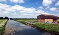 The New River Ancholme - geograph.org.uk - 310291.jpg 640 × 385; 88 KB
-
 View north to Pepperdale Covers and Farm - geograph.org.uk - 1265642.jpg 640 × 480; 217 KB


