Category:Cairnie (civil parish)
Scottish parish in Aberdeenshire, Scotland, UK | |||||
| Upload media | |||||
| Instance of | |||||
|---|---|---|---|---|---|
| Named after | |||||
| Location |
| ||||
| Population |
| ||||
| Area |
| ||||
 | |||||
Subcategories
This category has the following 3 subcategories, out of 3 total.
Media in category "Cairnie (civil parish)"
The following 200 files are in this category, out of 265 total.
(previous page) (next page)-
 "Flags" on the Burnside drive - geograph.org.uk - 5975182.jpg 1,600 × 1,200; 531 KB
-
 "That's it, the lights gone, let's go......" - geograph.org.uk - 5626990.jpg 1,200 × 900; 278 KB
-
 A bend in the A96 - geograph.org.uk - 4089340.jpg 640 × 480; 74 KB
-
 A bend in the A96 - geograph.org.uk - 4089351.jpg 640 × 480; 69 KB
-
 A bend in the A96 - geograph.org.uk - 4089465.jpg 640 × 480; 83 KB
-
 A breather between drives - geograph.org.uk - 5975218.jpg 1,600 × 1,202; 620 KB
-
 A Gap in the Forest - geograph.org.uk - 4343057.jpg 640 × 427; 355 KB
-
 A Heap of Boulders - geograph.org.uk - 4343298.jpg 640 × 427; 364 KB
-
 A mixed bag on Alehousehillock - geograph.org.uk - 5613886.jpg 886 × 1,200; 585 KB
-

-
 A section of minor road near to Raemurrack - geograph.org.uk - 5962631.jpg 4,000 × 3,000; 3.8 MB
-
 A section of Old Military Road going under the A96 - geograph.org.uk - 5962644.jpg 4,000 × 3,000; 2.66 MB
-
 A Window in the Woods - geograph.org.uk - 4343032.jpg 427 × 640; 525 KB
-
 A96 heading south east - geograph.org.uk - 4089312.jpg 640 × 480; 66 KB
-
 A96 heading south east - geograph.org.uk - 4089329.jpg 640 × 480; 53 KB
-
 A96 heading south east - geograph.org.uk - 4089445.jpg 640 × 480; 66 KB
-
 A96 heading south east - geograph.org.uk - 4089455.jpg 640 × 480; 64 KB
-
 A96 heading south east, Coachford - geograph.org.uk - 4089320.jpg 640 × 480; 63 KB
-
 A96 towards Huntly - geograph.org.uk - 4089301.jpg 640 × 480; 83 KB
-
 A96 towards Huntly - geograph.org.uk - 4089313.jpg 640 × 480; 60 KB
-
 A96 towards Huntly - geograph.org.uk - 4089325.jpg 640 × 480; 60 KB
-
 A96 towards Huntly - geograph.org.uk - 4089346.jpg 640 × 480; 63 KB
-
 A96 towards Huntly - geograph.org.uk - 4089454.jpg 640 × 480; 55 KB
-
 A96 towards Huntly - geograph.org.uk - 4089459.jpg 640 × 480; 69 KB
-
 Abandoned Forest Gate - geograph.org.uk - 4343306.jpg 640 × 427; 472 KB
-
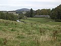
 Above Cairnie - geograph.org.uk - 2552468.jpg 3,456 × 2,304; 992 KB
-
 Access road to Inschtammack - geograph.org.uk - 1211063.jpg 640 × 480; 78 KB
-
 Access to Banks farm - geograph.org.uk - 2623311.jpg 935 × 673; 338 KB
-
 Access to Creag an Tuirc - geograph.org.uk - 2623402.jpg 1,263 × 927; 325 KB
-
 Access to Croft of Dykeside - geograph.org.uk - 2622061.jpg 1,296 × 972; 297 KB
-
 Access to Haddoch farmhouse - geograph.org.uk - 2622072.jpg 2,592 × 1,944; 798 KB
-
 Almost the Summit View - geograph.org.uk - 4343112.jpg 640 × 427; 324 KB
-
 Approach to buildings at Bridge of Hogston - geograph.org.uk - 2622376.jpg 2,592 × 1,944; 693 KB
-
 Approach to Tillyvale on B9022 - geograph.org.uk - 2622114.jpg 1,296 × 972; 372 KB
-
 Approaching Bin Moss - geograph.org.uk - 4343003.jpg 640 × 427; 408 KB
-
 Ashgrove garden centre and filling station - geograph.org.uk - 2623393.jpg 1,079 × 533; 138 KB
-
 Auchanachie Cottages - geograph.org.uk - 2623295.jpg 1,261 × 711; 268 KB
-
 Auchanachie Farm - geograph.org.uk - 2551906.jpg 3,456 × 2,304; 865 KB
-

-
 B9022 at Haddoch - geograph.org.uk - 3737952.jpg 1,600 × 1,200; 311 KB
-
 B9022 at Haddoch - geograph.org.uk - 3737953.jpg 1,600 × 1,200; 305 KB
-
 B9022 at Tillytarmont - geograph.org.uk - 3737950.jpg 1,600 × 1,200; 294 KB
-
 B9022 over River Isla - geograph.org.uk - 2622287.jpg 2,592 × 1,944; 657 KB
-

-
 Balloch Burn Bridge - geograph.org.uk - 6415478.jpg 640 × 426; 446 KB
-
 Balloch Burn Loop - geograph.org.uk - 6415475.jpg 640 × 426; 350 KB
-
 Beaters await deployment for the second drive - geograph.org.uk - 5983471.jpg 1,600 × 1,198; 407 KB
-
 Beaters exiting the glen by Ardonald - geograph.org.uk - 1002082.jpg 640 × 485; 151 KB
-
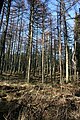
 Bin Forest - geograph.org.uk - 1226265.jpg 640 × 427; 256 KB
-
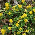 Black Medick (Medicago lupulina) - geograph.org.uk - 4033003.jpg 640 × 640; 594 KB
-
 Boghead House, near Cairnie - geograph.org.uk - 1237507.jpg 640 × 440; 48 KB
-
 Boulders from the Fields - geograph.org.uk - 4883721.jpg 640 × 427; 397 KB
-
 Bridge of Gilgatherbush (Old and New) - geograph.org.uk - 2623327.jpg 1,296 × 972; 468 KB
-
 Bridge of Hogston - geograph.org.uk - 2622395.jpg 1,151 × 687; 187 KB
-
 Bridge of Isla - geograph.org.uk - 2622258.jpg 2,592 × 1,944; 776 KB
-
 Buildings near Bridge of Hogston - geograph.org.uk - 4032966.jpg 640 × 427; 386 KB
-
 Burn of Hogston - geograph.org.uk - 4032973.jpg 640 × 427; 396 KB
-
 Cairnie Burn - geograph.org.uk - 2552481.jpg 2,304 × 3,456; 1.71 MB
-
 Cairnie Burn - geograph.org.uk - 3291111.jpg 782 × 776; 297 KB
-
 Cairnie road junction - geograph.org.uk - 2623374.jpg 1,296 × 972; 347 KB
-
 Cairnie telephone exchange - geograph.org.uk - 2623385.jpg 1,296 × 972; 319 KB
-
 Cairnie, near Huntly - geograph.org.uk - 5353154.jpg 1,024 × 682; 108 KB
-
 Clear Felled Forest - geograph.org.uk - 6415487.jpg 640 × 426; 324 KB
-
 Clear-felled Forest - geograph.org.uk - 4343100.jpg 640 × 427; 470 KB
-
 Clear-felled Forest - geograph.org.uk - 4343184.jpg 640 × 427; 479 KB
-
 Clearfell in The Bin Forest - geograph.org.uk - 991529.jpg 640 × 480; 117 KB
-
 Cleavers (Galium aparine) - geograph.org.uk - 4033360.jpg 640 × 628; 465 KB
-
 Clochren Bridge, near Ruthven - geograph.org.uk - 2623285.jpg 1,213 × 777; 259 KB
-
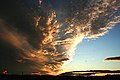 Cloudscape - geograph.org.uk - 1092280.jpg 640 × 427; 202 KB
-
 Coo looking through the gorse - geograph.org.uk - 1237515.jpg 640 × 428; 69 KB
-
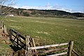
 Cows in field at Botary Mains - geograph.org.uk - 3291127.jpg 1,174 × 781; 441 KB
-
 Croft of Dykeside - geograph.org.uk - 4343304.jpg 640 × 427; 406 KB
-
 Crofthead Cottage - geograph.org.uk - 4033366.jpg 640 × 427; 496 KB
-
 Crop field, Hollowdyke - geograph.org.uk - 4089327.jpg 640 × 480; 49 KB
-
 Crossroads in Ruthven - geograph.org.uk - 5963458.jpg 4,000 × 3,000; 3.24 MB
-
 Derelict poultry sheds - geograph.org.uk - 1211124.jpg 640 × 473; 103 KB
-
 Deveron Downstream - geograph.org.uk - 2563018.jpg 2,304 × 3,456; 1.03 MB
-
 Deveron View - geograph.org.uk - 4343220.jpg 427 × 640; 380 KB
-
 Deveron View cottage - geograph.org.uk - 2622251.jpg 2,592 × 1,944; 714 KB
-
 DMU 170453 bound for Inverness - geograph.org.uk - 5042385.jpg 1,800 × 1,012; 2.15 MB
-

-

-
 Downstream from Bridge of Isla - geograph.org.uk - 2622304.jpg 1,944 × 2,592; 776 KB
-
 Drumdelgie junction off A96 - geograph.org.uk - 1211048.jpg 640 × 480; 70 KB
-
 Drumdelgie Parish Kirk - geograph.org.uk - 4883732.jpg 640 × 427; 430 KB
-
 Drumdelgie Parish Kirkyard - geograph.org.uk - 4883745.jpg 640 × 427; 428 KB
-
 Dwelling at Bridge of Hogston - geograph.org.uk - 2623254.jpg 1,227 × 759; 241 KB
-
 Dykehead - geograph.org.uk - 4032957.jpg 640 × 427; 381 KB
-
 Embankment beside the A96 - geograph.org.uk - 4089303.jpg 640 × 480; 97 KB
-
 Entering Ruthven from the east - geograph.org.uk - 2623261.jpg 1,089 × 783; 300 KB
-
 Entrance to the cave on The Bin - geograph.org.uk - 3289807.jpg 604 × 1,170; 196 KB
-
 Erratics - geograph.org.uk - 4343087.jpg 640 × 427; 451 KB
-
 Faint Path - geograph.org.uk - 6415457.jpg 640 × 426; 477 KB
-
 Fallen Trees - geograph.org.uk - 4343072.jpg 640 × 427; 445 KB
-
 Fallen Trees - geograph.org.uk - 4343216.jpg 427 × 640; 542 KB
-
 Farm buildings, Coachford - geograph.org.uk - 4089317.jpg 640 × 480; 69 KB
-
 Farm road to Binhall - geograph.org.uk - 3737439.jpg 1,600 × 1,200; 480 KB
-
 Farmland near Garromuir Wood - geograph.org.uk - 3737416.jpg 1,600 × 1,200; 605 KB
-
 Farmland, Auchairn - geograph.org.uk - 4089310.jpg 640 × 480; 66 KB
-
 Farmland, Gray Stone - geograph.org.uk - 4089444.jpg 640 × 480; 58 KB
-
 Forest Clearing - geograph.org.uk - 4343044.jpg 427 × 640; 425 KB
-
 Forest on Meikle Balloch - geograph.org.uk - 6415463.jpg 426 × 640; 516 KB
-
 Forest Road - geograph.org.uk - 4343077.jpg 640 × 427; 426 KB
-
 Forest Signpost - geograph.org.uk - 6415470.jpg 426 × 640; 428 KB
-
 Forest Track - geograph.org.uk - 4343040.jpg 640 × 427; 370 KB
-
 Forest Waymarker - geograph.org.uk - 6415488.jpg 640 × 426; 327 KB
-
 Former Forest - geograph.org.uk - 4343104.jpg 640 × 427; 509 KB
-
 From A920 farmland - geograph.org.uk - 4700056.jpg 640 × 480; 86 KB
-
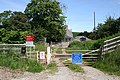
 Gated forestry road into The Bin forest - geograph.org.uk - 3737955.jpg 1,600 × 1,200; 407 KB
-
 Geese, Geese, and more Geese - geograph.org.uk - 5642884.jpg 1,200 × 901; 101 KB
-
 Grazing, Binside - geograph.org.uk - 4089447.jpg 640 × 480; 54 KB
-
 Grazing, Cairnie - geograph.org.uk - 4089343.jpg 640 × 480; 70 KB
-
 Grazing, Newton - geograph.org.uk - 4089335.jpg 640 × 480; 76 KB
-
 Guns and beaters disperse at Backmuir - geograph.org.uk - 5992837.jpg 1,600 × 1,201; 468 KB
-
 Guns in position at the Backmuir shoot - geograph.org.uk - 5644464.jpg 1,200 × 900; 257 KB
-
 Haddoch Cottages - geograph.org.uk - 4343293.jpg 640 × 427; 341 KB
-

-
 Highland Cattle - geograph.org.uk - 2551922.jpg 3,456 × 2,304; 834 KB
-
 Hill of Shenwall - geograph.org.uk - 1178947.jpg 427 × 640; 246 KB
-
 Hollowdyke - geograph.org.uk - 3799260.jpg 640 × 401; 344 KB
-
 Home Farm, Avochie House - geograph.org.uk - 2622237.jpg 2,592 × 1,944; 953 KB
-
 Hop Trefoil (trifolium campestre) - geograph.org.uk - 4033353.jpg 640 × 427; 456 KB
-
 Horntowie - geograph.org.uk - 3289812.jpg 1,097 × 636; 199 KB
-
 Houses at Crofthead - geograph.org.uk - 4033029.jpg 640 × 427; 367 KB
-
 In the Beaters' cart at Backmuir - geograph.org.uk - 5992832.jpg 1,600 × 1,198; 405 KB
-
 In the Shade - geograph.org.uk - 4343022.jpg 427 × 640; 506 KB
-
 Inschtammack - geograph.org.uk - 1226158.jpg 640 × 427; 271 KB
-
 Inschtammack Cottage - geograph.org.uk - 1211079.jpg 640 × 480; 113 KB
-
 Inside Drumdelgie Parish Kirk - geograph.org.uk - 4883741.jpg 640 × 427; 467 KB
-
 Interior of St Peter's Kirk - geograph.org.uk - 4883737.jpg 640 × 427; 499 KB
-

-
 Junction of minor roads at Shenwell Cottage - geograph.org.uk - 5962626.jpg 4,000 × 3,000; 3.62 MB
-
 Junction with A96 - geograph.org.uk - 1211055.jpg 640 × 480; 73 KB
-
 Larch Trees - geograph.org.uk - 4343172.jpg 427 × 640; 574 KB
-
 Light and Shade - geograph.org.uk - 4343211.jpg 427 × 640; 471 KB
-
 Light in the Gloom - geograph.org.uk - 4343047.jpg 427 × 640; 528 KB
-

-
 Little Daugh farmstead - geograph.org.uk - 2623267.jpg 1,296 × 972; 384 KB
-
 Littlemill Level Crossing - geograph.org.uk - 4033354.jpg 640 × 427; 469 KB
-
 London Pride (Saxifrage x urbium) - geograph.org.uk - 4033038.jpg 640 × 416; 279 KB
-
 Looking towards Boghead - geograph.org.uk - 4343300.jpg 640 × 427; 415 KB
-
 Looking Towards the Hill of Milleath - geograph.org.uk - 1226133.jpg 640 × 427; 239 KB
-
 Lower Sinsharnie - geograph.org.uk - 2623410.jpg 1,296 × 972; 453 KB
-
 Meltwater Channel - geograph.org.uk - 1178916.jpg 640 × 427; 254 KB
-
 Minor road approaching Netherton - geograph.org.uk - 5963516.jpg 4,000 × 3,000; 3.09 MB
-
 Minor road at Botary Mains - geograph.org.uk - 5962641.jpg 4,000 × 3,000; 3.27 MB
-
 Minor road at Crispin - geograph.org.uk - 5962639.jpg 4,000 × 3,000; 3.52 MB
-
 Minor road at Crofthead - geograph.org.uk - 3737940.jpg 1,600 × 1,200; 557 KB
-
 Minor road at Little Daugh - geograph.org.uk - 5963447.jpg 4,000 × 3,000; 3.37 MB
-
 Minor road at Nether Tullochs - geograph.org.uk - 5963513.jpg 4,000 × 3,000; 3.5 MB
-
 Minor road at the Bridge of Ardonald - geograph.org.uk - 5962640.jpg 4,000 × 3,000; 3.32 MB
-
 Minor road at the entrance to Craig Hithan - geograph.org.uk - 5962643.jpg 4,000 × 3,000; 3.53 MB
-
 Minor road heading towards Auchananachie - geograph.org.uk - 5963445.jpg 4,000 × 3,000; 3.58 MB
-
 Minor road heading towards Upper Hillside - geograph.org.uk - 5962628.jpg 4,000 × 3,000; 2.8 MB
-
 Minor road junction with B9022 - geograph.org.uk - 2622271.jpg 2,592 × 1,944; 555 KB
-
 Minor road near Bridge of Hogston - geograph.org.uk - 3737939.jpg 1,600 × 1,200; 345 KB
-
 Minor road near Cairnie - geograph.org.uk - 3737415.jpg 1,600 × 1,200; 552 KB
-
 Minor road near Cairnie - geograph.org.uk - 3737437.jpg 1,600 × 1,200; 480 KB
-
 Minor road near Ruthven - geograph.org.uk - 3737934.jpg 1,600 × 1,200; 387 KB
-
 Minor road near Ruthven - geograph.org.uk - 3737935.jpg 1,600 × 1,200; 398 KB
-
 Minor road near Ruthven - geograph.org.uk - 3737943.jpg 1,600 × 1,200; 312 KB
-
 Minor road to Carnie near Stibhard - geograph.org.uk - 5963439.jpg 4,000 × 3,000; 4.32 MB
-
 Minor road, Bridge and sometime Ford near Shinsharnie - geograph.org.uk - 5962646.jpg 4,000 × 3,000; 4.18 MB
-
 Missing Waymarker - geograph.org.uk - 6415480.jpg 640 × 426; 346 KB
-
 More Clear-fell - geograph.org.uk - 4343198.jpg 640 × 427; 442 KB
-
 Moss-covered Gravestones - geograph.org.uk - 4883752.jpg 640 × 427; 494 KB
-
 Mossy Carpet - geograph.org.uk - 4343051.jpg 640 × 427; 466 KB
-
 No through road to West Riggins - geograph.org.uk - 3737436.jpg 1,600 × 1,200; 458 KB
-
 North Tillytarmont - geograph.org.uk - 4033375.jpg 640 × 427; 405 KB
-
 Oakwood Cottage - geograph.org.uk - 2622217.jpg 2,592 × 1,944; 753 KB
-

-
 OK' that's it for the day.... - geograph.org.uk - 6031315.jpg 1,600 × 1,204; 466 KB
-
 Old Bridge of Gilgatherbush - geograph.org.uk - 2623362.jpg 858 × 785; 222 KB
-
 Old Kirkyard Gate - geograph.org.uk - 4883758.jpg 640 × 427; 500 KB
-
 On a clear day you can see forever.. - geograph.org.uk - 6040510.jpg 1,600 × 1,204; 506 KB
-
 Open Woodland - geograph.org.uk - 4343008.jpg 640 × 427; 452 KB
-
 Ordnance Survey Cut Mark - geograph.org.uk - 5967540.jpg 4,000 × 3,000; 3.87 MB
-
 Passing place on narrow country road - geograph.org.uk - 1211092.jpg 640 × 456; 73 KB
-
 Path Downhill - geograph.org.uk - 5167658.jpg 4,101 × 2,735; 2.19 MB
-
 Path into The Bin forest - geograph.org.uk - 3737954.jpg 1,600 × 1,200; 522 KB
-
 Patiently awaiting the beaters on the last drive - geograph.org.uk - 5983475.jpg 1,204 × 1,600; 561 KB
-
 Picking up with Pointers and Labradors - geograph.org.uk - 5642874.jpg 1,200 × 904; 416 KB
-
 Picnic Tables - geograph.org.uk - 4343178.jpg 640 × 427; 516 KB
-
 Pine Stand - geograph.org.uk - 5167665.jpg 2,656 × 3,982; 1.71 MB
-
 Railway bridge near Dykehead - geograph.org.uk - 2622347.jpg 1,233 × 775; 344 KB
-

-
 Recently Repaired Path - geograph.org.uk - 4343202.jpg 427 × 640; 460 KB
-
 River Deveron - geograph.org.uk - 2563013.jpg 2,304 × 3,456; 1.32 MB
-
 River Deveron - geograph.org.uk - 4343218.jpg 640 × 427; 402 KB
-
 River Deveron - geograph.org.uk - 5670092.jpg 640 × 480; 31 KB
-
 Road at Bridge of Hogston - geograph.org.uk - 5963464.jpg 4,000 × 3,000; 3.25 MB
-
 Road at Crofthead - geograph.org.uk - 5963466.jpg 4,000 × 3,000; 4.59 MB
-
 Road from Ruthven joining the B9022 at Bridge of Isla - geograph.org.uk - 5963474.jpg 4,000 × 3,000; 2.68 MB
-
 Road junction in Ruthven - geograph.org.uk - 2623274.jpg 1,167 × 641; 265 KB
-
 Road junction near Bridge of Isla - geograph.org.uk - 3737944.jpg 1,600 × 1,200; 362 KB
-

-
 Road near Dykehead - geograph.org.uk - 5963471.jpg 4,000 × 3,000; 3.52 MB
-
 Road near Garromuir Wood - geograph.org.uk - 5963436.jpg 4,000 × 3,000; 4.58 MB
-
 Road to Cairnie from Bridge of Isla - geograph.org.uk - 2622326.jpg 1,259 × 909; 354 KB
-


_-_geograph.org.uk_-_4033003.jpg)


_-_geograph.org.uk_-_2623327.jpg)


_-_geograph.org.uk_-_4033360.jpg)


_-_geograph.org.uk_-_4033353.jpg)


_-_geograph.org.uk_-_4033038.jpg)


&filefrom=Ruined+farm+buildings+at+Hogston+-+geograph.org.uk+-+3737938.jpg#mw-category-media)