Category:Calluna vulgaris in England (habitat)
Media in category "Calluna vulgaris in England (habitat)"
The following 52 files are in this category, out of 52 total.
-
 Harden Moss - geograph.org.uk - 1722610.jpg 640 × 480; 90 KB
-
 Bridleway to Groovebeck - geograph.org.uk - 791226.jpg 570 × 640; 157 KB
-
 Path marker post on Hayshaw Fell - geograph.org.uk - 1298721.jpg 640 × 479; 105 KB
-
 Boggy area on Waldridge Fell.jpg 2,848 × 2,136; 1.64 MB
-
 Heather near Hathersage, Peak District.jpg 3,888 × 2,592; 3.36 MB
-
 Near Hathersage, Peak District 8.jpg 3,888 × 2,592; 4.14 MB
-
 Troopers Hill 24.07.2012 02.jpg 1,920 × 1,275; 3.91 MB
-
 2015 Cogden Moor in bloom.jpg 4,608 × 3,456; 9.92 MB
-

-

-
 Burntridge Moor with heather in bloom - geograph.org.uk - 936880.jpg 640 × 480; 104 KB
-
 Burntridge Moor with heather in bloom - geograph.org.uk - 936956.jpg 640 × 480; 104 KB
-
 Cabin Hill plantation, Bingley Moor - geograph.org.uk - 44679.jpg 640 × 480; 164 KB
-
 Dry stone wall 05.JPG 1,859 × 1,702; 846 KB
-
 Dry stone wall 06.JPG 2,250 × 1,678; 1,004 KB
-
 Fence, Hayshaw Fell - geograph.org.uk - 1462091.jpg 640 × 480; 91 KB
-
 Fenny Shaw, Bingley Moor - geograph.org.uk - 44696.jpg 640 × 480; 167 KB
-
 Green Crag, Ilkley Moor - geograph.org.uk - 44780.jpg 640 × 480; 190 KB
-
 Grouse on Burntridge Moor - geograph.org.uk - 1535237.jpg 640 × 480; 173 KB
-
 Heather in Full Bloom, Stanghow Moor - geograph.org.uk - 40064.jpg 640 × 480; 161 KB
-
 Heather in Yorkshire 02.JPG 2,560 × 1,920; 2.2 MB
-
 Heather in Yorkshire 03.JPG 2,560 × 1,920; 639 KB
-
 Heather Moorland.jpg 1,500 × 1,003; 686 KB
-
 Heather, Hayshaw Fell - geograph.org.uk - 1462089.jpg 640 × 480; 120 KB
-
 Hole of Horcum.jpg 2,254 × 1,500; 1.29 MB
-
 Howshaw Tor - geograph.org.uk - 1445218.jpg 640 × 480; 208 KB
-
 Lilla Cross and Plaque Stone - geograph.org.uk - 908145.jpg 480 × 640; 89 KB
-

-
 Long Rigg with heather in bloom (3) - geograph.org.uk - 1535510.jpg 640 × 480; 142 KB
-
 On Hayshaw Fell - geograph.org.uk - 1461619.jpg 640 × 480; 93 KB
-
 Rivock - geograph.org.uk - 533232.jpg 640 × 480; 150 KB
-
 Rivock Plantation - geograph.org.uk - 47344.jpg 640 × 480; 151 KB
-
 Sheep on Ilkley Moor (6093650471).jpg 2,945 × 1,719; 4.29 MB
-
 Sunny Dale, Bingley Moor - geograph.org.uk - 44693.jpg 640 × 480; 181 KB
-

-
 Three Howes - geograph.org.uk - 528686.jpg 640 × 480; 85 KB
-

-

-
 Weir amongst the Heather - geograph.org.uk - 37870.jpg 640 × 480; 263 KB
-
 White Wells and Rombalds Moor in heather - geograph.org.uk - 287270.jpg 640 × 480; 136 KB
-
 Yellow Bog, Bingley Moor - geograph.org.uk - 44704.jpg 640 × 480; 174 KB
-
 2014 Track on Fremington Edge.jpg 4,608 × 3,456; 8.78 MB
-
 Boundary Stone - geograph.org.uk - 955503.jpg 640 × 480; 85 KB
-
 Glacial erratic, Midgley Moor - geograph.org.uk - 48816.jpg 640 × 427; 131 KB
-
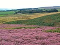
 Heather moorland near Tom Tallon's Crag - geograph.org.uk - 1508818.jpg 640 × 480; 126 KB
-
 Millers Grave, Midgley Moor - geograph.org.uk - 48809.jpg 640 × 427; 154 KB
-
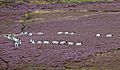
 Sheep on the Long Ridge, Rombalds Moor - geograph.org.uk - 48501.jpg 640 × 480; 200 KB
-
 Whetstone Gate radio masts - geograph.org.uk - 48267.jpg 640 × 480; 102 KB
-
 Whetstone Quarry - geograph.org.uk - 48261.jpg 640 × 480; 193 KB
-
 Heather near High Neb - geograph.org.uk - 1989506.jpg 3,296 × 2,472; 1.08 MB
-
 Heather seedlings - geograph.org.uk - 1976330.jpg 1,700 × 1,274; 689 KB
-
 Millstone Grit Scenery above Stanage Edge - geograph.org.uk - 2044667.jpg 2,608 × 1,952; 1.43 MB


_-_geograph.org.uk_-_1535261.jpg)
_-_geograph.org.uk_-_1535270.jpg)


_-_geograph.org.uk_-_1535510.jpg)


.jpg)


_-_geograph.org.uk_-_1535403.jpg)


