Category:Calthorpe Arms, Gray's Inn Road
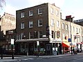
English: Calthorpe Arms, 252 Gray's Inn Road, London WC1 (on the corner with Wren Street).
| Object location | | View all coordinates using: OpenStreetMap |
|---|
Camden, Greater London, WC1X .jpg) | |||||
| Upload media | |||||
| Instance of | |||||
|---|---|---|---|---|---|
| Location | London, Greater London, London, England | ||||
| Street address |
| ||||
| Heritage designation |
| ||||
| official website | |||||
 | |||||
Media in category "Calthorpe Arms, Gray's Inn Road"
The following 13 files are in this category, out of 13 total.
-
 Calthorpe Arms - geograph.org.uk - 5403017.jpg 426 × 640; 59 KB
-

-
 Calthorpe Arms, Gray's Inn Road - geograph.org.uk - 1135745.jpg 640 × 480; 85 KB
-
 Calthorpe Arms, St Pancras, WC1 (2447308110).jpg 1,280 × 960; 311 KB
-
 Gradudiverso.jpg 2,736 × 3,648; 3.52 MB
-
 Inside the Calthorpe Arms (2) - geograph.org.uk - 3378454.jpg 640 × 480; 402 KB
-
 Inside the Calthorpe Arms - geograph.org.uk - 3378359.jpg 640 × 480; 131 KB
-

-
 Sign for the Calthorpe Arms, London (geograph 5488836).jpg 499 × 640; 101 KB
-
 The Calthorpe Arms - geograph.org.uk - 4234532.jpg 4,608 × 3,456; 6.37 MB
-

-

-


_-_geograph.org.uk_-_3378454.jpg)


.jpg)


_-_geograph.org.uk_-_1229254.jpg)
_-_geograph.org.uk_-_1229278.jpg)