Category:Can Gomar
| Object location | | View all coordinates using: OpenStreetMap |
|---|
cultural property in Casteldefels, Spain   Plànol de la planta baixa i pis (1926) | |||||
| Upload media | |||||
| Instance of | |||||
|---|---|---|---|---|---|
| Location | Castelldefels, Baix Llobregat, Àmbit metropolità de Barcelona, Barcelona Province, Catalonia | ||||
| Heritage designation | |||||
 | |||||
Català: Can Gomar - Can Ballester. (Castelldefels)
This is a category about a monument indexed in the Catalan heritage register of Béns Culturals d'Interès Nacional and the Spanish heritage register of Bienes de Interés Cultural under the reference RI-51-0005352. |
Subcategories
This category has only the following subcategory.
H
Media in category "Can Gomar"
The following 4 files are in this category, out of 4 total.
-
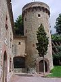 CanGomarCastelldefels.jpg 480 × 640; 98 KB
-
 Castelldefels - Torre de Can Gomar-Detail.jpg 1,920 × 2,560; 2.14 MB
-
 Castelldefels - Torre de Can Gomar.jpg 1,920 × 2,560; 2.09 MB
-
 Torre de Can Gomar.jpg 840 × 1,150; 829 KB


