Category:Canal de Pellafol
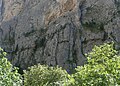
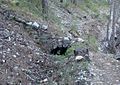
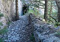
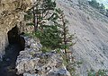
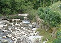
Français : Le canal de Pellafol est un ancien canal d'irrigation qui amenait l'eau de la Souloise, captée à Saint-Disdier (Hautes-Alpes) jusqu'au plateau de Pellafol (Isère).
 | |||||
| Upload media | |||||
| Instance of | |||||
|---|---|---|---|---|---|
| Location | |||||
| Date of official opening |
| ||||
| Length |
| ||||
| Mouth of the watercourse | |||||
| Drainage basin |
| ||||
 | |||||
Media in category "Canal de Pellafol"
The following 23 files are in this category, out of 23 total.
-
 Canal de Pellafol-22.jpg 1,230 × 870; 470 KB
-
 Canal de Pellafol-23.jpg 1,235 × 875; 319 KB
-
 Canal de Pellafol-25.jpg 1,240 × 875; 482 KB
-
 Canal de Pellafol-28.jpg 675 × 900; 189 KB
-
 Canal de Pellafol-37.jpg 1,240 × 890; 561 KB
-
 Canal de Pellafol-41.jpg 1,245 × 875; 380 KB
-
 Canal de Pellafol-43.jpg 1,230 × 885; 443 KB
-
 Canal de Pellafol-47.jpg 1,220 × 861; 367 KB
-
 Canal de Pellafol-66.jpg 1,200 × 850; 469 KB
-
 Canal de Pellafol-69.jpg 1,220 × 860; 566 KB
-
 Canal de Pellafol-70.jpg 1,220 × 875; 584 KB
-
 Canal de Pellafol-72.jpg 1,230 × 870; 390 KB
-
 Canal de Pellafol-74.JPG 1,215 × 865; 452 KB
-
 Canal de Pellafol-77.jpg 1,230 × 880; 410 KB
-
 Canal de Pellafol-79.jpg 1,250 × 860; 496 KB
-
 Canal de Pellafol-83.jpg 1,160 × 960; 336 KB
-
 Canal de Pellafol-84.jpg 1,210 × 860; 444 KB
-
 Canal de Pellafol-91.jpg 1,260 × 844; 524 KB
-
 Canal de Pellafol-92.jpg 1,225 × 865; 446 KB
-
 Défilé de la Souloise-82.jpg 800 × 930; 329 KB
-
 Souloise-83.jpg 1,235 × 875; 437 KB
-
 Souloise-84.jpg 1,200 × 865; 501 KB
-
 Souloise-85.jpg 1,215 × 855; 499 KB


