Category:Cantsfield
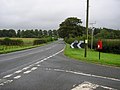
English: Cantsfield is a hamlet and civil parish in the City of Lancaster district, in Lancashire, England near the boundary with North Yorkshire. It is situated near the River Greta and on the A687 road near the junction with the A683. The parish had a population of 76 as of the 2001 census. The village is a designated conservation area.
hamlet and civil parish in Lancashire, UK  | |||||
| Upload media | |||||
| Instance of | |||||
|---|---|---|---|---|---|
| Location | Lancaster, Lancashire, North West England, England | ||||
| Population |
| ||||
 | |||||
Media in category "Cantsfield"
The following 53 files are in this category, out of 53 total.
-

-
 A683 Wrayton - geograph.org.uk - 1476240.jpg 640 × 480; 73 KB
-
 A687 - geograph.org.uk - 4513463.jpg 640 × 426; 79 KB
-

-
 A687 near Greta Bridge - geograph.org.uk - 3340596.jpg 640 × 480; 93 KB
-
 A687 westbound nears Cantsfield - geograph.org.uk - 3338998.jpg 640 × 480; 31 KB
-
 Access Lane to Abbotson Farm - geograph.org.uk - 5154039.jpg 1,600 × 1,067; 492 KB
-

-

-
 Approaching Scaleber - geograph.org.uk - 1910352.jpg 640 × 480; 102 KB
-
 Approaching Scaleber - geograph.org.uk - 5153637.jpg 1,600 × 1,067; 642 KB
-
 Boundary markers old and new - geograph.org.uk - 4390301.jpg 1,024 × 553; 569 KB
-

-
 Bridleway heading Northwards to Cantsfield - geograph.org.uk - 5156328.jpg 1,600 × 1,067; 389 KB
-
 Cantsfield - geograph.org.uk - 48708.jpg 640 × 480; 153 KB
-
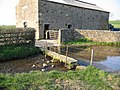 Cantsfield Beck - geograph.org.uk - 378596.jpg 636 × 477; 149 KB
-
 Cantsfield Hall.jpg 640 × 480; 116 KB
-
 Cattle and sheep grazing at Cantsfield Beck - geograph.org.uk - 2453041.jpg 1,024 × 636; 154 KB
-
 Countryside twixt Cowan Bridge and Burton-in-Lonsdale - geograph.org.uk - 5153627.jpg 1,600 × 1,067; 672 KB
-
 Cut silage field, Cantsfield - geograph.org.uk - 2452192.jpg 800 × 600; 112 KB
-
 Entrance drive, Thurland Castle - geograph.org.uk - 1993304.jpg 640 × 480; 119 KB
-
 Entrance to Cantsfield House - geograph.org.uk - 5154044.jpg 1,600 × 1,067; 568 KB
-
 Farm Track from Cantsfield (1) - geograph.org.uk - 5154031.jpg 1,600 × 1,067; 697 KB
-
 Farm Track from Cantsfield (2) - geograph.org.uk - 5154034.jpg 1,600 × 1,067; 484 KB
-
 Fields east of Cantsfield - geograph.org.uk - 2449978.jpg 800 × 600; 127 KB
-
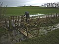
 Ford at Cantsfield - geograph.org.uk - 4251739.jpg 3,872 × 2,592; 4.5 MB
-
 Fording the Greta - geograph.org.uk - 1896859.jpg 640 × 480; 146 KB
-
 Grazing land near Cantsfield - geograph.org.uk - 2461543.jpg 640 × 480; 303 KB
-
 Grazing land near Cantsfield - geograph.org.uk - 2461553.jpg 640 × 480; 277 KB
-
 Grazing land near Cantsfield - geograph.org.uk - 378599.jpg 636 × 477; 80 KB
-
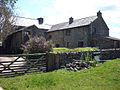
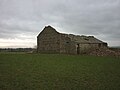 High Barn - geograph.org.uk - 4804628.jpg 640 × 480; 71 KB
-
 Hot cattle at Halfway House - geograph.org.uk - 3560721.jpg 800 × 600; 141 KB
-
 Large ash trees near Out Barn - geograph.org.uk - 4805436.jpg 640 × 484; 103 KB
-
 Looking towards Scaleber - geograph.org.uk - 5153642.jpg 1,600 × 1,067; 486 KB
-
 Lower Reaches of the River Greta - geograph.org.uk - 5156367.jpg 1,600 × 1,080; 835 KB
-
 Old Boundary Marker by the A687 - geograph.org.uk - 6035688.jpg 612 × 640; 474 KB
-
 Out Barn - geograph.org.uk - 5153621.jpg 1,600 × 1,067; 646 KB
-
 Parkland, Thurland Castle - geograph.org.uk - 5926455.jpg 640 × 480; 71 KB
-
 River Greta between Cantsfield and Wrayton - geograph.org.uk - 5154056.jpg 1,600 × 1,067; 841 KB
-
 Road sign, A683 - geograph.org.uk - 4513457.jpg 640 × 620; 60 KB
-
 The A687 near Cantsfield - geograph.org.uk - 3959761.jpg 1,600 × 1,202; 549 KB
-
 The countryside around Cantsfield Beck - geograph.org.uk - 2450792.jpg 800 × 600; 111 KB
-
 The end of the path - geograph.org.uk - 2344180.jpg 640 × 480; 153 KB
-
 The going is 'soft'^ - geograph.org.uk - 4804638.jpg 800 × 600; 135 KB
-
 The Greta Bridge - geograph.org.uk - 4601524.jpg 4,592 × 3,056; 6.2 MB
-
 The River Greta - geograph.org.uk - 1896900.jpg 640 × 480; 88 KB
-

-
 The River Greta flowing west - geograph.org.uk - 1910391.jpg 640 × 480; 123 KB
-
 The River Greta, Greta Bridge - geograph.org.uk - 5926460.jpg 640 × 480; 113 KB
-
 The track past Out Barn - geograph.org.uk - 4805180.jpg 720 × 540; 88 KB
-
 Track heading North towards Laithbutts - geograph.org.uk - 5153299.jpg 1,600 × 1,067; 760 KB
-
 Wigginber - geograph.org.uk - 5153676.jpg 1,600 × 1,067; 396 KB
-
 Wigginber near Cantsfield - geograph.org.uk - 1910368.jpg 640 × 480; 105 KB


_-_geograph.org.uk_-_5154031.jpg)
_-_geograph.org.uk_-_5154034.jpg)


