Category:Capel St. Mary
village in Suffolk, England  | |||||
| Upload media | |||||
| Instance of | |||||
|---|---|---|---|---|---|
| Location | Capel St. Mary, Babergh, Suffolk, East of England, England | ||||
 | |||||
Subcategories
This category has the following 5 subcategories, out of 5 total.
Media in category "Capel St. Mary"
The following 144 files are in this category, out of 144 total.
-
 A12 - geograph.org.uk - 3261358.jpg 640 × 388; 32 KB
-
 A12 descending towards Lattinford Bridge - geograph.org.uk - 4057687.jpg 1,536 × 1,152; 973 KB
-
 A12 east of Capel St Mary - geograph.org.uk - 3546916.jpg 3,384 × 2,497; 1.12 MB
-
 A12 Ipswich Road, Capel St.Mary - geograph.org.uk - 4116391.jpg 2,016 × 1,667; 478 KB
-
 A12 Ipswich Road, Capel St.Mary - geograph.org.uk - 4116405.jpg 1,597 × 1,812; 313 KB
-
 A12 north of Great Gilberts Farm - geograph.org.uk - 3546899.jpg 3,418 × 2,559; 1.44 MB
-
 A12 towards Ipswich - geograph.org.uk - 2947727.jpg 640 × 480; 85 KB
-
 A12 towards Ipswich - geograph.org.uk - 5875726.jpg 1,024 × 684; 243 KB
-
 A12 towards Ipswich - geograph.org.uk - 5875744.jpg 1,024 × 684; 195 KB
-
 A12 towards Ipswich - geograph.org.uk - 5875751.jpg 1,024 × 684; 214 KB
-
 A12 Westbound - geograph.org.uk - 3846466.jpg 640 × 480; 327 KB
-
 A12, Capel St Mary - geograph.org.uk - 3261361.jpg 640 × 430; 39 KB
-
 Allotments along Pound Lane - geograph.org.uk - 282106.jpg 640 × 480; 95 KB
-
 Apple Tree Cottage, Capel St Mary - geograph.org.uk - 4210852.jpg 4,320 × 3,240; 5.28 MB
-
 Approach to the A12 slip-road at Capelrig - geograph.org.uk - 4621520.jpg 1,240 × 930; 451 KB
-
 Approaching The A.12 - geograph.org.uk - 3604778.jpg 1,024 × 768; 222 KB
-
 Bee on Willowherb - geograph.org.uk - 2520346.jpg 960 × 1,280; 557 KB
-
 Capel Post Office - geograph.org.uk - 2513895.jpg 3,648 × 2,736; 2.77 MB
-
 Capel St Mary sign - geograph.org.uk - 3838408.jpg 3,008 × 2,254; 900 KB
-
 Capel St Mary village sign (detail) - geograph.org.uk - 6635231.jpg 855 × 855; 366 KB
-
 Capel St Mary village sign - geograph.org.uk - 6635230.jpg 3,264 × 2,448; 1.87 MB
-
 Capel St. Mary's new War Memorial - geograph.org.uk - 6046034.jpg 3,264 × 2,448; 2.22 MB
-
 Capel St.Mary Post Office ^ Post Office The Street Postbox - geograph.org.uk - 3838769.jpg 3,072 × 2,304; 1.06 MB
-
 Capel St.Mary Post Office ^ Post Office The Street Postbox - geograph.org.uk - 3839083.jpg 3,072 × 2,304; 1.11 MB
-
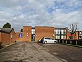 Capel St.Mary Village Hall - geograph.org.uk - 3838674.jpg 3,072 × 2,304; 1.4 MB
-
 Chapel Close, Capel St. Mary - geograph.org.uk - 2947722.jpg 640 × 480; 66 KB
-

-

-
 Days Green Postbox - geograph.org.uk - 3842144.jpg 3,072 × 2,304; 2.49 MB
-
 Days Green Postbox - geograph.org.uk - 3842150.jpg 3,072 × 2,304; 2.65 MB
-
 Days Green Postbox - geograph.org.uk - 3842151.jpg 2,304 × 3,072; 2.1 MB
-
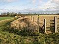
 Ditch separating field and footpath - geograph.org.uk - 2745170.jpg 640 × 480; 272 KB
-
 Dodnash wood yard - geograph.org.uk - 2519757.jpg 3,648 × 2,736; 3.7 MB
-
 Eastbound A12 near Capel St Mary - geograph.org.uk - 3848701.jpg 640 × 480; 219 KB
-
 Eastbound A12 towards Ipswich - geograph.org.uk - 3848698.jpg 640 × 480; 250 KB
-
 Field boundary - geograph.org.uk - 2519224.jpg 3,648 × 2,736; 2.63 MB
-
 Fields off Pound Lane - geograph.org.uk - 1824133.jpg 3,072 × 2,304; 1.35 MB
-
 Fields off Pound Lane - geograph.org.uk - 1824152.jpg 3,072 × 2,304; 1.4 MB
-
 Footbridge And Pipe - geograph.org.uk - 3730909.jpg 1,024 × 768; 358 KB
-
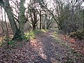
 Footpath in Great Martin's Hill Wood - geograph.org.uk - 2519770.jpg 3,648 × 2,736; 4.29 MB
-
-

-
 Footpath off The Street - geograph.org.uk - 3842163.jpg 2,304 × 3,072; 1.79 MB
-
 Footpath sign - geograph.org.uk - 3730865.jpg 1,024 × 768; 245 KB
-
 Footpath through Holly Wood, Bentley - geograph.org.uk - 2754874.jpg 640 × 480; 297 KB
-
 Footpath to Brook Lane - geograph.org.uk - 1824246.jpg 3,072 × 2,304; 1.68 MB
-
 Footpath to Cotswold Poultry Farm - geograph.org.uk - 1833981.jpg 2,304 × 3,072; 1.23 MB
-
 Footpath to Cotswold Poultry Farm ^ the A12 - geograph.org.uk - 1824110.jpg 3,072 × 2,304; 1.61 MB
-
 Footpath to Cotswold Poultry Farm ^ the A12 - geograph.org.uk - 1824325.jpg 2,304 × 3,072; 1.51 MB
-
 Footpath to East End Road - geograph.org.uk - 3482206.jpg 3,072 × 2,304; 1.67 MB
-
 Footpath to East End Road - geograph.org.uk - 3482207.jpg 3,072 × 2,304; 1.68 MB
-
 Footpath to Pound Lane - geograph.org.uk - 1833968.jpg 3,072 × 2,304; 1.29 MB
-
 Footpath to Pound Lane - geograph.org.uk - 1833973.jpg 3,072 × 2,304; 1.29 MB
-
 Footpath to Pound Lane - geograph.org.uk - 1833993.jpg 2,304 × 3,072; 1.66 MB
-
 Former Service Station on Eastbound A12 - geograph.org.uk - 3848700.jpg 640 × 480; 219 KB
-
 Former services, A12 - geograph.org.uk - 3885641.jpg 640 × 336; 30 KB
-
 Friars, Capel St.Mary - geograph.org.uk - 3838664.jpg 3,072 × 2,304; 1.04 MB
-
 Great Martin's Hill Wood - geograph.org.uk - 3730640.jpg 1,024 × 768; 402 KB
-
 Grove Farmhouse, Capel St Mary - geograph.org.uk - 2754882.jpg 640 × 480; 197 KB
-
 Harvest Moon Cafe - geograph.org.uk - 2519787.jpg 3,648 × 2,736; 2.62 MB
-
 Harvest Moon Cafe - geograph.org.uk - 3838513.jpg 3,072 × 2,304; 842 KB
-
 Hillberry Cottage - geograph.org.uk - 2519238.jpg 3,648 × 2,736; 2.96 MB
-
 House in Capel St. Mary - geograph.org.uk - 2947719.jpg 640 × 481; 107 KB
-
 House, Capel St Mary - geograph.org.uk - 5969471.jpg 1,024 × 681; 168 KB
-

-
 Jubilee Cottage and Appletree Cottage - geograph.org.uk - 2519255.jpg 3,648 × 2,736; 2.6 MB
-
 Lay-by on A12 near Bush Farm, Capel St Mary - geograph.org.uk - 4057670.jpg 1,536 × 1,152; 878 KB
-
 Layby on the A12 near Capel St Mary - geograph.org.uk - 3846316.jpg 640 × 480; 296 KB
-
 Little Owls - geograph.org.uk - 2519218.jpg 3,648 × 2,736; 3.6 MB
-
 Londis, Capel St Mary - geograph.org.uk - 5969474.jpg 1,024 × 681; 109 KB
-
 London Rd - geograph.org.uk - 5969462.jpg 1,024 × 681; 186 KB
-
 London Road Capel St. Mary - geograph.org.uk - 3604773.jpg 1,024 × 768; 242 KB
-
 London Road sign - geograph.org.uk - 3840655.jpg 3,008 × 2,254; 952 KB
-
 London Road, Capel St.Mary - geograph.org.uk - 3840653.jpg 3,072 × 2,304; 832 KB
-
 London Road, Capelgrove - geograph.org.uk - 3838505.jpg 3,072 × 2,304; 1.95 MB
-
 Long Footpath - geograph.org.uk - 3730892.jpg 768 × 1,024; 315 KB
-
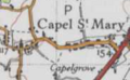 Map of Capel St Mary, OS 1946.png 183 × 113; 37 KB
-
 Mill Close sign - geograph.org.uk - 3840252.jpg 3,072 × 2,304; 2.17 MB
-
 Mill Close, Capel St.Mary - geograph.org.uk - 3840324.jpg 3,048 × 2,284; 1.09 MB
-
 Mill Close, Capel St.Mary - geograph.org.uk - 3840325.jpg 3,048 × 2,209; 989 KB
-
 Mill Hill, Capel St. Mary - geograph.org.uk - 2947720.jpg 640 × 480; 78 KB
-
 Mill Hill, Capel St.Mary - geograph.org.uk - 1824224.jpg 3,072 × 2,304; 1.39 MB
-
 Mill Hill, Capel St.Mary - geograph.org.uk - 3840258.jpg 3,072 × 2,304; 1.29 MB
-
 Mill Hill, Capel St.Mary - geograph.org.uk - 3840323.jpg 3,072 × 2,304; 1.23 MB
-
 Murco Service Station, Capel St Mary - geograph.org.uk - 3848703.jpg 640 × 480; 229 KB
-
 Murco Services, A12 - geograph.org.uk - 3885645.jpg 640 × 407; 44 KB
-
 Open Plan Capel.jpg 1,500 × 1,125; 510 KB
-
 Parade of Shops off The Street - geograph.org.uk - 3839941.jpg 3,072 × 2,304; 1.83 MB
-
 Parade of shops, Capel - geograph.org.uk - 2457631.jpg 640 × 480; 181 KB
-

-
 Path off London Road - geograph.org.uk - 3838494.jpg 2,304 × 3,072; 2.08 MB
-
 Path through pine wood - geograph.org.uk - 2519864.jpg 3,648 × 2,736; 3.82 MB
-
 Path to Holly Wood - geograph.org.uk - 2519954.jpg 3,648 × 2,736; 4.89 MB
-
 Pavilion at the Playing Field - geograph.org.uk - 3838656.jpg 3,072 × 2,304; 1.2 MB
-
 Playing Field off Friars - geograph.org.uk - 3838648.jpg 3,072 × 2,304; 1.38 MB
-
 Playing Field off Friars - geograph.org.uk - 3838653.jpg 3,072 × 2,304; 1.24 MB
-
 Post Office The Street Postbox - geograph.org.uk - 3839072.jpg 2,304 × 3,072; 2.19 MB
-
 Post Office The Street Postbox - geograph.org.uk - 3839074.jpg 2,196 × 2,928; 1.8 MB
-
 Post Office The Street Postbox - geograph.org.uk - 3839076.jpg 2,304 × 3,072; 2.04 MB
-
 Pound Lane - geograph.org.uk - 1389407.jpg 640 × 480; 62 KB
-
 Pound Lane, Capel St.Mary - geograph.org.uk - 1824095.jpg 2,304 × 3,072; 1.51 MB
-
 Pound Lane, Capel St.Mary - geograph.org.uk - 1824101.jpg 2,304 × 3,072; 1.29 MB
-
 Pound Lane, Capel St.Mary - geograph.org.uk - 1824159.jpg 2,304 × 3,072; 1.45 MB
-
 Pound Lane, Capel St.Mary - geograph.org.uk - 1824163.jpg 3,072 × 2,304; 1.49 MB
-
 Pound Lane, Capel St.Mary - geograph.org.uk - 3840232.jpg 3,072 × 2,304; 1.14 MB
-

-
 Pylons - geograph.org.uk - 3730674.jpg 1,024 × 768; 140 KB
-
 Recently Coppiced Sweet Chestnut Trees - geograph.org.uk - 2520056.jpg 3,648 × 2,736; 5.3 MB
-
 Road junction on A12 at Pound Lane, Capel St Mary - geograph.org.uk - 4057679.jpg 1,536 × 1,152; 797 KB
-
 Road junction, Capel St Mary - geograph.org.uk - 5969464.jpg 1,024 × 681; 165 KB
-
 Rotting Away - geograph.org.uk - 3730875.jpg 1,024 × 768; 385 KB
-
 Sheep at Spring Hill Farm - geograph.org.uk - 1833990.jpg 3,072 × 2,304; 1.4 MB
-
 Slip road to A12 - geograph.org.uk - 5969477.jpg 1,024 × 681; 129 KB
-
 Spring Hill Farm - geograph.org.uk - 1833975.jpg 3,072 × 2,304; 1.25 MB
-
 Spring Hill Farm - geograph.org.uk - 1833985.jpg 3,072 × 2,304; 1.31 MB
-
 Station Road west of Windy Farm - geograph.org.uk - 3580806.jpg 3,648 × 2,736; 1.83 MB
-

-
 Stile on the footpath at Cotswold Poultry Farm - geograph.org.uk - 1833962.jpg 2,304 × 3,072; 1.38 MB
-
 Sycamore Cottage Windmill Hill Postbox - geograph.org.uk - 3840255.jpg 2,187 × 2,916; 1.91 MB
-
 Sycamore Cottage Windmill Hill Postbox - geograph.org.uk - 3840256.jpg 1,835 × 2,955; 1.8 MB
-
 Sycamore Cottage Windmill Hill Postbox - geograph.org.uk - 3840257.jpg 2,304 × 3,072; 2.59 MB
-

-
 Telecommunication Mast at Cotswold Poultry Farm - geograph.org.uk - 1824298.jpg 2,304 × 3,072; 1.27 MB
-
 Telephone Box ^ Sycamore Cottage Windmill Hill Postbox - geograph.org.uk - 3840247.jpg 3,072 × 2,304; 1.73 MB
-
 Telephone Box ^ Sycamore Cottage Windmill Hill Postbox - geograph.org.uk - 3840253.jpg 2,989 × 2,240; 1.84 MB
-
 The A12, Capel St Mary - geograph.org.uk - 5377066.jpg 2,300 × 1,722; 1.19 MB
-
 The A12, Capel St Mary - geograph.org.uk - 5377068.jpg 2,304 × 1,728; 828 KB
-
 The Haywain - geograph.org.uk - 2519232.jpg 3,648 × 2,736; 4.44 MB
-
 The Old St - geograph.org.uk - 5969473.jpg 1,024 × 681; 173 KB
-
 The Row sign - geograph.org.uk - 3840337.jpg 3,072 × 2,304; 1.96 MB
-
 The Street ^ Days Green Postbox - geograph.org.uk - 3842125.jpg 3,072 × 2,304; 1.04 MB
-
 The Street ^ Days Green Postbox - geograph.org.uk - 3842137.jpg 3,072 × 2,304; 1.68 MB
-
 The Street, Capel St. Mary - geograph.org.uk - 2947724.jpg 640 × 480; 59 KB
-
 The Street, Capel St.Mary - geograph.org.uk - 1824220.jpg 2,304 × 3,072; 1.3 MB
-
 The Street, Capel St.Mary - geograph.org.uk - 3839091.jpg 3,072 × 2,304; 1.27 MB
-
 The Street, Capel St.Mary - geograph.org.uk - 3839910.jpg 3,072 × 2,304; 1.23 MB
-
 The Street, Capel St.Mary - geograph.org.uk - 3840664.jpg 3,072 × 2,304; 1.18 MB
-
 The Street, Capel St.Mary - geograph.org.uk - 3842166.jpg 3,072 × 2,304; 1.41 MB
-
 The White Horse - geograph.org.uk - 5969472.jpg 1,024 × 681; 109 KB
-

-
 Tractor Wheel Marks - geograph.org.uk - 3730896.jpg 768 × 1,024; 307 KB
-
 Tree And Hedge Line - geograph.org.uk - 3730699.jpg 768 × 1,024; 313 KB
-
 View towards Grove Farm, Capel St Mary - geograph.org.uk - 2745145.jpg 640 × 480; 202 KB
-
 Winter sunshine, Bentley - geograph.org.uk - 2754872.jpg 640 × 480; 298 KB


_-_geograph.org.uk_-_6635231.jpg)


