Category:Cardinalidae distribution maps
Media in category "Cardinalidae distribution maps"
The following 63 files are in this category, out of 63 total.
-
 Amaurospiza aequatorialis map.svg 1,367 × 856; 88 KB
-
 Amaurospiza concolor map after split with aequatorialis.svg 644 × 412; 93 KB
-
 Amaurospiza concolor map.svg 1,367 × 856; 95 KB
-
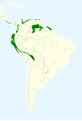
 Amaurospiza moesta map 2.svg 2,008 × 1,984; 608 KB
-
 BlackHeadedGrosBeakMap2.JPG 387 × 363; 37 KB
-
 Cardinalis cardinalis map.svg 709 × 626; 452 KB
-
 Cardinalis phoeniceus map.svg 306 × 276; 224 KB
-
 Cardinalis sinuatus map.svg 1,712 × 1,992; 309 KB
-
 Caryothraustes canadensis map.svg 454 × 608; 188 KB
-
 Caryothraustes poliogaster map.svg 1,367 × 856; 96 KB
-
 Chlorothraupis carmioli map 2.svg 1,181 × 1,732; 1.9 MB
-
 Chlorothraupis carmioli map.svg 512 × 393; 346 KB
-
 Chlorothraupis frenata map.svg 1,181 × 1,732; 1.89 MB
-
 Chlorothraupis olivacea map.svg 454 × 608; 174 KB
-
 Chlorothraupis stolzmanni map.svg 1,181 × 1,732; 1.89 MB
-
 Cyanocompsa brissonii map.svg 1,181 × 1,732; 1.95 MB
-
 Cyanocompsa parellina map.svg 1,367 × 856; 98 KB
-
 Cyanoloxia cyanoides map.svg 1,367 × 856; 107 KB
-
 Cyanoloxia glaucocaerulea map.svg 1,181 × 1,732; 1.92 MB
-
 Cyanoloxia rothschildii map.svg 1,181 × 1,732; 2.05 MB
-
 Distribución del colorín pecho naranja.png 696 × 401; 352 KB
-
 Distribuição geográfica de Piranga flava - IUCN 2022.png 1,366 × 768; 810 KB
-
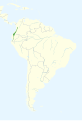
 Granatellus pelzelni map.svg 1,181 × 1,732; 1.95 MB
-
 Granatellus sallaei map.svg 1,367 × 856; 91 KB
-
 Granatellus venustus map.svg 1,367 × 856; 90 KB
-
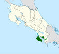 Habia atrimaxillaris map.svg 1,148 × 1,034; 315 KB
-
 Habia cristata map.svg 1,379 × 1,864; 381 KB
-
 Habia fuscicauda map.svg 1,367 × 856; 102 KB
-
 Habia gutturalis map.svg 1,379 × 1,864; 381 KB
-
 Habia rubica map.svg 740 × 700; 291 KB
-
 IndigoBuntingRangeMap.png 400 × 600; 8 KB
-
 IndigoBuntingRangeMapCropped.png 360 × 330; 6 KB
-
 Northern Cardinal-rangemap.gif 800 × 600; 66 KB
-
 Passerina amoena map.svg 1,712 × 1,992; 434 KB
-
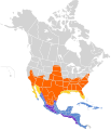 Passerina caerulea map.svg 1,712 × 1,992; 440 KB
-
 Passerina ciris distribution.jpg 695 × 615; 79 KB
-
 Passerina rositae range map.png 1,020 × 552; 868 KB
-
 Passerina versicolor map.svg 1,367 × 856; 100 KB
-
 Periporphyrus erythromelas map.svg 1,181 × 1,732; 1.94 MB
-
 Pheucticus aureoventris map.svg 1,181 × 1,732; 1.92 MB
-
 Pheucticus chrysogaster map.svg 1,181 × 1,732; 1.9 MB
-
 Pheucticus chrysopeplus map.svg 1,367 × 856; 89 KB
-
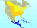
 Pheucticus melanocephalus map.svg 1,712 × 1,992; 463 KB
-
 Pheucticus tibialis map.svg 512 × 393; 334 KB
-
 Piranga bidentata map.svg 1,367 × 856; 96 KB
-
 Piranga erythrocephala map.svg 1,000 × 680; 140 KB
-
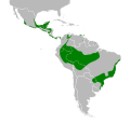
 Piranga flava map 2.svg 1,181 × 1,732; 1.95 MB
-
 Piranga flava map.png 642 × 978; 88 KB
-
 Piranga hepatica map 2.svg 1,300 × 1,353; 722 KB
-
 Piranga hepatica map.png 500 × 460; 58 KB
-
 Piranga hepatica, Piranga lutea - combined map.svg 389 × 377; 651 KB
-
 Piranga hepatica, Piranga lutea, Piranga flava - combined map.svg 389 × 377; 658 KB
-
 Piranga leucoptera map.svg 740 × 700; 271 KB
-
 Piranga ludoviciana map.svg 389 × 377; 572 KB
-
 Piranga lutea map.png 550 × 510; 59 KB
-
 Piranga lutea map.svg 1,181 × 1,732; 1.92 MB
-
 Piranga olivacea map.svg 389 × 377; 626 KB
-
 Piranga roseogularis map.svg 1,367 × 856; 89 KB
-
 Piranga rubra map.svg 389 × 377; 682 KB
-
 Piranga rubriceps map.svg 1,181 × 1,732; 1.89 MB
-
 Rhodothraupis celaeno map.svg 1,000 × 680; 137 KB
-
 Rose-breasted Grosbeak-rangemap.gif 800 × 600; 56 KB
-
 Spiza americana map.svg 389 × 377; 609 KB


