Category:Carlops
village in Scottish Borders, Scotland, UK  | |||||
| Upload media | |||||
| Instance of | |||||
|---|---|---|---|---|---|
| Location |
| ||||
 | |||||
Subcategories
This category has the following 2 subcategories, out of 2 total.
H
- Habbie's Howe (5 F)
P
- Patie's Hill (9 F)
Media in category "Carlops"
The following 56 files are in this category, out of 56 total.
-
 A patchwork bridge - geograph.org.uk - 1005024.jpg 640 × 480; 102 KB
-
 A walker near Fairliehope - geograph.org.uk - 1452868.jpg 640 × 480; 93 KB
-
 Access Lane from Baddinsgill House - geograph.org.uk - 783060.jpg 640 × 480; 95 KB
-
 Back Burn at Kitleyknowe - geograph.org.uk - 1804702.jpg 1,024 × 768; 175 KB
-
 Baddinsgill Burn - geograph.org.uk - 1509362.jpg 480 × 640; 139 KB
-
 Baddinsgill Dam - geograph.org.uk - 32172.jpg 634 × 380; 35 KB
-
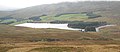 Baddinsgill Reservoir - geograph.org.uk - 1517888.jpg 640 × 275; 48 KB
-
 Beech lined fields, Carlops. - geograph.org.uk - 79401.jpg 640 × 480; 100 KB
-
 Bridge over Carlops Burn at Kitley Knowe - geograph.org.uk - 1804695.jpg 1,024 × 768; 168 KB
-
 Bridge over the River North Esk - geograph.org.uk - 1452880.jpg 640 × 360; 79 KB
-
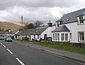
 Carlops - geograph.org.uk - 39882.jpg 640 × 480; 99 KB
-
 Carlops - geograph.org.uk - 782934.jpg 640 × 494; 67 KB
-
 Fields towards Kitleyknowe - geograph.org.uk - 1420741.jpg 640 × 424; 54 KB
-
 Head of the Lyne Water - geograph.org.uk - 1517326.jpg 640 × 480; 123 KB
-
 Jess Cottage - Carlops.jpg 686 × 530; 110 KB
-
 Jess Cottage Carlops.jpg 700 × 503; 101 KB
-
 Lyne Water - geograph.org.uk - 1509443.jpg 640 × 480; 117 KB
-
 Lyne Water - geograph.org.uk - 1509451.jpg 640 × 480; 119 KB
-
 Moorland below Wether Law - geograph.org.uk - 1517740.jpg 640 × 480; 107 KB
-
 Moorland tree - geograph.org.uk - 25601.jpg 640 × 480; 283 KB
-
 N Esk from Mill Bridge - geograph.org.uk - 1420866.jpg 640 × 424; 109 KB
-
 Ordnance Survey Sheet NT 15 West Linton, Published 1955.jpg 11,212 × 11,180; 24.31 MB
-
 Pick a sign - geograph.org.uk - 750014.jpg 640 × 480; 50 KB
-
 Plank of Wood over Ravendean Burn - geograph.org.uk - 783585.jpg 640 × 480; 93 KB
-
 River North Esk - geograph.org.uk - 783957.jpg 640 × 480; 98 KB
-
 Road bridge at Carlops - geograph.org.uk - 1421557.jpg 640 × 427; 116 KB
-
 Slopes of Little Hill - geograph.org.uk - 1209144.jpg 640 × 480; 108 KB
-
 Spillway, North Esk Reservoir - geograph.org.uk - 784166.jpg 640 × 480; 62 KB
-
 Spittal Farm - geograph.org.uk - 74934.jpg 640 × 480; 57 KB
-
 The Allan Ramsay - geograph.org.uk - 32177.jpg 640 × 436; 53 KB
-
 The Carlins Loup, Carlops.jpg 2,560 × 1,920; 1.91 MB
-
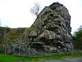
 The Carlops Boulder - geograph.org.uk - 32175.jpg 480 × 640; 91 KB
-
 The Mill Bridge, Amazondean, Nr. Carlops - geograph.org.uk - 1035817.jpg 640 × 427; 126 KB
-
 The North Esk from Carlops Bridge - geograph.org.uk - 750022.jpg 640 × 480; 115 KB
-

-
 Winter fodder, South Mains. - geograph.org.uk - 79437.jpg 640 × 480; 109 KB
-
 Across the Coaly Burn. - geograph.org.uk - 79442.jpg 640 × 445; 64 KB
-
 Ascent of The Mount - geograph.org.uk - 1517759.jpg 640 × 480; 103 KB
-
 Baddinsgill Reservoir and Dam Wall - geograph.org.uk - 783071.jpg 640 × 480; 93 KB
-
 Balloon - geograph.org.uk - 78001.jpg 480 × 640; 141 KB
-
 Between Mount Maw and Grain Heads - geograph.org.uk - 1517891.jpg 640 × 480; 100 KB
-
 Cairn Muir - geograph.org.uk - 1509417.jpg 640 × 480; 116 KB
-
 Cairn Muir - geograph.org.uk - 354941.jpg 640 × 480; 91 KB
-
 Carlophill Farm - geograph.org.uk - 49065.jpg 640 × 480; 233 KB
-
 Contrast - geograph.org.uk - 76997.jpg 640 × 480; 147 KB
-
 Dam in the Baddinsgill Burn - geograph.org.uk - 331336.jpg 640 × 480; 105 KB
-
 Gods Gift - geograph.org.uk - 750039.jpg 640 × 480; 108 KB
-
 Hazlieburn - geograph.org.uk - 79388.jpg 640 × 480; 60 KB
-
 Kitleyknowe. - geograph.org.uk - 79376.jpg 640 × 480; 112 KB
-
 Lochan in the Baddinsgill Burn - geograph.org.uk - 331321.jpg 640 × 480; 103 KB
-
 Mid Hill - geograph.org.uk - 49047.jpg 640 × 480; 281 KB
-
 Old quarry workings - geograph.org.uk - 79384.jpg 640 × 480; 73 KB
-
 Old Wall - geograph.org.uk - 331329.jpg 640 × 480; 125 KB
-
 Suspension Bridge - geograph.org.uk - 76982.jpg 640 × 480; 180 KB
-
 Symmetry - geograph.org.uk - 76996.jpg 640 × 480; 109 KB
-
 West Mains - geograph.org.uk - 79391.jpg 640 × 480; 86 KB


