Category:Carperby-cum-Thoresby
civil parish in North Yorkshire, United Kingdom  | |||||
| Upload media | |||||
| Instance of | |||||
|---|---|---|---|---|---|
| Location | Richmondshire, North Yorkshire, Yorkshire and the Humber, England | ||||
 | |||||
English: Carperby-cum-Thoresby is a civil parish in the Richmondshire district of North Yorkshire, England. The parish contains the village of Carperby, situated north of Aysgarth.
Subcategories
This category has the following 2 subcategories, out of 2 total.
C
Y
- Yore Bridge, Aysgarth (17 F)
Media in category "Carperby-cum-Thoresby"
The following 200 files are in this category, out of 332 total.
(previous page) (next page)-
 A fragrant path - geograph.org.uk - 2618522.jpg 4,000 × 3,000; 2.44 MB
-
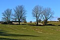
 A Pasture in Wensleydale - geograph.org.uk - 4114871.jpg 5,184 × 3,456; 6.95 MB
-
 A railway age survivor - geograph.org.uk - 2618542.jpg 4,000 × 3,000; 3.29 MB
-
 A View over Blue Scar - geograph.org.uk - 5276283.jpg 5,184 × 3,456; 5.48 MB
-
 Ancient Ash Tree - geograph.org.uk - 946392.jpg 640 × 440; 82 KB
-
 Ancient Giant - geograph.org.uk - 2638410.jpg 1,600 × 1,200; 276 KB
-
 Ancient Sycamore - geograph.org.uk - 2072556.jpg 2,472 × 3,296; 1.78 MB
-
 Approaching Carperby - geograph.org.uk - 4114760.jpg 5,184 × 3,456; 7.57 MB
-

-
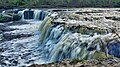
 Aysgarth Falls - geograph.org.uk - 4700945.jpg 3,628 × 2,419; 2.61 MB
-
 Aysgarth Falls - geograph.org.uk - 5788783.jpg 640 × 427; 92 KB
-
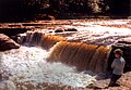
 Aysgarth Falls - High Force - geograph.org.uk - 6431554.jpg 1,800 × 1,199; 442 KB
-
 Aysgarth Falls - Lower Force - geograph.org.uk - 6431556.jpg 1,797 × 1,198; 472 KB
-
 Aysgarth Falls Middle Force - geograph.org.uk - 6482777.jpg 4,032 × 1,960; 4.32 MB
-
 Aysgarth Falls, aerial (3) - geograph.org.uk - 5897532.jpg 533 × 800; 124 KB
-
 Aysgarth Falls, Lower Force - geograph.org.uk - 4929634.jpg 3,072 × 1,728; 1.34 MB
-
 Aysgarth Falls, Middle Force - geograph.org.uk - 4929606.jpg 3,072 × 1,728; 2.55 MB
-
 Aysgarth High Falls - geograph.org.uk - 6333362.jpg 640 × 360; 89 KB
-
 Aysgarth Higher Falls - geograph.org.uk - 6422398.jpg 1,024 × 768; 610 KB
-
 Aysgarth Lower Falls - geograph.org.uk - 4574352.jpg 2,000 × 1,387; 1.03 MB
-
 Aysgarth Lower Falls - geograph.org.uk - 4634232.jpg 800 × 533; 152 KB
-
 Aysgarth Lower Falls - geograph.org.uk - 4640306.jpg 800 × 533; 174 KB
-
 Aysgarth Lower Falls - geograph.org.uk - 4640308.jpg 800 × 533; 141 KB
-
 Aysgarth Lower Falls - geograph.org.uk - 5837975.jpg 1,024 × 677; 205 KB
-
 Aysgarth Lower Falls - geograph.org.uk - 6423992.jpg 1,024 × 768; 685 KB
-
 Aysgarth Lower Force - geograph.org.uk - 6423968.jpg 1,024 × 766; 632 KB
-
 Aysgarth Middle Falls - geograph.org.uk - 4846806.jpg 800 × 533; 137 KB
-
 Aysgarth Middle Falls - geograph.org.uk - 5197309.jpg 2,399 × 1,599; 698 KB
-
 Aysgarth Middle Falls - geograph.org.uk - 5574314.jpg 2,000 × 1,333; 2.63 MB
-
 Aysgarth Middle Falls from the viewpoint - geograph.org.uk - 5795696.jpg 4,608 × 3,456; 5.23 MB
-
 Aysgarth Middle Falls on the River Ure - geograph.org.uk - 4094250.jpg 1,024 × 768; 318 KB
-
 Aysgarth Middle Falls, River Ure - geograph.org.uk - 6423962.jpg 1,024 × 768; 645 KB
-
 Aysgarth Upper Falls - geograph.org.uk - 4156078.jpg 640 × 425; 397 KB
-
 Aysgarth Upper Falls - geograph.org.uk - 4640299.jpg 800 × 533; 146 KB
-
 Aysgarth Upper Falls - geograph.org.uk - 6422399.jpg 1,024 × 769; 598 KB
-
 Aysgarth Upper Falls on the River Ure - geograph.org.uk - 4094246.jpg 1,024 × 768; 324 KB
-
 Ballowfield countryside - geograph.org.uk - 2084499.jpg 2,816 × 2,112; 3.59 MB
-
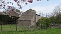
 Barn in field near Carperby - geograph.org.uk - 4206840.jpg 1,500 × 899; 1.21 MB
-
 Barn in Wensleydale near Carperby - geograph.org.uk - 6004079.jpg 1,600 × 900; 686 KB
-
 Barn, Bear Park - geograph.org.uk - 5493937.jpg 1,024 × 576; 353 KB
-
 Barns above Carperby - geograph.org.uk - 4302978.jpg 5,400 × 3,600; 5.83 MB
-
 Barns off Low Lane - geograph.org.uk - 5496229.jpg 1,024 × 683; 346 KB
-
 Bear Park - geograph.org.uk - 5493935.jpg 1,024 × 576; 324 KB
-
 Beck flowing towards the River Ure - geograph.org.uk - 4300079.jpg 5,400 × 3,600; 6.48 MB
-
 Beck flowing under Thoresby Lane - geograph.org.uk - 4300068.jpg 5,400 × 3,600; 2.68 MB
-
 Beldon Beck - geograph.org.uk - 5274094.jpg 5,184 × 3,456; 6.46 MB
-
 Benchmark on barn conversion - geograph.org.uk - 2516159.jpg 683 × 1,024; 277 KB
-
 Benchmark on disused railway bridge abutment - geograph.org.uk - 2514292.jpg 1,024 × 683; 251 KB
-
 Benchmark on electricity substation wall - geograph.org.uk - 3779857.jpg 1,024 × 683; 271 KB
-
-
 Benchmark on gatepost of East End Farm - geograph.org.uk - 2516200.jpg 683 × 1,024; 241 KB
-
 Benchmark on gatepost on Church Lane - geograph.org.uk - 2515916.jpg 683 × 1,024; 242 KB
-
-

-
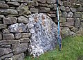
 Benchmark on stone at side of Brunton Bank - geograph.org.uk - 2516287.jpg 1,024 × 683; 305 KB
-

-
 Beside the Ure, upstream of Aysgarth Falls - geograph.org.uk - 6140611.jpg 1,600 × 1,063; 780 KB
-
 Boggy Moor near Goodwell Seat - geograph.org.uk - 5555942.jpg 5,184 × 3,456; 7.52 MB
-
 Bolton Castle, aerial (2) - geograph.org.uk - 5897608.jpg 800 × 533; 107 KB
-
 Bolton Castle, aerial 2018 (1) - geograph.org.uk - 5897602.jpg 800 × 533; 118 KB
-
 Bridleway near Ponderledge Scar Wensleydale - geograph.org.uk - 2548325.jpg 2,088 × 1,468; 941 KB
-
 Broadleaf plantation at Carperby - geograph.org.uk - 2717015.jpg 4,000 × 2,582; 2.76 MB
-
 Brownfield Hut - geograph.org.uk - 5274114.jpg 5,184 × 3,456; 5.8 MB
-
 Carperby Cross and Village Green, Wensleydale - geograph.org.uk - 6003542.jpg 1,600 × 900; 472 KB
-
 Carperby Cross and village green, Wensleydale - geograph.org.uk - 6003780.jpg 1,600 × 900; 596 KB
-
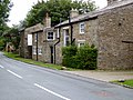
 Carperby West End - geograph.org.uk - 5765559.jpg 640 × 480; 105 KB
-
 Carperby, - West End - geograph.org.uk - 4114799.jpg 5,184 × 3,456; 5.84 MB
-
 CASE Earthmover at West End Farm - geograph.org.uk - 2638425.jpg 1,600 × 1,200; 260 KB
-
 Castle Bolton, aerial 2016 - geograph.org.uk - 5089881.jpg 640 × 427; 70 KB
-
 Castle Bolton, aerial 2018 - geograph.org.uk - 5897549.jpg 800 × 533; 116 KB
-
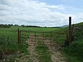
 Church Lane and field gateway - geograph.org.uk - 2515922.jpg 1,024 × 683; 178 KB
-
 Clapper Bridge - geograph.org.uk - 2072002.jpg 3,296 × 2,472; 1.96 MB
-
 Conservation area near Thoresby - geograph.org.uk - 6174788.jpg 1,024 × 768; 255 KB
-
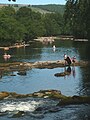 Cooling off at Redmire - geograph.org.uk - 5830719.jpg 720 × 960; 216 KB
-
 Coppiced hazel, Freeholders Wood, Aysgarth - geograph.org.uk - 6140616.jpg 1,600 × 1,063; 758 KB
-
 Coppicing by the crossroads - geograph.org.uk - 4921585.jpg 4,320 × 3,240; 5.47 MB
-
 Copse near Thoresby - geograph.org.uk - 4300058.jpg 5,400 × 3,600; 2.08 MB
-
 Copse on a hill, Bear Park - geograph.org.uk - 6333031.jpg 640 × 360; 85 KB
-
 Cottage at the east end of Carperby - geograph.org.uk - 6140376.jpg 1,600 × 900; 422 KB
-
 Cottages in Carperby - geograph.org.uk - 4623517.jpg 1,024 × 768; 832 KB
-
 Cross and village green, Carperby - geograph.org.uk - 4304844.jpg 5,400 × 3,600; 2.23 MB
-
 Crossing the Ure at Slapestone Wath - geograph.org.uk - 4170851.jpg 800 × 600; 206 KB
-
 Cyclists on Oxclose Road above Wensleydale - geograph.org.uk - 6140395.jpg 1,600 × 900; 302 KB
-
 Dairy Cattle at High Thoresby - geograph.org.uk - 2618550.jpg 4,000 × 3,000; 2.32 MB
-
 Decaying woodland on Haw Bank - geograph.org.uk - 1190722.jpg 640 × 480; 131 KB
-
 Desolate moorland on Whitaside Moor - geograph.org.uk - 5889519.jpg 1,499 × 815; 1 MB
-
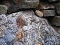 Details of rock in dry stone wall - geograph.org.uk - 4099083.jpg 2,816 × 2,112; 1.22 MB
-
 Disused railway bridge at Aysgarth - geograph.org.uk - 4831398.jpg 640 × 427; 130 KB
-
 Disused Railway Bridge at Aysgarth - geograph.org.uk - 6423958.jpg 1,024 × 682; 404 KB
-
 Disused railway embankment at Aysgarth - geograph.org.uk - 4831396.jpg 640 × 427; 147 KB
-
 Dry stone wall at New Pasture - geograph.org.uk - 4098906.jpg 2,574 × 1,839; 961 KB
-
 Dry stone wall Ponderledge Scar - geograph.org.uk - 4099074.jpg 2,693 × 1,924; 962 KB
-
 Dry stream above West Bolton - geograph.org.uk - 4098914.jpg 2,112 × 2,816; 1.12 MB
-
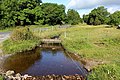
 Duck Pond at West Grove Farm - geograph.org.uk - 5131636.jpg 3,264 × 1,836; 2.88 MB
-
 East End Farm - geograph.org.uk - 4304800.jpg 5,400 × 3,600; 2.83 MB
-
 Eller Beck at Ballowfields - geograph.org.uk - 4112594.jpg 4,656 × 3,105; 7.63 MB
-
 Eller Beck cutting through escarpment near Ivy Scar - geograph.org.uk - 6003975.jpg 1,600 × 1,058; 756 KB
-
 Entering Carperby from the west - geograph.org.uk - 6003426.jpg 1,600 × 1,094; 550 KB
-
 Farm buildings at West Bolton - geograph.org.uk - 6111717.jpg 1,024 × 768; 155 KB
-
 Farm Track at Hollins House - geograph.org.uk - 4156050.jpg 640 × 425; 396 KB
-
 Farm track near Carperby - geograph.org.uk - 5496233.jpg 1,024 × 683; 459 KB
-
 Fence Line - geograph.org.uk - 3439378.jpg 4,000 × 3,000; 2.37 MB
-
 Field and trees near Aysgarth - geograph.org.uk - 4831411.jpg 640 × 427; 87 KB
-
 Field entrance near the River Ure - geograph.org.uk - 5413742.jpg 640 × 480; 56 KB
-
 Field in the middle of Carperby - geograph.org.uk - 4304827.jpg 5,400 × 3,600; 2.61 MB
-
 Field path Bear Park near Aysgarth - geograph.org.uk - 4099110.jpg 2,636 × 1,883; 868 KB
-
 Fields above Carperby, Wensleydale - geograph.org.uk - 6003395.jpg 1,600 × 1,065; 592 KB
-
 Fields north of Carperby - geograph.org.uk - 2737623.jpg 640 × 480; 64 KB
-
 Fields on the southern edge of Carperby - geograph.org.uk - 6140378.jpg 1,600 × 1,063; 439 KB
-
 Fields to Angelhaw Hill - geograph.org.uk - 1409625.jpg 640 × 480; 50 KB
-
 Fields, West Bolton - geograph.org.uk - 585089.jpg 640 × 427; 68 KB
-
 Flooded field on the edge of Carperby - geograph.org.uk - 4304818.jpg 5,400 × 3,600; 3.09 MB
-
 Flooding by the track to Hollins House - geograph.org.uk - 4299700.jpg 5,400 × 3,600; 5.19 MB
-
 Flowers beside Brunton Bank - geograph.org.uk - 2516294.jpg 1,024 × 683; 185 KB
-
 Footpath across fields near Aysgarth - geograph.org.uk - 4831408.jpg 640 × 427; 76 KB
-
 Footpath at Ballowfields - geograph.org.uk - 4112604.jpg 4,773 × 3,234; 7.62 MB
-
 Footpath entrance near Bear Park - geograph.org.uk - 4831414.jpg 640 × 427; 84 KB
-
 Footpath from Low Lane towards Carperby - geograph.org.uk - 3779851.jpg 1,024 × 683; 301 KB
-
 Footpath junction with finger post and gate - geograph.org.uk - 2515943.jpg 1,024 × 683; 198 KB
-
 Footpath leading from Low Lane towards Carperby - geograph.org.uk - 4117682.jpg 5,179 × 3,260; 7.16 MB
-
 Footpath leading to Carperby - geograph.org.uk - 4117676.jpg 4,901 × 3,451; 7.63 MB
-
 Footpath through a new plantation - geograph.org.uk - 4299684.jpg 5,400 × 3,600; 6.55 MB
-
 Footpath to Askrigg - geograph.org.uk - 4298421.jpg 5,400 × 3,600; 2.81 MB
-
 Footpath to Aysgarth - geograph.org.uk - 2850648.jpg 3,000 × 4,000; 3.38 MB
-
 Footpath to Aysgarth - geograph.org.uk - 4098920.jpg 3,264 × 2,448; 3.86 MB
-
 Footpath to Aysgarth - geograph.org.uk - 4299688.jpg 5,400 × 3,600; 3.22 MB
-
 Footpath to Carperby - geograph.org.uk - 4117668.jpg 4,893 × 3,260; 7.44 MB
-
 Ford and bridge on Watery Lane - geograph.org.uk - 4300092.jpg 5,400 × 3,600; 3.09 MB
-
 Ford and top of waterfall - geograph.org.uk - 4098900.jpg 3,264 × 2,448; 4.14 MB
-
 Gate and Stile on Track to Low Thoresby - geograph.org.uk - 4156054.jpg 640 × 425; 397 KB
-
 Gate on path to High Thoresby - geograph.org.uk - 4156066.jpg 640 × 425; 486 KB
-
 Gated Stile Bear Park - geograph.org.uk - 4156044.jpg 640 × 425; 430 KB
-
 Gatepost with benchmark beside road to Redmire - geograph.org.uk - 2515931.jpg 683 × 1,024; 286 KB
-

-
 Gateway to minor road into Carperby - geograph.org.uk - 3781145.jpg 1,024 × 683; 265 KB
-
 Geese and pond by West Grove Farm - geograph.org.uk - 4304853.jpg 5,400 × 3,600; 4.88 MB
-
 Grassland at St. Joseph's Wood - geograph.org.uk - 4623507.jpg 1,024 × 768; 859 KB
-
-
 Green Lane, Thoresby - geograph.org.uk - 945704.jpg 640 × 480; 89 KB
-
 Greenhaw Hut - geograph.org.uk - 6174701.jpg 1,024 × 768; 149 KB
-
 Grouse Butts - geograph.org.uk - 3439381.jpg 4,000 × 3,000; 3.3 MB
-
 Gully and tree in Ponderledge Scar, Carperby - geograph.org.uk - 6140383.jpg 1,600 × 1,063; 496 KB
-
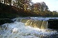
 High Force at Aysgarth Falls - geograph.org.uk - 6001017.jpg 1,600 × 1,067; 354 KB
-
 High Force at Aysgarth Falls - geograph.org.uk - 6001025.jpg 1,600 × 1,067; 314 KB
-
 High Force, Aysgarth - geograph.org.uk - 5494337.jpg 1,024 × 576; 426 KB
-
 High Force, Aysgarth - geograph.org.uk - 5494343.jpg 1,024 × 576; 373 KB
-
 High Thoresby - geograph.org.uk - 945710.jpg 640 × 361; 48 KB
-
 Horse dock and goods shed at Aysgarth Station - geograph.org.uk - 3785318.jpg 1,024 × 683; 207 KB
-
 Ice and puddles on the track near Kelder Well - geograph.org.uk - 4299706.jpg 5,400 × 3,600; 2.88 MB
-
 If you go down to the woods today - geograph.org.uk - 2837741.jpg 3,048 × 1,899; 1.79 MB
-
 In the manger - geograph.org.uk - 5493941.jpg 1,024 × 576; 356 KB
-
 Ivy Scar - geograph.org.uk - 1577011.jpg 640 × 480; 72 KB
-
 Ivy Scar - geograph.org.uk - 1809723.jpg 3,075 × 1,267; 572 KB
-
 Ivy Scar - geograph.org.uk - 5495851.jpg 1,024 × 683; 314 KB
-
 Ivy Scar from Oxclose Road - geograph.org.uk - 1617053.jpg 640 × 480; 133 KB
-
 Ivy Scar from Oxclose Road - geograph.org.uk - 6078671.jpg 1,280 × 850; 563 KB
-
 Junction of footpaths - geograph.org.uk - 4098921.jpg 2,814 × 2,010; 1.05 MB
-
 Kendell Beck, Thoresby - geograph.org.uk - 2850669.jpg 3,296 × 2,000; 1.57 MB
-
 Limestone pasture - geograph.org.uk - 5493932.jpg 1,024 × 576; 300 KB
-
 Limestone riverine potholes, Lower Falls, Aysgarth - geograph.org.uk - 6004298.jpg 1,600 × 1,066; 869 KB
-
 Locker Tarn - geograph.org.uk - 6111706.jpg 1,024 × 768; 203 KB
-
 Looking downriver from the top of the Lower Falls - geograph.org.uk - 5795683.jpg 4,608 × 3,456; 6.87 MB
-
 Looking over Ballowfield - geograph.org.uk - 3341206.jpg 2,048 × 1,536; 415 KB
-
 Low gate above Carperby - geograph.org.uk - 4154783.jpg 640 × 425; 327 KB
-
 Low Lane, Carperby - geograph.org.uk - 5496231.jpg 1,024 × 683; 431 KB
-
 Low Thoresby - geograph.org.uk - 2850676.jpg 3,436 × 1,980; 1.09 MB
-
 Low water on the Ure - geograph.org.uk - 5865610.jpg 4,319 × 2,998; 2.95 MB
-
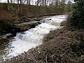
 Lower Falls at Aysgarth - geograph.org.uk - 5795679.jpg 4,608 × 3,456; 4.52 MB
-
 Lower Falls, Aysgarth - geograph.org.uk - 4298433.jpg 5,400 × 3,600; 2.81 MB
-
 Lower Force at Aygarth Falls - geograph.org.uk - 6001033.jpg 1,600 × 1,067; 322 KB
-
 Lower Force on Aysgarth Falls - geograph.org.uk - 4993220.jpg 3,953 × 2,965; 5.99 MB
-
 Lower Force on Aysgarth Falls - geograph.org.uk - 4993225.jpg 4,000 × 3,000; 2.76 MB
-
 Manure spreading about to commence - geograph.org.uk - 5748963.jpg 4,320 × 2,754; 2.73 MB
-
 Middle Falls, Aysgarth - geograph.org.uk - 4298425.jpg 4,652 × 3,101; 2.43 MB
-
 Middle Force of the Aysgarth Falls - geograph.org.uk - 6001042.jpg 1,600 × 1,067; 341 KB
-
 Modernised barn beside main road - geograph.org.uk - 2516176.jpg 1,024 × 683; 161 KB
-
 Molehills and rocks - geograph.org.uk - 699750.jpg 640 × 480; 101 KB
-
 Moorland on Spring Ridge - geograph.org.uk - 5555919.jpg 5,184 × 3,456; 7.24 MB
-
 Moorland sheep - geograph.org.uk - 699754.jpg 640 × 480; 81 KB
-

-
 Muddy corner of a field at Low Thoresby - geograph.org.uk - 4300108.jpg 5,400 × 3,600; 2.26 MB
-
 New fishing hut by the Ure - geograph.org.uk - 4170856.jpg 659 × 480; 114 KB
-
 New Pasture and Wegber Scar - geograph.org.uk - 6078675.jpg 1,280 × 720; 456 KB
-
 New plantation near Thoresby - geograph.org.uk - 4300035.jpg 5,400 × 3,600; 2.63 MB
-
 New plantation near Thoresby - geograph.org.uk - 4300047.jpg 5,400 × 3,600; 2.93 MB
-
 New tree planting, Thoresby - geograph.org.uk - 2850658.jpg 2,980 × 2,667; 2.2 MB
-
 No time to stop - geograph.org.uk - 3223270.jpg 640 × 553; 203 KB
-

-
 Old Ford alone in the Dales - geograph.org.uk - 2072021.jpg 3,296 × 2,472; 1.69 MB
-
 Old Lead Workings - geograph.org.uk - 5684037.jpg 3,000 × 4,000; 3.3 MB
-
 Old mill race gates above upper Aysgarth Falls, High Force - geograph.org.uk - 4928934.jpg 3,072 × 1,728; 2.54 MB
-

-
 Old plough strips at Carperby - geograph.org.uk - 2717020.jpg 3,975 × 2,000; 1.26 MB
-
 Old rail bridge at High Thoresby - geograph.org.uk - 2618556.jpg 3,000 × 4,000; 2.75 MB
-
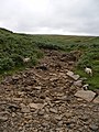
 Old railway track, Carperby. - geograph.org.uk - 431392.jpg 640 × 480; 208 KB
-
 On Great Wegber - geograph.org.uk - 6426017.jpg 1,600 × 778; 113 KB
-
 On the Aysgarth to Castle Bolton path, Wensleydale - geograph.org.uk - 6140627.jpg 1,600 × 1,063; 404 KB
-
 On the Carperby to Castle Bolton footpath - geograph.org.uk - 6003872.jpg 1,600 × 900; 629 KB
-
 On the Hollins House to Carperby footpath - geograph.org.uk - 6140631.jpg 1,600 × 900; 293 KB
-
 On the path to Oxclose Gate from Carperby - geograph.org.uk - 6140392.jpg 1,600 × 1,063; 511 KB


_-_geograph.org.uk_-_5897532.jpg)


_-_geograph.org.uk_-_5897608.jpg)
_-_geograph.org.uk_-_5897602.jpg)


