Category:Carshalton
suburb of London in the London Borough of Sutton, England  Vue de All Saints Church  Localisation de Carshalton | |||||
| Upload media | |||||
| Instance of | |||||
|---|---|---|---|---|---|
| Location | London Borough of Sutton, Greater London, London, England | ||||
| Located in or next to body of water | |||||
| Population |
| ||||
 | |||||
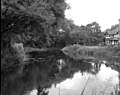
English: Category for files related to Carshalton, which is a suburban area of the London Borough of Sutton, England. It is located 10 miles (16.1 km) south-southwest of Charing Cross, situated in the valley of the River Wandle, one of the sources of which is Carshalton Ponds in the centre of the village. It also a postal town of outer London and encompasses postcode district: SM5
Subcategories
This category has the following 24 subcategories, out of 24 total.
A
C
- Carshalton railway station (31 F)
- Carshalton Old Library (2 F)
- Carshalton Park (30 F)
- Carshalton Straw Jack (17 F)
- Carshalton War Memorial (15 F)
- Charles Cryer Theatre (7 F)
G
M
- Mill Lane, Carshalton (20 F)
N
O
- Oaks Park (London) (37 F)
- Old Rectory, Carshalton (4 F)
P
Q
W
- West Street Lane, Carshalton (4 F)
- Westcroft Leisure Centre (4 F)
Media in category "Carshalton"
The following 192 files are in this category, out of 192 total.
-
 1 and 2 Wrythe Green Road.jpg 4,646 × 3,659; 1.8 MB
-
 1 and 3 Nightingale Road.jpg 5,184 × 3,888; 1.97 MB
-
 19 Park Hill.jpg 5,184 × 3,888; 2.45 MB
-
 1A and 2A Orchard Hill 2.jpg 5,184 × 3,888; 1.89 MB
-
 1A and 2A Orchard Hill.jpg 4,645 × 3,386; 1.52 MB
-
 2 Sutton Lavender Field.jpg 1,000 × 664; 628 KB
-
 2012 torch relay day 66 Sutton (7630902222).jpg 3,648 × 2,736; 3.55 MB
-
 2012 torch relay day 66 Sutton (7630906938).jpg 3,648 × 2,736; 3.03 MB
-
 2014-09-20 08 Carshalton House.jpg 750 × 560; 580 KB
-
 4 High Street.jpg 5,184 × 3,888; 3.53 MB
-
 5-7 Wrights Row.jpg 5,184 × 3,888; 2.87 MB
-
 5A Orchard Hill.jpg 5,184 × 3,888; 2.8 MB
-
 6 The Square 2.jpg 5,184 × 3,888; 2.65 MB
-
 6 The Square.jpg 5,184 × 3,888; 2.59 MB
-
 Ashcombe Sweet Chestnut (1).jpg 3,024 × 4,032; 5.78 MB
-
 Ashcombe Sweet Chestnut (2).jpg 3,024 × 4,032; 5.42 MB
-
 Ashcombe Sweet Chestnut (3).jpg 3,024 × 4,032; 5.1 MB
-
 Ashcombe Sweet Chestnut (4).jpg 3,024 × 4,032; 5.47 MB
-
 Ashcombe Sweet Chestnut (5).jpg 3,024 × 4,032; 4.35 MB
-
 Ashcombe Sweet Chestnut (6).jpg 3,024 × 4,032; 5.21 MB
-
 Ashcombe Sweet Chestnut (7).jpg 3,024 × 4,032; 4.61 MB
-
 Ashcombe Sweet Chestnut (8).jpg 3,024 × 4,032; 4.8 MB
-
 Ashcombe Sweet Chestnut (9).jpg 3,024 × 4,032; 5.5 MB
-
 Austenasia Coat of Arms.png 2,997 × 2,222; 1.48 MB
-
-

-
 Beacon Grove from the back - panoramio.jpg 2,816 × 2,112; 3.35 MB
-
 Beacon Grove from the front - panoramio.jpg 2,816 × 2,112; 3.29 MB
-
 Bramblehaw End 1.jpg 5,184 × 3,888; 2.23 MB
-
 Bramblehaw End.jpg 5,184 × 3,888; 2.05 MB
-

-
 Butter Hill Mill Carshalton.jpg 1,600 × 1,064; 986 KB
-
 Byne Road, Carshalton - geograph.org.uk - 3699375.jpg 1,600 × 1,200; 670 KB
-
 Carshalton (5) - Flickr - tonymonblat.jpg 4,608 × 3,456; 3.68 MB
-
 Carshalton Boys Sports College.jpg 3,845 × 2,378; 3.51 MB
-
 Carshalton Cator Road - geograph.org.uk - 2901768.jpg 3,600 × 2,700; 7.33 MB
-
 Carshalton Environmrental Fair IMG 2633.jpg 960 × 1,280; 147 KB
-
 Carshalton Grotto.jpg 4,320 × 3,240; 4.57 MB
-
 Carshalton Methodist Church (geograph 4177792).jpg 2,304 × 1,728; 686 KB
-
 Carshalton Methodist Church, Ruskin Road, London Borough of Sutton.JPG 4,320 × 3,240; 4.1 MB
-
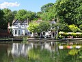
 Carshalton Ponds, Surrey, one of the two sources of the River Wandle.jpg 874 × 546; 628 KB
-
 Carshalton Road Pastures information board.jpg 2,000 × 1,523; 953 KB
-
 Carshalton Road Pastures.jpg 2,500 × 1,875; 1.39 MB
-
 Carshalton Surrey London Borough of Sutton.JPG 4,320 × 3,240; 4.83 MB
-
 Carshalton Sutton Surrey London Costa Coffee.JPG 4,000 × 3,000; 2.57 MB
-
 Carshalton Urban District Council boundary marker 1898.jpg 2,035 × 2,370; 1.18 MB
-
 Carshalton Village pond - geograph.org.uk - 1407082.jpg 640 × 480; 376 KB
-
 Carshalton Village, Surrey, London Borough of Sutton - Flickr - tonymonblat.jpg 3,937 × 1,683; 5.86 MB
-
 Carshalton, Banstead Road - geograph.org.uk - 2899616.jpg 3,822 × 2,652; 4.86 MB
-
 Carshalton, Beeches Avenue - geograph.org.uk - 2899587.jpg 4,320 × 3,240; 5.44 MB
-
 Carshalton, Fairview Road - geograph.org.uk - 2901660.jpg 640 × 435; 84 KB
-
 Carshalton, Hawthorn Road - geograph.org.uk - 2901701.jpg 4,110 × 2,898; 5.61 MB
-
 Carshalton, Hawthorn Road - geograph.org.uk - 2901724.jpg 3,906 × 2,688; 5.06 MB
-
 Carshalton, Hawthorn Road - geograph.org.uk - 2901736.jpg 4,320 × 3,240; 6.28 MB
-
 Carshalton, King's Lane - geograph.org.uk - 2901746.jpg 4,174 × 2,855; 5.14 MB
-
 Carshalton, London Borough of Sutton (2) - Flickr - tonymonblat.jpg 3,000 × 4,000; 5.06 MB
-
 Carshalton, London Borough of Sutton (3) - Flickr - tonymonblat.jpg 3,000 × 2,875; 4.86 MB
-
 Carshalton, London Borough of Sutton (6) - Flickr - tonymonblat.jpg 3,926 × 2,560; 4.44 MB
-
 Carshalton, London Borough of Sutton (7) - Flickr - tonymonblat.jpg 4,000 × 2,293; 3.26 MB
-
 Carshalton, London Borough of Sutton (8) - Flickr - tonymonblat.jpg 4,000 × 2,643; 4.51 MB
-
 Carshalton, London Borough of Sutton (9) - Flickr - tonymonblat.jpg 4,000 × 3,000; 5.51 MB
-
 Carshalton, Palmerston Road - geograph.org.uk - 2897589.jpg 4,320 × 3,240; 7.46 MB
-
 Carshalton, Park Lane - geograph.org.uk - 2901588.jpg 3,886 × 2,543; 4.9 MB
-

-
 Carshalton, Queen Mary's Avenue - geograph.org.uk - 2901621.jpg 3,972 × 2,760; 5.5 MB
-
 Carshalton, Stanley Park Road - geograph.org.uk - 2901566.jpg 3,772 × 2,560; 5.18 MB
-
 Carshalton, Stanley Park Road - geograph.org.uk - 2901603.jpg 4,180 × 2,969; 5.88 MB
-
 Carshalton, Talbot Road - geograph.org.uk - 2901788.jpg 640 × 440; 93 KB
-
 Carshalton, Wales Avenue - geograph.org.uk - 2899773.jpg 3,342 × 2,268; 4.27 MB
-
 Carshalton, Westcroft Road - geograph.org.uk - 2899728.jpg 3,576 × 2,472; 3.8 MB
-
 Carshalton, Westmead Road - geograph.org.uk - 2901828.jpg 4,197 × 2,964; 5.88 MB
-
 Carshalton14116446063 ee1950653f o.jpg 3,648 × 2,736; 3.3 MB
-

-
 Culvert in front of Honeywood Lodge 1.jpg 5,184 × 3,888; 3.58 MB
-
 Culvert in front of Honeywood Lodge 2.jpg 5,184 × 3,888; 2.45 MB
-
 Dingwall Road, Carshalton - geograph.org.uk - 4057683.jpg 1,024 × 768; 111 KB
-

-
 East churchyard wall.jpg 5,184 × 3,888; 3.84 MB
-
 Elm Pond Culvert.jpg 5,184 × 3,888; 2.44 MB
-
 Ferncot.jpg 5,184 × 3,888; 2.12 MB
-
 Flag of Austenasia.svg 900 × 600; 245 bytes
-
 Former fire engine house in churchyard wall.jpg 5,184 × 3,888; 2.69 MB
-

-
-
 Garage Block at Radcliffe Garden, Sutton.png 978 × 632; 1.63 MB
-
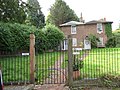
 Gate House 1.jpg 5,184 × 3,888; 3.43 MB
-
 Gate House 2.jpg 5,184 × 3,888; 2.81 MB
-
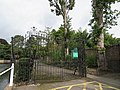 Gates at South West entrance to Grove Park.jpg 5,184 × 3,888; 2.92 MB
-
 Gates at south west entrance to The Grove.jpg 5,184 × 3,888; 2.89 MB
-
 Gateway next to Honeywood Lodge.jpg 5,184 × 3,888; 3.09 MB
-
 Grazzi Mille, Carshalton, London Borough of Sutton - Flickr - tonymonblat.jpg 3,446 × 1,826; 2.46 MB
-
 Honeywood Museum.jpg 5,184 × 3,888; 3.29 MB
-
 Houses on Woodmansterne Road, Carshalton Beeches (geograph 3295846).jpg 2,048 × 1,536; 1.53 MB
-

-
 Junction of Cowper Avenue and Westmead Road - geograph.org.uk - 2562776.jpg 1,600 × 1,200; 576 KB
-
 Kings Drive, Carshalton - geograph.org.uk - 4057706.jpg 1,024 × 768; 293 KB
-
 Laburnum Avenue, Carshalton, Surrey - geograph.org.uk - 624430.jpg 548 × 640; 48 KB
-
 Lavender Field London Borough of Sutton.jpg 2,000 × 1,328; 1.6 MB
-
 Lavender field Sutton.jpg 2,410 × 3,065; 6.79 MB
-
 Lavish Lavender Carshalton London Borough of Sutton.jpg 2,945 × 1,997; 3.36 MB
-
 Little Holland House, Carshalton - geograph.org.uk - 317003.jpg 640 × 480; 156 KB
-
 Little Woodcote Bronze Hoard in the Museum of London.jpg 4,126 × 3,053; 6.43 MB
-
 London - Sutton - Oaks Park (geograph 4069209).jpg 4,288 × 2,848; 6.35 MB
-
 Lower Pond, Carshalton, London Borough of Sutton (2) - Flickr - tonymonblat.jpg 3,705 × 2,778; 3.88 MB
-
 Lower Pond, Carshalton, London Borough of Sutton (4) - Flickr - tonymonblat.jpg 3,863 × 1,783; 3.08 MB
-
 Lower Pond, Carshalton, London Borough of Sutton - Flickr - tonymonblat.jpg 3,694 × 2,770; 4.24 MB
-
 Lower Pond, Carshalton, Surrey, London Borough of Sutton (3) - Flickr - tonymonblat.jpg 2,913 × 2,853; 3.98 MB
-
 Macmillan Williams Solicitors, The Orangery.jpg 5,184 × 3,888; 2.32 MB
-
 Madeley Cottage and Saint Mary's, Carshalton (East Face - 01).jpg 3,772 × 2,847; 8.27 MB
-
 Madeley Cottage and Saint Mary's, Carshalton (Southeast View - 01).jpg 4,119 × 3,180; 11.62 MB
-
 Madeley Cottage.jpg 5,184 × 3,888; 3.34 MB
-
 Mayfield Lavender - geograph.org.uk - 1165761.jpg 640 × 360; 334 KB
-
 Mayfield Lavender Field LB Sutton.jpg 1,000 × 664; 786 KB
-
 Mayfield Lavender Fields in Sutton, London.jpg 640 × 425; 412 KB
-
 Mayfield Lavender London Borough of Sutton.jpg 1,000 × 664; 865 KB
-
 Mayfield Lavender, Woodmansterne (geograph 3559669).jpg 4,000 × 2,250; 7.54 MB
-
 Mayfield Lavender, Woodmansterne - geograph.org.uk - 1386274.jpg 640 × 427; 440 KB
-
 Mayfield Lavender, Woodmansterne - geograph.org.uk - 1386279.jpg 640 × 427; 358 KB
-
 Mayfield Lavender, Woodmansterne - geograph.org.uk - 1386284.jpg 640 × 360; 243 KB
-
 Middleton flats.jpg 732 × 465; 64 KB
-
 Muschamp Road, Carshalton - geograph.org.uk - 3699244.jpg 1,600 × 1,200; 585 KB
-
 Nick Howe Bike Builder.jpg 3,264 × 2,448; 1.69 MB
-
 North churchyard wall.jpg 4,006 × 2,903; 2.09 MB
-
 Orangery Plaque.jpg 5,184 × 3,888; 3.39 MB
-
 P1170403 Artist..Carshalton 10.04.14...jpg 426 × 538; 348 KB
-
 P1260298 Mayfield Lavender Fields...jpg 932 × 544; 565 KB
-
 P1340426 Carlshalton...jpg 3,974 × 2,232; 2.73 MB
-
 P1340473 Carshalton....jpg 2,588 × 2,180; 1.21 MB
-
 P1470056 Carshalton Surrey...jpg 3,692 × 2,022; 5.54 MB
-
 P1470059 Carshalton Surrey...jpg 3,802 × 2,100; 6.46 MB
-
 P1470100 Carshalton Surrey...jpg 3,920 × 1,962; 4.27 MB
-
 P1470121 Ruskin Hall,Ruskin Road, Carshalton Surrey...jpg 3,706 × 2,054; 3.45 MB
-
 P1470125 Ruskin Hall,Ruskin Road, Carshalton Surrey...jpg 3,936 × 1,944; 3.96 MB
-
 P1470128 Ruskin Hall,Ruskin Road, Carshalton Surrey...jpg 3,920 × 1,928; 4.41 MB
-
 P1470152 Ruskin Hall,Ruskin Road, Carshalton Surrey...jpg 3,920 × 2,168; 3.04 MB
-
 Parkfields.jpg 4,043 × 2,718; 1.78 MB
-
 Petrol station, Wrythe Lane, Carshalton - geograph.org.uk - 2338268.jpg 4,320 × 3,240; 3.95 MB
-
 Picturesque Surrey Carshalton on the Wandle. (NBY 443088).jpg 2,353 × 3,600; 2.1 MB
-
 Pier incorporating boundary stone.jpg 5,184 × 3,888; 2.18 MB
-
 Piers and wall to original Parkfields.jpg 5,184 × 3,888; 2.68 MB
-
 Piers to original Parkfields.jpg 5,184 × 3,888; 2.95 MB
-
 Plaque for Anne Boleyn's Well.jpg 5,184 × 3,888; 1.81 MB
-
 Pond by London Road - geograph.org.uk - 1208926.jpg 640 × 360; 86 KB
-
 Rendering of the redevelopment of the garage block at Radecliff Garden in Carshalton.jpg 6,623 × 4,678; 1.85 MB
-
 River Wandle at Carshalton - geograph.org.uk - 476943.jpg 640 × 506; 110 KB
-
 River Wandle in Carshalton - geograph.org.uk - 415310.jpg 640 × 480; 168 KB
-
 River Wandle in Carshalton - geograph.org.uk - 477292.jpg 640 × 480; 118 KB
-

-
-
 Rose Cottage, West Street.jpg 5,184 × 3,888; 2.7 MB
-
 Sassis coffee bar, Carshalton, London Borough of Sutton - Flickr - tonymonblat.jpg 3,942 × 1,840; 2.65 MB
-
 Secombe Theatre, Sutton (geograph 4518059).jpg 2,666 × 4,000; 6.87 MB
-

-
 Shops on Stanley Park Road, Carshalton Beeches - geograph.org.uk - 4623321.jpg 2,560 × 1,920; 1.51 MB
-
 Sluices on the Wandle, Carshalton, Surrey - geograph.org.uk - 476979.jpg 640 × 613; 157 KB
-
 Speedex House, Westcroft Road (geograph 3094169).jpg 1,024 × 768; 192 KB
-
 St Helier flats.jpg 944 × 602; 408 KB
-
 Stanley Park Road at the junction of Balfour Road - geograph.org.uk - 4808658.jpg 2,063 × 1,547; 875 KB
-
 Street Scene, Heathdene Road, Carshalton - geograph.org.uk - 1208849.jpg 640 × 480; 100 KB
-
 Sutton Lavender field 201.jpg 1,000 × 1,506; 1.79 MB
-
 The Ariston Festival Stage - Luca Slade, Clay Bennett, Will Parsonson, Finn Bunce.jpg 6,426 × 3,677; 3.56 MB
-
 The Causeway, Carshalton - geograph.org.uk - 5437941.jpg 1,600 × 899; 301 KB
-
 The fountain at Butter Hill - geograph.org.uk - 362488.jpg 640 × 480; 382 KB
-
 The Grange, Carshalton, Surrey - geograph.org.uk - 485407.jpg 640 × 427; 104 KB
-
 The Oaks Park, grotto.jpg 3,000 × 2,250; 3.11 MB
-
 The tallest London plane in Britain, Festival Walk, Carshalton (geograph 2993640).jpg 4,000 × 3,000; 4.08 MB
-
 UK London - River Wandle, Carshalton.jpg 4,752 × 3,168; 11.48 MB
-
 UK London - Winter 2010, Carshalton Ecology Centre.jpg 1,704 × 2,272; 2.64 MB
-
 Upper Pond, Carshalton, Surrey, London Borough of Sutton - Flickr - tonymonblat.jpg 4,000 × 3,000; 6.27 MB
-
 Victorian post box, Beeches Avenue, Sutton 1.jpg 3,888 × 5,184; 2.99 MB
-
 Victorian post box, Beeches Avenue, Sutton 2.jpg 3,888 × 5,184; 2.96 MB
-
 View Near Woodmansterne, Surrey - geograph.org.uk - 1386309.jpg 640 × 360; 80 KB
-
 Wall to East of Gate House 1.jpg 5,184 × 3,888; 3.89 MB
-
 Wall to East of Gate House 2.jpg 5,184 × 3,888; 2.87 MB
-
 Wall to rear of no 6 connecting 4 and 6 High Street.jpg 5,184 × 3,888; 3.72 MB
-
 Wallington Bridge 1809.jpg 5,184 × 3,888; 3.57 MB
-
 Wandle Bank side view.jpg 5,184 × 3,888; 3.35 MB
-
 Wandle Bank.jpg 5,184 × 3,888; 2.65 MB
-
 Wandle sluices, Carshalton, Surrey - geograph.org.uk - 485480.jpg 640 × 427; 129 KB
-
 Weeping willow and shops on Erskine Road (geograph 3699803).jpg 709 × 886; 1.23 MB
-
-
 West churchyard wall.jpg 5,184 × 3,888; 3.9 MB
-
 Westcroft 1.jpg 5,184 × 3,888; 2.6 MB
-
 Westcroft 2.jpg 3,625 × 3,086; 1.55 MB
-
 Westcroft 3.jpg 5,184 × 3,888; 3.3 MB
-
 Westcroft Farm Cottage.jpg 5,184 × 3,888; 2.78 MB
-
 Woodcote House.jpg 4,170 × 3,043; 1.62 MB
-
 Wrythe Green, Carshalton (geograph 2338252).jpg 4,320 × 3,240; 4.95 MB
-
 Wrythe Green, Carshalton - geograph.org.uk - 624431.jpg 640 × 497; 45 KB
-
 Wrythe Lane, Carshalton - geograph.org.uk - 2338263.jpg 4,320 × 3,240; 3.89 MB
-
 Wrythe, Austenasia 1.jpg 1,649 × 2,484; 1.33 MB
-
 Wrythe, Austenasia 2.jpg 2,338 × 2,540; 2.21 MB


.jpg)
.jpg)


.jpg)
.jpg)
.jpg)
.jpg)
.jpg)
.jpg)
.jpg)
.jpg)
.jpg)


.jpg)


_-_Flickr_-_tonymonblat.jpg)


.jpg)


_-_Flickr_-_tonymonblat.jpg)
_-_Flickr_-_tonymonblat.jpg)
_-_Flickr_-_tonymonblat.jpg)
_-_Flickr_-_tonymonblat.jpg)
_-_Flickr_-_tonymonblat.jpg)
_-_Flickr_-_tonymonblat.jpg)


.jpg)


.jpg)
_-_Flickr_-_tonymonblat.jpg)
_-_Flickr_-_tonymonblat.jpg)

_-_Flickr_-_tonymonblat.jpg)

.jpg)
.jpg)


.jpg)


.jpg)


.jpg)


.jpg)


.jpg)


.jpg)


.jpg)


