Category:Cassop-cum-Quarrington
Main Wikipedia article: Cassop-cum-Quarrington.

Civil parish in County Durham, United Kingdom | |||||
| Upload media | |||||
| Instance of | |||||
|---|---|---|---|---|---|
| Location | County Durham, North East England, England | ||||
| Population |
| ||||
 | |||||
Subcategories
This category has the following 6 subcategories, out of 6 total.
Media in category "Cassop-cum-Quarrington"
The following 99 files are in this category, out of 99 total.
-
 A1(M) heading south, Junction 61 - geograph.org.uk - 3229458.jpg 640 × 480; 64 KB
-
 A1(M) northbound - geograph.org.uk - 3107523.jpg 640 × 480; 43 KB
-
 A1(M) northbound - geograph.org.uk - 3107524.jpg 640 × 480; 48 KB
-
 A1(M) northbound - geograph.org.uk - 3107526.jpg 640 × 480; 48 KB
-
 A1(M) northbound at Bowburn - geograph.org.uk - 5831333.jpg 1,024 × 765; 113 KB
-
 A1(M) northbound nearing Junction 61 - geograph.org.uk - 5831321.jpg 1,024 × 744; 118 KB
-
 A1(M) South of Bowburn - geograph.org.uk - 6456117.jpg 800 × 533; 251 KB
-
 A1(M) South of Durham - geograph.org.uk - 6456124.jpg 800 × 533; 237 KB
-
 A1(M), overbridge Junction 61 - geograph.org.uk - 2578328.jpg 640 × 430; 49 KB
-
 A1(M), overbridges Junction 61 - geograph.org.uk - 2578326.jpg 640 × 430; 53 KB
-
 A688 northbound - geograph.org.uk - 5631421.jpg 640 × 480; 49 KB
-
 A688 northbound - geograph.org.uk - 5631425.jpg 640 × 480; 34 KB
-
 A688 northbound - geograph.org.uk - 5631427.jpg 640 × 480; 39 KB
-
 Approaching the A1 - geograph.org.uk - 1905180.jpg 1,280 × 874; 208 KB
-
 B6291 northbound - geograph.org.uk - 5631441.jpg 640 × 480; 64 KB
-
 B6291 northbound - geograph.org.uk - 5631443.jpg 640 × 419; 44 KB
-
 B6291 towards Junction 61, A1(M) - geograph.org.uk - 3229455.jpg 640 × 480; 63 KB
-
 Bowburn Hall Hotel - geograph.org.uk - 3391690.jpg 4,608 × 3,456; 4.69 MB
-
 Bridleway approaching Parkhill - geograph.org.uk - 6324895.jpg 2,000 × 1,099; 2.37 MB
-
 Bridleway from Roman Road in Parkhill to Old Quarrington - geograph.org.uk - 2988733.jpg 3,648 × 2,736; 3.32 MB
-
 Bridleway, Old Quarrington - geograph.org.uk - 6214162.jpg 1,024 × 768; 328 KB
-
 Bus shelter on the B6291 - geograph.org.uk - 3229457.jpg 640 × 480; 114 KB
-
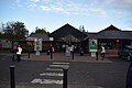
 Bus stop and car park - geograph.org.uk - 5915370.jpg 640 × 427; 94 KB
-
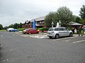
 Car park, Durham Services, A1(M), Junction 61 - geograph.org.uk - 6574505.jpg 2,000 × 831; 1.51 MB
-
 Cassop Grange - geograph.org.uk - 3546815.jpg 3,648 × 2,736; 3.58 MB
-
 Country road - geograph.org.uk - 5631431.jpg 640 × 480; 61 KB
-
 Days Inn Hotel at Durham Services - geograph.org.uk - 5131611.jpg 3,264 × 1,836; 3.23 MB
-
 Days Inn hotel, Durham Services, A1(M), Junction 61 - geograph.org.uk - 6574501.jpg 2,000 × 1,153; 2.11 MB
-
 Days Inn Motel at Bowburn Motorway Service Area beside A1M - geograph.org.uk - 4163206.jpg 3,980 × 2,212; 4.94 MB
-
 Dene House Farm - geograph.org.uk - 2970572.jpg 2,048 × 1,536; 693 KB
-
 Durham Road - Bowburn - geograph.org.uk - 6026744.jpg 4,128 × 3,096; 3.67 MB
-
 Durham Services - geograph.org.uk - 4587666.jpg 1,472 × 830; 740 KB
-
 Durham Services - geograph.org.uk - 5183923.jpg 1,600 × 1,067; 288 KB
-
 Durham Services - geograph.org.uk - 5186628.jpg 800 × 600; 100 KB
-
-
 Durham Services, A1(M), Junction 61 - geograph.org.uk - 6574494.jpg 2,000 × 1,331; 3.01 MB
-
 Farmers bridge over the A688 from Heugh Hall Farm - geograph.org.uk - 2502424.jpg 3,648 × 2,736; 2.08 MB
-
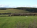
 Farmland near Quarrington Farm - geograph.org.uk - 6213222.jpg 1,024 × 768; 235 KB
-
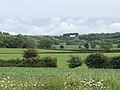
 Farmland near Tursdale - geograph.org.uk - 2422041.jpg 640 × 430; 23 KB
-
 Farmland, Cassop Vale - geograph.org.uk - 5838903.jpg 1,024 × 768; 186 KB
-
 Farmland, Cassop Vale - geograph.org.uk - 6187137.jpg 1,024 × 768; 179 KB
-
 Farmland, Tursdale - geograph.org.uk - 5874101.jpg 1,024 × 683; 223 KB
-
 Field flash - geograph.org.uk - 3546758.jpg 3,648 × 2,736; 2.84 MB
-
 Field gate from the A688 - geograph.org.uk - 2502433.jpg 3,648 × 2,736; 2.64 MB
-

-
 Footpath between hedges - geograph.org.uk - 6324547.jpg 2,000 × 1,096; 1.94 MB
-
 Footpath, Coxhoe - geograph.org.uk - 5893177.jpg 768 × 1,024; 335 KB
-
 Grazing off the A688 - geograph.org.uk - 3229463.jpg 640 × 480; 84 KB
-
 Great North Road A1(M) - geograph.org.uk - 3413745.jpg 1,307 × 1,039; 286 KB
-
 Groundwork at construction site - geograph.org.uk - 5934637.jpg 1,999 × 1,207; 1.81 MB
-
 Houses in Cassop - geograph.org.uk - 4720162.jpg 1,500 × 990; 1.31 MB
-
 Houses off Tail-upon-End Lane - geograph.org.uk - 3229472.jpg 640 × 480; 51 KB
-
 Houses on Southlands Avenue - geograph.org.uk - 3229454.jpg 1,024 × 713; 177 KB
-
 Infrastructure work for new development - geograph.org.uk - 6182367.jpg 1,024 × 768; 179 KB
-
 Landscaped area adjacent to housing estate - geograph.org.uk - 6324509.jpg 1,999 × 1,074; 2.1 MB
-
 Minor road descending from Old Cassop - geograph.org.uk - 6040769.jpg 1,600 × 962; 346 KB
-
 Monolith, Crow Trees - geograph.org.uk - 2540296.jpg 1,792 × 1,184; 474 KB
-
 New house at Old Quarrington - geograph.org.uk - 6325603.jpg 2,000 × 1,160; 2.37 MB
-

-

-
 Old Waggonway, Quarrington Hill - geograph.org.uk - 5838898.jpg 1,024 × 768; 319 KB
-
 Parish Church of Christ the King - geograph.org.uk - 5934108.jpg 2,000 × 1,130; 1.62 MB
-
 Path beside the A688 - geograph.org.uk - 3229461.jpg 640 × 480; 108 KB
-
 Path in Cassop Vale - geograph.org.uk - 3534000.jpg 3,648 × 2,736; 3.42 MB
-
 Pond in Cassop Vale - geograph.org.uk - 3533959.jpg 3,648 × 2,736; 3.08 MB
-
 Pond in Farmland - geograph.org.uk - 5893384.jpg 1,024 × 768; 212 KB
-
 Ponds, Crow Trees Nature Reserve - geograph.org.uk - 6023751.jpg 1,024 × 665; 214 KB
-
 Post box, Durham Services, A1(M), Junction 61 - geograph.org.uk - 6574498.jpg 966 × 2,000; 2.06 MB
-
 Public green space - geograph.org.uk - 5915373.jpg 640 × 427; 121 KB
-
 Quarrington Farm - geograph.org.uk - 2540279.jpg 1,792 × 1,184; 503 KB
-
 Quarrington Quarry - geograph.org.uk - 3805655.jpg 1,440 × 1,080; 455 KB
-
 Quarrington Quarry - geograph.org.uk - 3805734.jpg 1,440 × 1,080; 573 KB
-
 Road descending to cross Chapman Beck - geograph.org.uk - 6040892.jpg 1,600 × 908; 688 KB
-
 Roadchef Durham Services - geograph.org.uk - 5523930.jpg 1,024 × 683; 345 KB
-
 Roadworks on the A688 - geograph.org.uk - 6213225.jpg 1,024 × 768; 206 KB
-
 Ruins of Cassop Hall - geograph.org.uk - 3534428.jpg 3,648 × 2,736; 3.37 MB
-
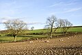 Sheep 'grazing' on turnips - geograph.org.uk - 6054141.jpg 1,600 × 1,068; 641 KB
-
 Sheep in field close to Bowburn - geograph.org.uk - 5937527.jpg 2,000 × 1,058; 1.68 MB
-
 Site of Bowburn Colliery - geograph.org.uk - 5906879.jpg 1,024 × 768; 257 KB
-
 Strawberry Hill - geograph.org.uk - 4151966.jpg 2,560 × 1,920; 1.97 MB
-
 Terrace of houses at Bowburn - geograph.org.uk - 5934563.jpg 2,000 × 1,347; 2.43 MB
-
 The A688 heading south - geograph.org.uk - 3229460.jpg 640 × 480; 77 KB
-
 The A688 seen from Durham Services - geograph.org.uk - 6574503.jpg 2,000 × 1,141; 2.31 MB
-
 The B6291 road approaching Junction 61 on the A1(M) - geograph.org.uk - 2988748.jpg 3,648 × 2,736; 1.94 MB
-
 The Days Inn, Roadchef Motorway Service Area, Durham - geograph.org.uk - 3229459.jpg 1,600 × 1,006; 437 KB
-
 The End of the Line - geograph.org.uk - 5869619.jpg 1,024 × 683; 214 KB
-
 The Heatherlad Inn - geograph.org.uk - 5631429.jpg 640 × 480; 72 KB
-
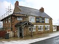
 The Kicking Cuddy, Parkhill - geograph.org.uk - 3229453.jpg 640 × 375; 42 KB
-
 The lane down from Old Cassop - geograph.org.uk - 3546790.jpg 3,648 × 2,736; 2.92 MB
-
 The lane up to Old Cassop - geograph.org.uk - 3534018.jpg 3,648 × 2,736; 3.3 MB
-
 The Old Main Line - geograph.org.uk - 2540240.jpg 1,792 × 1,184; 489 KB
-
 Track to Whitwell South Farm - geograph.org.uk - 3229470.jpg 640 × 480; 57 KB
-
 Trackbed of the Leamside line - geograph.org.uk - 5906902.jpg 1,024 × 768; 358 KB
-
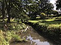 Tursdale Beck near Hett Mill - geograph.org.uk - 5906891.jpg 1,024 × 768; 325 KB
-
 Two routes approaching Parkhill - geograph.org.uk - 6324893.jpg 2,000 × 1,082; 2.12 MB
-
 Vegetable Garden - geograph.org.uk - 5867024.jpg 1,024 × 765; 332 KB
-
 View along Tail Upon End Road - geograph.org.uk - 3546856.jpg 3,648 × 2,736; 3.08 MB
-
 View along the A688 - geograph.org.uk - 3546805.jpg 3,648 × 2,736; 2.83 MB
-
 View over Cassop Vale - geograph.org.uk - 3533969.jpg 3,648 × 2,736; 3.46 MB
_heading_south,_Junction_61_-_geograph.org.uk_-_3229458.jpg)
_northbound_-_geograph.org.uk_-_3107523.jpg)
_northbound_-_geograph.org.uk_-_3107524.jpg)
_northbound_-_geograph.org.uk_-_3107526.jpg)
_northbound_at_Bowburn_-_geograph.org.uk_-_5831333.jpg)
_northbound_nearing_Junction_61_-_geograph.org.uk_-_5831321.jpg)
_South_of_Bowburn_-_geograph.org.uk_-_6456117.jpg)
_South_of_Durham_-_geograph.org.uk_-_6456124.jpg)
,_overbridge_Junction_61_-_geograph.org.uk_-_2578328.jpg)
,_overbridges_Junction_61_-_geograph.org.uk_-_2578326.jpg)


_-_geograph.org.uk_-_3229455.jpg)


,_Junction_61_-_geograph.org.uk_-_6574505.jpg)


,_Junction_61_-_geograph.org.uk_-_6574501.jpg)


_motorway_-_geograph.org.uk_-_4056300.jpg)
,_Junction_61_-_geograph.org.uk_-_6574494.jpg)


_south_of_Junction_61_-_geograph.org.uk_-_2578323.jpg)


_-_geograph.org.uk_-_3413745.jpg)


_after_Bowburn_Interchange_-_geograph.org.uk_-_6456122.jpg)
,_Bridge_at_Bowburn_Junction_-_geograph.org.uk_-_6456119.jpg)


,_Junction_61_-_geograph.org.uk_-_6574498.jpg)


_-_geograph.org.uk_-_2988748.jpg)


