Category:Castleton, Dorset
civil parish in Dorset, United Kingdom  | |||||
| Upload media | |||||
| Instance of | |||||
|---|---|---|---|---|---|
| Location | Dorset, South West England, England | ||||
| Population |
| ||||
 | |||||
English: Castleton is a village in west Dorset, England. The village had a population of 130 in 2001. Castleton is in the group parish of Yeo Head together with the three village parishes of Poyntington, Goathill and Oborne. This parish is within the district of West Dorset.
Subcategories
This category has the following 4 subcategories, out of 4 total.
Media in category "Castleton, Dorset"
The following 195 files are in this category, out of 195 total.
-
 A farm on the A30 near Oborne - geograph.org.uk - 3490702.jpg 800 × 600; 182 KB
-
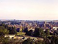
 A View Over East Sherborne - geograph.org.uk - 3224589.jpg 1,600 × 1,200; 614 KB
-
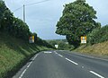
 A30 east near Lynwood Farm - geograph.org.uk - 3421564.jpg 640 × 402; 49 KB
-
 A30 passing Crackmore woods - geograph.org.uk - 3421819.jpg 640 × 444; 64 KB
-
 A30 towards Sherborne - geograph.org.uk - 1454013.jpg 640 × 480; 164 KB
-
 A30 west of Babylon Hill - geograph.org.uk - 4831371.jpg 1,600 × 960; 264 KB
-
 Agricultural Storage Tanks - geograph.org.uk - 2593365.jpg 640 × 480; 114 KB
-
 Ambrose Hill - geograph.org.uk - 2137443.jpg 2,592 × 1,944; 1.52 MB
-
 Ambrose Hill - geograph.org.uk - 2598005.jpg 640 × 480; 67 KB
-
 Arable field near Sherborne - geograph.org.uk - 2278123.jpg 640 × 482; 99 KB
-
 Autumn leaves by Sherborne Castle lake - geograph.org.uk - 5174924.jpg 3,648 × 2,736; 3.63 MB
-
 B3145 - geograph.org.uk - 4463339.jpg 800 × 450; 148 KB
-
 B3148 just south of Checcombe Lane track - geograph.org.uk - 4730991.jpg 640 × 474; 200 KB
-
 Barbican, Sherborne Old Castle - geograph.org.uk - 4920859.jpg 2,048 × 1,536; 736 KB
-
 Barn and mast by Checcombe's Lane - geograph.org.uk - 5936540.jpg 5,202 × 3,465; 2.11 MB
-
 Beehives at Sherborne Castle - geograph.org.uk - 5058692.jpg 3,264 × 2,448; 3.85 MB
-
 Boundary Stone, Milborneport ISII - geograph.org.uk - 6558454.jpg 428 × 876; 366 KB
-
 BP Manhole cover - geograph.org.uk - 2307115.jpg 640 × 480; 121 KB
-

-
-
 Bridge in Sherborne Castle grounds - geograph.org.uk - 5695636.jpg 768 × 1,024; 256 KB
-
 Bridleway to Coombe Farm - geograph.org.uk - 6621448.jpg 1,024 × 768; 234 KB
-
 Car Park Terrace Playing Fields - geograph.org.uk - 2814960.jpg 480 × 640; 87 KB
-
 Cattle in Sherborne Castle parkland - geograph.org.uk - 5174952.jpg 3,648 × 2,736; 3.17 MB
-
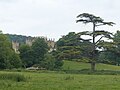
 Cedar trees, Sherborne Castle - geograph.org.uk - 5695633.jpg 1,024 × 768; 215 KB
-
 Checcombe Lane - geograph.org.uk - 1556331.jpg 480 × 640; 139 KB
-
 Checcombe Lane - geograph.org.uk - 2136878.jpg 2,592 × 1,944; 1.74 MB
-
 Checcombe Lane approaching the B3148 - geograph.org.uk - 3881846.jpg 3,776 × 2,520; 4.05 MB
-
 Checcombe lane, looking southward - geograph.org.uk - 5939215.jpg 5,202 × 3,465; 2.69 MB
-
 Checcombe Lane, part of the Monarch's Way - geograph.org.uk - 6656561.jpg 1,600 × 1,061; 1,002 KB
-
 Claire-voie or claire-voire viewpoint at Sherborne Castle - geograph.org.uk - 5174962.jpg 3,648 × 2,736; 3.33 MB
-
 Clatcombe Lane - geograph.org.uk - 1556480.jpg 640 × 500; 142 KB
-
 Clatcombe Lane - geograph.org.uk - 6621689.jpg 1,024 × 798; 268 KB
-
 Coombe Farm - geograph.org.uk - 5936515.jpg 5,202 × 3,465; 2.88 MB
-
 Coombe Lane - geograph.org.uk - 2136862.jpg 2,592 × 1,944; 2.14 MB
-
 Coombe Lane - geograph.org.uk - 5936494.jpg 5,202 × 3,465; 3.93 MB
-
 Coombe Lane - geograph.org.uk - 5936507.jpg 5,202 × 3,465; 3.46 MB
-
 Countryside south of Sherborne - geograph.org.uk - 1180202.jpg 640 × 410; 80 KB
-
 Dancing Hill, Sherborne - geograph.org.uk - 5322065.jpg 640 × 427; 24 KB
-
 Decorative stonework, Sherborne Old Castle - geograph.org.uk - 4920853.jpg 2,048 × 1,536; 797 KB
-

-
 Edge of the woods from Coombe Lane. Looking westwards - geograph.org.uk - 5936501.jpg 5,202 × 3,465; 3.16 MB
-
 Entrance to Sherborne Castle (new) - geograph.org.uk - 2019208.jpg 3,648 × 2,736; 2.23 MB
-
 Farmland Near Sherborne - geograph.org.uk - 3208755.jpg 1,024 × 879; 322 KB
-
 Farmland to the North of Sherborne Old Castle - geograph.org.uk - 3609670.jpg 1,024 × 768; 972 KB
-
 Field by Checcombe Lane - geograph.org.uk - 2137230.jpg 2,592 × 1,944; 1.85 MB
-
 Field east of Wyke Farm - geograph.org.uk - 3473866.jpg 640 × 360; 40 KB
-
 Field of stubble, above Sherborne - geograph.org.uk - 6621428.jpg 1,024 × 768; 265 KB
-
 Field off Coombe Lane - geograph.org.uk - 5936526.jpg 5,202 × 3,465; 3.77 MB
-
 Field view near Dymor - geograph.org.uk - 5936468.jpg 5,202 × 3,465; 3.45 MB
-
 Fields near Limekiln Farm - geograph.org.uk - 3208865.jpg 1,600 × 1,067; 470 KB
-
 Fields near Oborne - geograph.org.uk - 6309350.jpg 1,024 × 768; 85 KB
-
 Fields near Sherborne - geograph.org.uk - 6309355.jpg 1,024 × 768; 79 KB
-
 Fields north-west of Coombe Lane - geograph.org.uk - 2137170.jpg 2,592 × 1,944; 1.12 MB
-
 Ha-ha in Sherborne Castle gardens - geograph.org.uk - 5174939.jpg 2,736 × 2,049; 4 MB
-
 Haydon Park Camp, near Sherborne - geograph.org.uk - 5180316.jpg 640 × 426; 49 KB
-
 Hedgerow. - geograph.org.uk - 2593392.jpg 640 × 480; 78 KB
-
 Higher Clatcombe Farm - geograph.org.uk - 2813738.jpg 640 × 480; 60 KB
-
 Hillside above Hardings House Lane - geograph.org.uk - 6621435.jpg 1,024 × 782; 251 KB
-
 Hollow lane north of Bradford Abbas - geograph.org.uk - 3879076.jpg 3,776 × 2,520; 4.25 MB
-
 Honeycomb Wood - geograph.org.uk - 782169.jpg 640 × 447; 105 KB
-
 Ivy covered trees on Gainsborough Hill - geograph.org.uk - 2822659.jpg 2,272 × 1,704; 2.93 MB
-
-

-
 Lay-by on Sherborne Hill - geograph.org.uk - 4831801.jpg 1,600 × 1,197; 286 KB
-
 Lenthay Dairy House - geograph.org.uk - 5322097.jpg 640 × 427; 59 KB
-
 Limekiln Farm - geograph.org.uk - 6033207.jpg 1,024 × 760; 245 KB
-
 Limekiln Farm - geograph.org.uk - 782157.jpg 640 × 360; 62 KB
-
 Lodge house, Sherborne Castle Estate - geograph.org.uk - 5180359.jpg 640 × 426; 83 KB
-
 Low Railway Bridge at Wyke Farms - geograph.org.uk - 2307105.jpg 640 × 480; 118 KB
-
 Low Railway Bridge, Wyke Farm - geograph.org.uk - 2307109.jpg 640 × 480; 118 KB
-
 Low's Hill Lane west of Sherborne - geograph.org.uk - 5704226.jpg 2,048 × 1,536; 2.19 MB
-
 Macmillan Way crossing in Honeycombe Wood - geograph.org.uk - 6033179.jpg 1,024 × 752; 278 KB
-
 Minor road at Pinford near Sherborne - geograph.org.uk - 2015927.jpg 3,648 × 2,736; 2.07 MB
-
 Monarch's Way - geograph.org.uk - 5936534.jpg 5,202 × 3,465; 4.24 MB
-

-
 New Road, Sherborne - geograph.org.uk - 4475978.jpg 800 × 600; 191 KB
-
 On Charlock Hill - geograph.org.uk - 2137408.jpg 2,592 × 1,944; 1.23 MB
-
 On Charlock Hill - geograph.org.uk - 2137421.jpg 2,592 × 1,944; 1.51 MB
-
 Outskirts of Sherborne - geograph.org.uk - 2593384.jpg 640 × 480; 77 KB
-

-
 Part of the dry moat of Sherborne Old Castle - geograph.org.uk - 4920724.jpg 2,048 × 1,536; 750 KB
-
 Pathfinder Toll House east of Sherborne - geograph.org.uk - 6114406.jpg 640 × 426; 139 KB
-
 Patson Hill - geograph.org.uk - 2137436.jpg 2,592 × 1,944; 2.01 MB
-
 Patson Hill Lane - geograph.org.uk - 3881851.jpg 3,776 × 2,520; 4.08 MB
-
 Perimeter wall - geograph.org.uk - 5695707.jpg 1,024 × 768; 248 KB
-
 Pinford Farm - geograph.org.uk - 5251043.jpg 640 × 427; 32 KB
-
 Playing fields, Sherborne - geograph.org.uk - 4463586.jpg 800 × 533; 233 KB
-
 Ploughed field - geograph.org.uk - 4463336.jpg 800 × 450; 157 KB
-
 Protected verge, New Road, Sherborne - geograph.org.uk - 4474079.jpg 800 × 664; 164 KB
-
 Public Footpath in the Deer Park, Sherborne - geograph.org.uk - 2015971.jpg 2,736 × 3,648; 1.95 MB
-

-

-
 Publicfootpath passing through a cornfield, near Sherborne - geograph.org.uk - 2015885.jpg 3,648 × 2,736; 2.17 MB
-
 Railway cutting, Bradford Abbas - geograph.org.uk - 870457.jpg 426 × 640; 71 KB
-
 Railway line from Yeovil to Waterloo - geograph.org.uk - 6031732.jpg 1,024 × 764; 170 KB
-
 Railway Line in a cutting - geograph.org.uk - 1454066.jpg 480 × 640; 210 KB
-

-
 Rayleigh Grove, home of Sherborne Town FC - geograph.org.uk - 2166387.jpg 1,600 × 1,200; 296 KB
-
 Red Hole Lane - geograph.org.uk - 2813762.jpg 640 × 480; 79 KB
-
 Right of way leading off Marston Road - geograph.org.uk - 6656557.jpg 1,600 × 800; 481 KB
-
 Road to Coombe Farm - geograph.org.uk - 5936531.jpg 5,202 × 3,465; 2.71 MB
-
 Road to Lenthay Dairy - geograph.org.uk - 2333269.jpg 640 × 480; 137 KB
-
 Root crops near Trent - geograph.org.uk - 1714738.jpg 640 × 480; 169 KB
-
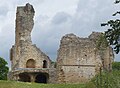
 Ruins of Sherborne Castle - geograph.org.uk - 6309359.jpg 1,024 × 768; 91 KB
-
 Sandford Orcas Road - geograph.org.uk - 6621454.jpg 1,024 × 806; 193 KB
-
 Sandford Orcas Road - geograph.org.uk - 6621696.jpg 1,024 × 768; 253 KB
-
 Sandord Orcas Road - geograph.org.uk - 5251045.jpg 640 × 427; 61 KB
-
 Sherborne - geograph.org.uk - 4280865.jpg 4,000 × 2,666; 6.83 MB
-
 Sherborne - geograph.org.uk - 4280867.jpg 4,000 × 2,666; 7.61 MB
-
 Sherborne - geograph.org.uk - 4281611.jpg 3,932 × 2,621; 7.17 MB
-
 Sherborne Castle - ancient Beech tree - geograph.org.uk - 6685851.jpg 800 × 600; 242 KB
-
 Sherborne Castle - autumn colour - geograph.org.uk - 6685859.jpg 1,024 × 768; 367 KB
-
 Sherborne Castle - Autumn gold - geograph.org.uk - 6686473.jpg 1,024 × 768; 376 KB
-
 Sherborne Castle - geograph.org.uk - 6181855.jpg 1,600 × 1,200; 555 KB
-
 Sherborne Castle - geograph.org.uk - 6182312.jpg 1,024 × 671; 147 KB
-
 Sherborne Castle gardens - geograph.org.uk - 6182319.jpg 1,024 × 768; 170 KB
-
 Sherborne Castle lake - a weir - geograph.org.uk - 6685334.jpg 640 × 480; 97 KB
-
 Sherborne Castle, Ducks by the footpath to the Boat House - geograph.org.uk - 4992415.jpg 3,678 × 2,456; 7.19 MB
-
 Sherborne Castle, The Anemone Walk from the East Lawn - geograph.org.uk - 4992389.jpg 3,678 × 2,456; 5.95 MB
-
 Sherborne Castle, The Boat House - geograph.org.uk - 4992379.jpg 3,660 × 2,422; 5.77 MB
-
 Sherborne Castle, the boathouse and lake - geograph.org.uk - 6685329.jpg 1,024 × 768; 175 KB
-
 Sherborne Deer Park - geograph.org.uk - 665312.jpg 640 × 480; 93 KB
-
 Sherborne from The Terrace - geograph.org.uk - 3493210.jpg 640 × 480; 68 KB
-
 Sherborne Golf Club - geograph.org.uk - 2813749.jpg 640 × 480; 87 KB
-
 Sherborne Golf Course - geograph.org.uk - 3743478.jpg 640 × 480; 52 KB
-
 Sherborne golf course - geograph.org.uk - 487219.jpg 640 × 477; 72 KB
-
 Sherborne Hill A325 - geograph.org.uk - 6181798.jpg 1,024 × 768; 210 KB
-
 Sherborne Hill A325 - geograph.org.uk - 6181808.jpg 1,024 × 739; 199 KB
-
 Sherborne Lake - geograph.org.uk - 2896495.jpg 900 × 596; 275 KB
-
 Sherborne Lake - geograph.org.uk - 6181826.jpg 1,600 × 1,200; 813 KB
-
 Sherborne Lake - geograph.org.uk - 93208.jpg 640 × 480; 56 KB
-
 Sherborne Old Castle - geograph.org.uk - 6182331.jpg 1,024 × 721; 295 KB
-
 Sherborne Old Castle - geograph.org.uk - 6182333.jpg 1,024 × 768; 172 KB
-
 Sherborne Old Castle - geograph.org.uk - 6182335.jpg 1,024 × 750; 219 KB
-
 Sherborne Park - geograph.org.uk - 6181821.jpg 1,600 × 1,200; 479 KB
-
 Sherborne Town FC - geograph.org.uk - 561541.jpg 640 × 425; 66 KB
-
-

-
 Sherborne, The London Line - geograph.org.uk - 2932623.jpg 900 × 596; 634 KB
-
 Silverlake Cottages - geograph.org.uk - 5322099.jpg 640 × 427; 51 KB
-
 Silverlake Farm - geograph.org.uk - 2593374.jpg 640 × 480; 103 KB
-
 SLOW on New Road, Sherborne - geograph.org.uk - 4474122.jpg 800 × 738; 164 KB
-
 Sprouting Wheat - geograph.org.uk - 2333261.jpg 640 × 465; 74 KB
-
 Straw Rolls in the landscape. - geograph.org.uk - 1454020.jpg 640 × 480; 168 KB
-
 Strip Lynchets - geograph.org.uk - 2599259.jpg 640 × 448; 79 KB
-
 Thatching in progress, Middle Lodge Sherborne Park - geograph.org.uk - 2015988.jpg 3,588 × 1,982; 1.22 MB
-
 The A352 on Sherborne Hill - geograph.org.uk - 6033197.jpg 1,024 × 768; 203 KB
-
 The MacMillan Way follows this road for a while - geograph.org.uk - 6621682.jpg 1,024 × 768; 273 KB
-
 The Monarch's Way joining Checcombe Lane - geograph.org.uk - 3881840.jpg 3,534 × 2,348; 1.21 MB
-
-

-

-

-

-

-

-

-

-

-

-

-
-

-
-

-
 The railway line to Salisbury and Waterloo - geograph.org.uk - 5706012.jpg 1,024 × 768; 291 KB
-
 The road to Sandford Orcas - geograph.org.uk - 2136846.jpg 2,592 × 1,944; 2.34 MB
-
 The waterfall at Sherborne castle lake - geograph.org.uk - 2751461.jpg 1,536 × 2,048; 1.55 MB
-
 Towards Silverlake Farm - geograph.org.uk - 3473874.jpg 640 × 325; 49 KB
-
 Track into the dry moat, Sherborne Old Castle - geograph.org.uk - 4920867.jpg 2,048 × 1,536; 734 KB
-
 Track Round Sherborne Castle Park - geograph.org.uk - 3224131.jpg 640 × 480; 80 KB
-
 Track to Honeycomb Farm - geograph.org.uk - 782175.jpg 640 × 360; 102 KB
-
 Track to Trent Path Lane - geograph.org.uk - 2593404.jpg 640 × 480; 107 KB
-
 Track to Trent Path Lane - geograph.org.uk - 4730987.jpg 640 × 469; 90 KB
-
 Trent Path Lane looking Southeastwards towards Sherborne - geograph.org.uk - 5939218.jpg 5,202 × 3,465; 3.72 MB
-
 Tucker's Cross trigpoint - geograph.org.uk - 5164473.jpg 640 × 451; 87 KB
-
 Turf Production - geograph.org.uk - 2593412.jpg 640 × 480; 81 KB
-
 Two hedges and a field entrance by A30 - geograph.org.uk - 4831388.jpg 1,600 × 1,200; 364 KB
-
 Underdown Lane, Oborne - geograph.org.uk - 4355188.jpg 640 × 480; 132 KB
-
 Underwood Lane, Oborne - geograph.org.uk - 5914709.jpg 480 × 640; 103 KB
-
 Underwood Lane, Sherborne - geograph.org.uk - 5914708.jpg 480 × 640; 67 KB
-
 View across the A30 - geograph.org.uk - 1454019.jpg 640 × 480; 161 KB
-
 View from Raleigh's Seat - geograph.org.uk - 6181860.jpg 1,600 × 1,200; 488 KB
-
 View of road from Raleigh's Seat, Sherborne Castle - geograph.org.uk - 5174935.jpg 3,648 × 2,736; 3.82 MB
-
 View to Old Park from Sherborne Castle - geograph.org.uk - 5174918.jpg 3,648 × 2,736; 2.36 MB
-
 View towards Ambrose Hill - geograph.org.uk - 5936479.jpg 5,202 × 3,465; 2.54 MB
-
 Watery Lane - geograph.org.uk - 5545292.jpg 1,024 × 768; 240 KB
-
 Weighbridge, Sherborne Estate - geograph.org.uk - 2822200.jpg 2,272 × 1,704; 3.3 MB
-
 Weir - Sherborne Castle lake - geograph.org.uk - 6685347.jpg 640 × 480; 141 KB
-
 Welcome to Sherborne, Ancient Abbey Town - geograph.org.uk - 4474040.jpg 800 × 540; 137 KB
-
 Wooded valley, Sherborne Park - geograph.org.uk - 2822195.jpg 2,041 × 1,530; 990 KB
-
 Woodland section of Macmillan Way (Quarr Lane) - geograph.org.uk - 5936464.jpg 5,202 × 3,465; 6.22 MB
-
 Yeo valley near Thornford - geograph.org.uk - 4755650.jpg 2,718 × 1,388; 800 KB
-


_-_geograph.org.uk_-_2019208.jpg)


_-_geograph.org.uk_-_3153869.jpg)
_-_geograph.org.uk_-_3153871.jpg)
_-_geograph.org.uk_-_3153890.jpg)
_-_geograph.org.uk_-_3153940.jpg)
_-_geograph.org.uk_-_3153950.jpg)
_-_geograph.org.uk_-_3153970.jpg)
_-_geograph.org.uk_-_3155051.jpg)
_-_geograph.org.uk_-_3155067.jpg)
_-_geograph.org.uk_-_3155092.jpg)
_-_geograph.org.uk_-_3155100.jpg)
_-_geograph.org.uk_-_3155107.jpg)
_-_geograph.org.uk_-_3155123.jpg)
_-_geograph.org.uk_-_3155136.jpg)
_-_geograph.org.uk_-_3155149.jpg)
_-_geograph.org.uk_-_3155162.jpg)
_-_geograph.org.uk_-_3155180.jpg)


_-_geograph.org.uk_-_5936464.jpg)

