Category:Cathcart, Glasgow
area of Glasgow, Scotland, UK  | |||||
| Upload media | |||||
| Instance of | |||||
|---|---|---|---|---|---|
| Location |
| ||||
 | |||||
Subcategories
This category has the following 19 subcategories, out of 19 total.
B
- Baptist Church, Cathcart (3 F)
C
- Cathcart railway station (33 F)
- Couper Institute (7 F)
H
- Holmlea Primary School (27 F)
- Holmlea Road Bridge (5 F)
- Holmwood House, Glasgow (12 F)
L
- Linn Park, Glasgow (33 F)
M
O
T
U
- United Free Church, Cathcart (3 F)
Media in category "Cathcart, Glasgow"
The following 44 files are in this category, out of 44 total.
-
 38-40 Snuff Mill Road, Lindsay Tenement - 1.jpg 3,024 × 3,580; 8.47 MB
-
 38-40 Snuff Mill Road, Lindsay Tenement - 2.jpg 2,936 × 3,915; 8.51 MB
-
 38-40 Snuff Mill Road, Lindsay Tenement - 3.jpg 2,611 × 3,264; 6.5 MB
-
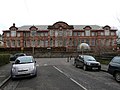 Battlefield School - geograph.org.uk - 1190030.jpg 640 × 480; 73 KB
-
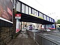
 Cathcart railway bridge - geograph.org.uk - 2140241.jpg 640 × 445; 138 KB
-
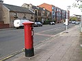
 Clarkston Road - geograph.org.uk - 2142161.jpg 640 × 465; 131 KB
-
 Clarkston Road - geograph.org.uk - 3438673.jpg 604 × 640; 182 KB
-
 Clarkston Road, Cathcart (geograph 5409912).jpg 640 × 480; 147 KB
-
 Clarkston Road, Cathcart - geograph.org.uk - 5409897.jpg 640 × 480; 181 KB
-
 Clarkston Road, Cathcart - geograph.org.uk - 5409902.jpg 640 × 480; 186 KB
-
 Clarkston Road, G44 (2) (geograph 2143692).jpg 640 × 480; 74 KB
-
 Footbridge over White Cart Water - geograph.org.uk - 2141477.jpg 640 × 398; 96 KB
-
 From the Snuff Mill Bridge (geograph 6882655).jpg 3,000 × 2,000; 5.33 MB
-
 Gate at Weirs Pumps factory - geograph.org.uk - 2142710.jpg 480 × 640; 102 KB
-
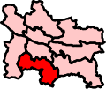 Glasgow Cathcart (Scottish Parliament constituency).svg 151 × 127; 23 KB
-
 Glasgow Cathcart ScottishParliamentConstituency.PNG 162 × 136; 3 KB
-
 Glasgow wards 2017 no02 Newlands.png 2,000 × 2,040; 504 KB
-
 Hampden Park Glasgow - panoramio (cropped).jpg 1,820 × 1,365; 1.69 MB
-
 Hampden Park Glasgow - panoramio.jpg 3,072 × 2,304; 4.72 MB
-
 Holmlea Road - geograph.org.uk - 2141525.jpg 640 × 480; 160 KB
-
 Holmlea Road - geograph.org.uk - 2141535.jpg 640 × 431; 102 KB
-
 Inverlair Avenue (geograph 2142721).jpg 640 × 480; 120 KB
-
 Manse Brae Bridges - geograph.org.uk - 733702.jpg 640 × 480; 62 KB
-
 Map of Renfrewshire Sheet 013, Ordnance Survey, 1863-1864.jpg 10,737 × 7,188; 7.87 MB
-
 Map of Renfrewshire Sheet 013, Ordnance Survey, 1863-1864.tiff 10,737 × 7,188; 220.81 MB
-
 Mini-roundabout on Netherlee Road (geograph 2468399).jpg 800 × 449; 127 KB
-
 Netherlee Road (geograph 2468646).jpg 640 × 480; 121 KB
-
 Newlands Road - geograph.org.uk - 2141815.jpg 640 × 466; 134 KB
-
 Park at Orchy Street (geograph 2141514).jpg 640 × 424; 134 KB
-
 Railway bridge near Cathcart Railway Station (geograph 6971474).jpg 800 × 600; 121 KB
-
 Rannoch Street - geograph.org.uk - 2141470.jpg 640 × 421; 130 KB
-
 Scene in Cathcart Cemetery (geograph 2654247).jpg 640 × 480; 133 KB
-
 Snuff Mill Bridge, White Cart, Cathcart, Glasgow - near Linn Park.jpg 3,822 × 2,830; 5.24 MB
-
 Snuff Mill Bridge, White Cart, Cathcart, Glasgow.jpg 4,608 × 2,882; 5.79 MB
-
 Systems House - geograph.org.uk - 2142724.jpg 640 × 404; 104 KB
-
 Weir Pumps, Cathcart - geograph.org.uk - 926614.jpg 480 × 640; 44 KB
-
 Weirs Pumps building (geograph 2142709).jpg 640 × 480; 97 KB
-
 Weirs Pumps building - geograph.org.uk - 2141810.jpg 640 × 480; 128 KB
-
 Weirs Pumps building - geograph.org.uk - 2142234.jpg 640 × 422; 111 KB
-
 Weirs Pumps building - geograph.org.uk - 2142249.jpg 480 × 640; 93 KB
-
 Weirs Pumps building - geograph.org.uk - 2142255.jpg 640 × 480; 121 KB
-
 Weirs Pumps factory - geograph.org.uk - 2142706.jpg 640 × 480; 119 KB
-
 White Cart Water - geograph.org.uk - 2141745.jpg 640 × 480; 194 KB
-
 White Cart Water Flood Prevention (geograph 6042164).jpg 2,000 × 1,333; 3.01 MB


.jpg)


_(geograph_2143692).jpg)

.jpg)

.svg)


.jpg)


.jpg)


.jpg)
.jpg)

.jpg)
.jpg)

.jpg)


.jpg)


.jpg)