Category:Catholic cemetery in Klimówka
| Object location | | View all coordinates using: OpenStreetMap |
|---|
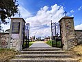
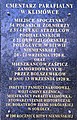
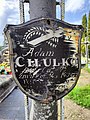
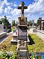
Polski: Cmentarz rzymsko-katolicki z początku XX wieku w Klimówce.
 | |||||
| Upload media | |||||
| Instance of | |||||
|---|---|---|---|---|---|
| Location | Klimówka, Gmina Kuźnica, Sokółka County, Podlaskie Voivodeship, Poland | ||||
| Heritage designation |
| ||||
 | |||||
Subcategories
This category has only the following subcategory.
Media in category "Catholic cemetery in Klimówka"
The following 32 files are in this category, out of 32 total.
-
 Klimówka cmentarz 01.jpg 4,000 × 3,000; 5.23 MB
-
 Klimówka cmentarz 02.jpg 2,288 × 3,552; 10.5 MB
-
 Klimówka cmentarz grób 01.jpg 3,000 × 4,000; 6.64 MB
-
 Klimówka cmentarz grób 02.jpg 3,000 × 4,000; 5.42 MB
-
 Klimówka cmentarz grób 02a.jpg 3,000 × 4,000; 3.92 MB
-
 Klimówka cmentarz grób 03.jpg 3,000 × 4,000; 5.42 MB
-
 Klimówka cmentarz grób 04.jpg 3,000 × 4,000; 6.24 MB
-
 Klimówka cmentarz grób 05.jpg 3,000 × 4,000; 6.48 MB
-
 Klimówka cmentarz grób 05a.jpg 3,000 × 4,000; 6.38 MB
-
 Klimówka cmentarz grób 06.jpg 3,000 × 4,000; 5.27 MB
-
 Klimówka cmentarz grób 07.jpg 3,000 × 4,000; 5.16 MB
-
 Klimówka cmentarz grób 07a.jpg 3,000 × 4,000; 7.34 MB
-
 Klimówka cmentarz grób 08.jpg 3,000 × 4,000; 5.65 MB
-
 Klimówka cmentarz grób 09.jpg 3,000 × 4,000; 4.98 MB
-
 Klimówka cmentarz grób 10.jpg 3,000 × 4,000; 6.35 MB
-
 Klimówka cmentarz grób 11.jpg 3,000 × 4,000; 6.1 MB
-
 Klimówka cmentarz grób 12.jpg 3,000 × 4,000; 6.09 MB
-
 Klimówka cmentarz grób 12a.jpg 3,000 × 4,000; 6.6 MB
-
 Klimówka cmentarz grób 13.jpg 3,000 × 4,000; 5.85 MB
-
 Klimówka cmentarz grób 14.jpg 3,000 × 4,000; 6.7 MB
-
 Klimówka cmentarz grób 14a.jpg 3,000 × 4,000; 6.89 MB
-
 Klimówka cmentarz grób 15.jpg 3,000 × 4,000; 6.11 MB
-
 Klimówka cmentarz grób 16.jpg 3,000 × 4,000; 6.22 MB
-
 Klimówka cmentarz grób 17.jpg 3,000 × 4,000; 6.92 MB
-
 Klimówka cmentarz grób 18.jpg 3,000 × 4,000; 6.74 MB
-
 Klimówka cmentarz grób 19.jpg 3,000 × 4,000; 5.89 MB
-
 Klimówka cmentarz grób 20.jpg 3,000 × 4,000; 7.68 MB
-
 Klimówka cmentarz grób 20a.jpg 3,000 × 4,000; 5.26 MB
-
 Klimówka cmentarz grób 21.jpg 4,000 × 3,000; 8.29 MB
-
 Klimówka cmentarz grób 21a.jpg 3,000 × 4,000; 5.19 MB
-
 Klimówka cmentarz grób 22.jpg 4,000 × 3,000; 7.77 MB
-
 Klimówka cmentarz grób 23.jpg 3,000 × 4,000; 5.69 MB


