Category:Catholic church Niedergösgen
| Object location | | View all coordinates using: OpenStreetMap |
|---|
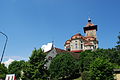
church and castle building in Niedergösgen in the canton of Solothurn, Switzerland   | |||||
| Upload media | |||||
| Instance of | |||||
|---|---|---|---|---|---|
| Part of | |||||
| Named after | |||||
| Location | Niedergösgen, Gösgen District, Olten-Gösgen, Solothurn, Switzerland | ||||
| Street address |
| ||||
| Heritage designation | |||||
 | |||||
Media in category "Catholic church Niedergösgen"
The following 29 files are in this category, out of 29 total.
-
 Goesgen katolika preghejo 370.JPG 3,872 × 2,592; 4.34 MB
-
 Niedergoesgen katiloka preghejo 399.JPG 2,592 × 3,872; 3.54 MB
-
 Niedergoesgen katiloka preghejo 402.JPG 3,872 × 2,592; 4.14 MB
-
 Niedergoesgen katolika preghejo 348.JPG 2,592 × 3,872; 3.68 MB
-
 Niedergoesgen katolika preghejo 350.JPG 3,872 × 2,592; 4.21 MB
-
 Niedergoesgen katolika preghejo 354.JPG 3,872 × 2,592; 4.03 MB
-
 Niedergoesgen katolika preghejo 355.JPG 3,872 × 2,592; 4.38 MB
-
 Niedergoesgen katolika preghejo 369.JPG 3,872 × 2,592; 4.5 MB
-
 Niedergoesgen katolika preghejo 373.JPG 3,872 × 2,592; 4.7 MB
-
 Niedergoesgen katolika preghejo 375.JPG 3,872 × 2,592; 4.65 MB
-
 Niedergoesgen katolika preghejo 378.JPG 3,872 × 2,592; 4.21 MB
-
 Niedergoesgen katolika preghejo 379.JPG 3,872 × 2,592; 4.29 MB
-
 Niedergoesgen katolika preghejo 380.JPG 2,592 × 3,872; 4.33 MB
-
 Niedergoesgen katolika preghejo 382.JPG 3,872 × 2,592; 4.2 MB
-
 Niedergoesgen katolika preghejo 394.JPG 3,872 × 2,592; 3.96 MB
-
 Niedergoesgen katolika preghejo 395.JPG 3,872 × 2,592; 3.8 MB
-
 Niedergoesgen katolika preghejo 396.JPG 2,592 × 3,872; 4.15 MB
-
 Niedergoesgen katolika preghejo 398.JPG 3,872 × 2,592; 3.73 MB
-
 Niedergoesgen katolika preghejo 400.JPG 3,872 × 2,592; 3.52 MB
-
 Niedergoesgen katolika preghejo 401.JPG 3,872 × 2,592; 3.85 MB
-
 Niedergoesgen katolika preghejo orgeno 397.JPG 3,872 × 2,592; 3.45 MB
-
 Niedergoesgen Kirche um Turm 01.jpg 4,368 × 2,912; 7.22 MB
-
 Niedergoesgen Kirche um Turm 02.jpg 4,160 × 2,752; 7.59 MB
-
 Niedergoesgen komunuma domo kaj katolika preghejo 357.JPG 3,872 × 2,592; 4.56 MB
-
 Niedergoesgen malnova kastelvalo inter komunuma domo kaj katolika preghejo 377.JPG 3,872 × 2,592; 4.7 MB
-
 Niedergoesgen turo de la katolika preghejo 389.JPG 2,592 × 3,872; 3.48 MB
-
 Niedergoesgen turo de la katolika preghejo 390.JPG 2,592 × 3,872; 3.1 MB
-
 Niedergoesgen-Schlosskirche.jpg 800 × 800; 153 KB
-
 Niedergösgen SO katholische Schlosskirche Schlossrainstrasse 7.jpg 4,965 × 4,269; 9.09 MB


