Category:Catterline
village in Aberdeenshire, Scotland, UK   | |||||
| Upload media | |||||
| Instance of | |||||
|---|---|---|---|---|---|
| Location |
| ||||
 | |||||
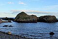
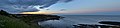
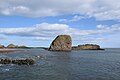
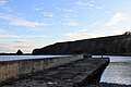
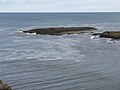
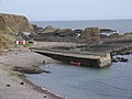
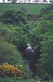
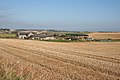
English: Catterline is a coastal village on the North Sea in Aberdeenshire, Scotland. It is situated about six kilometers south of Stonehaven; nearby to the north are Dunnottar Castle and Fowlsheugh Nature Reserve. Other noted architectural or historic features in the general area include Fetteresso Castle, Fiddes Castle, Chapel of St. Mary and St. Nathalan and Muchalls Castle.
Subcategories
This category has the following 2 subcategories, out of 2 total.
B
- Braidon Bay, Aberdeenshire (8 F)
P
Media in category "Catterline"
The following 68 files are in this category, out of 68 total.
-
 'Big Hoos' in Roadside of Catterline - geograph.org.uk - 1371528.jpg 640 × 480; 98 KB
-
 A92 Southbound Near Catterline - geograph.org.uk - 175728.jpg 640 × 282; 43 KB
-
 Birds on the rocks - geograph.org.uk - 6110628.jpg 4,367 × 3,279; 3.49 MB
-
 By Swallow Cove - geograph.org.uk - 5826648.jpg 3,204 × 2,136; 4.6 MB
-
 Catterline and its beach - geograph.org.uk - 4628411.jpg 800 × 601; 525 KB
-
 Catterline Bay - geograph.org.uk - 1979486.jpg 640 × 480; 57 KB
-
 Catterline Bay - geograph.org.uk - 2567404.jpg 4,000 × 3,000; 2.65 MB
-
 Catterline Bay - geograph.org.uk - 6104067.jpg 6,000 × 4,000; 4.95 MB
-
 Catterline Bay and Pier - geograph.org.uk - 4127510.jpg 3,264 × 2,448; 3.05 MB
-
 Catterline Bay Scotland.jpg 13,400 × 3,096; 14.81 MB
-
 Catterline coastal rocks - geograph.org.uk - 6104073.jpg 6,000 × 4,000; 4.8 MB
-
 Catterline coastal scene - geograph.org.uk - 6104079.jpg 6,000 × 4,000; 4.85 MB
-
 Catterline Harbour - geograph.org.uk - 2567359.jpg 4,000 × 3,000; 2.6 MB
-
 Catterline Harbour.jpg 640 × 480; 75 KB
-
 Catterline old cemetery - geograph.org.uk - 257927.jpg 640 × 480; 86 KB
-
 Catterline Pier - geograph.org.uk - 5826635.jpg 4,272 × 2,848; 4.86 MB
-
 Clover Field at Barras - geograph.org.uk - 571317.jpg 640 × 427; 122 KB
-
 Cottages at Catterline - geograph.org.uk - 4127444.jpg 3,264 × 2,448; 3.15 MB
-
 Creel Inn, Catterline - geograph.org.uk - 257922.jpg 640 × 480; 46 KB
-

-
 Erick Law - geograph.org.uk - 571286.jpg 640 × 427; 91 KB
-
 Forley Craig at Catterline - geograph.org.uk - 4127477.jpg 3,264 × 2,448; 4.5 MB
-
 Intertidal area, Catterline - geograph.org.uk - 4628418.jpg 800 × 601; 478 KB
-
 Midtown of Barras - geograph.org.uk - 571339.jpg 640 × 427; 82 KB
-
 Natural arch into Eyemouth Creek - geograph.org.uk - 6388280.jpg 1,024 × 768; 224 KB
-
 Pier, Catterline - geograph.org.uk - 4628372.jpg 800 × 601; 452 KB
-
 Roadside of Catterline - geograph.org.uk - 1371524.jpg 573 × 424; 50 KB
-
 Sea Pinks - geograph.org.uk - 361938.jpg 640 × 480; 198 KB
-
 Spring Cottage - geograph.org.uk - 177814.jpg 640 × 480; 72 KB
-
 Stack by Dunnie Wolf - geograph.org.uk - 5825848.jpg 4,071 × 2,715; 1.04 MB
-
 Swallow Cove - geograph.org.uk - 4294193.jpg 1,600 × 1,200; 425 KB
-
 Taking in the Straw Bales - geograph.org.uk - 571289.jpg 640 × 427; 94 KB
-
 The Kaim of Forley - geograph.org.uk - 4127515.jpg 3,264 × 2,448; 4.34 MB
-
 The pier at Catterline - geograph.org.uk - 4127463.jpg 3,264 × 2,448; 2.99 MB
-
 The pier, Catterline - geograph.org.uk - 4628404.jpg 800 × 601; 527 KB
-
 Todhead Point - geograph.org.uk - 1978539.jpg 640 × 480; 80 KB
-
 Trelong Bay. - geograph.org.uk - 4293326.jpg 1,024 × 768; 107 KB
-
 A view of Todhead Lighthouse - geograph.org.uk - 257933.jpg 480 × 640; 57 KB
-
 A92 near Inverbervie - geograph.org.uk - 800382.jpg 640 × 427; 204 KB
-
 Barras - geograph.org.uk - 571378.jpg 640 × 427; 88 KB
-
 Barras - geograph.org.uk - 800343.jpg 640 × 427; 247 KB
-
 Barras Smiddy - geograph.org.uk - 571359.jpg 640 × 427; 104 KB
-
 Brakes of Barras - geograph.org.uk - 571571.jpg 640 × 427; 110 KB
-
 Catterline Bridge - geograph.org.uk - 1412598.jpg 640 × 409; 91 KB
-
 Catterline Burn - geograph.org.uk - 115741.jpg 409 × 640; 84 KB
-
 Catterline Graveyard - geograph.org.uk - 1412557.jpg 640 × 416; 73 KB
-
 Catterline Pier - geograph.org.uk - 1412547.jpg 640 × 427; 65 KB
-
 Catterline pier - geograph.org.uk - 257921.jpg 640 × 480; 69 KB
-
 Cattlerline Bay - geograph.org.uk - 1412221.jpg 640 × 427; 47 KB
-
 Chapel of Barras - geograph.org.uk - 571590.jpg 640 × 427; 117 KB
-
 Cottage near Roadside of Catterline - geograph.org.uk - 177817.jpg 640 × 480; 72 KB
-
 East Mains of Barras - geograph.org.uk - 177819.jpg 640 × 480; 99 KB
-
 Farm road to Brigstanes Farm - geograph.org.uk - 177058.jpg 640 × 480; 100 KB
-
 Fishermen's Bothy - geograph.org.uk - 7224.jpg 619 × 416; 95 KB
-
 Into Slains Park - geograph.org.uk - 397269.jpg 640 × 480; 144 KB
-

-
 Leys of Barras Farm - geograph.org.uk - 744504.jpg 640 × 480; 79 KB
-
 Midtown of Barras - geograph.org.uk - 571308.jpg 640 × 427; 134 KB
-
 Millhill, South of Catterline - geograph.org.uk - 551111.jpg 640 × 428; 122 KB
-
 Mitton of Barras - geograph.org.uk - 571408.jpg 640 × 427; 88 KB
-

-
 Road near Fernieflatt farm, Kinneff - geograph.org.uk - 178041.jpg 480 × 640; 117 KB
-
 Roadside of Catterline - geograph.org.uk - 529498.jpg 640 × 428; 120 KB
-
 Rows of haybales at Fernieflatt - geograph.org.uk - 177816.jpg 640 × 480; 72 KB
-
 St John's Hill - geograph.org.uk - 571434.jpg 640 × 427; 95 KB
-
 St John's Hill - geograph.org.uk - 571548.jpg 640 × 427; 95 KB
-
 Todhead Lighthouse - geograph.org.uk - 257937.jpg 640 × 488; 42 KB
-
 Zulu at Catterline. - geograph.org.uk - 110856.jpg 640 × 424; 116 KB


