Category:Catteshall
English: Catteshall is a hamlet between the town of Godalming and the villages of Unstead and Thorncombe Street accessible only by an unsurfaced track not suitable for most vehicles. Catteshall Manor is at the top of the hill and the former Ram Cider House is at the bottom. The cider house is named after a ram pump which pumps water from a natural spring up the hill. The hamlet's name is thought to come from Gattes Hill which literally means "gate to hill".
Subcategories
This category has the following 2 subcategories, out of 2 total.
C
- Catteshall Lock (12 F)
F
Media in category "Catteshall"
The following 19 files are in this category, out of 19 total.
-
 Catteshall - geograph.org.uk - 3919365.jpg 3,648 × 2,736; 4.47 MB
-
 Catteshall Lock 1.jpg 2,560 × 1,920; 2.31 MB
-
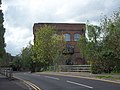 Catteshall Mill 01.jpg 2,880 × 2,160; 2.02 MB
-
 Catteshall Mill 02.jpg 2,880 × 2,160; 1.92 MB
-
 Catteshall Mill 03.jpg 2,160 × 2,880; 1.48 MB
-
 Catteshall Mill 04.jpg 2,880 × 2,160; 1.53 MB
-
 Catteshall Mill 05.jpg 2,880 × 2,160; 1.5 MB
-
 Catteshall Mill.jpg 1,536 × 1,024; 1.11 MB
-
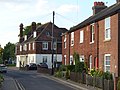 Catteshall Road, Catteshall.jpg 2,560 × 1,920; 1.87 MB
-
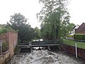
 Catteshall Weir.jpg 640 × 480; 146 KB
-
 Flood on Meadrow (A3100) - geograph.org.uk - 370336.jpg 524 × 632; 121 KB
-
 Former Cider House, Catteshall .jpg 640 × 480; 72 KB
-
 Former Ram Cider House.jpg 2,560 × 1,920; 2.23 MB
-
 Lady Garden Cottage, Catteshall.jpg 2,880 × 2,160; 966 KB
-
 Lloyds Pharmacy, Catteshall.jpg 640 × 425; 301 KB
-
 Old Mill, Catteshall - geograph.org.uk - 1377185.jpg 640 × 480; 128 KB
-
 Ram Cider House, Catteshall in 1990 - geograph.org.uk - 351117.jpg 640 × 402; 70 KB
-
 Rowing Boats at Catteshall - geograph.org.uk - 2050655.jpg 2,560 × 1,920; 1.81 MB
-
 The Old Cider House, Catteshall.jpg 3,000 × 2,003; 1.92 MB


_-_geograph.org.uk_-_370336.jpg)


