Category:Cemetery Oud-Zuilen
| Object location | | View all coordinates using: OpenStreetMap |
|---|
 | |||||
| Upload media | |||||
| Instance of | |||||
|---|---|---|---|---|---|
| Location | Oud-Zuilen, Stichtse Vecht, Utrecht, Netherlands | ||||
| Street address |
| ||||
| Heritage designation |
| ||||
 | |||||
Nederlands: De Begraafplaats Oud-Zuilen is een eind 18e-eeuwse begraafplaats in het Nederlandse dorp Oud-Zuilen. De begraafplaats is in 1781/1782 gesticht door baron W.R. van Tuyll van Serooskerken als particuliere buitenbegraafplaats op diens landgoed ter hoogte van Slot Zuylen. In die tijd was het een van de eerste in haar soort in Nederland.
|
This is a category about rijksmonument number 384277
|
| Address |
|
Media in category "Cemetery Oud-Zuilen"
The following 8 files are in this category, out of 8 total.
-
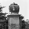
 Bekroning hekpijler - Oud-Zuilen - 20180933 - RCE.jpg 1,197 × 1,200; 309 KB
-
 Cemetery Oud-Zuilen detail gate.jpg 3,264 × 2,448; 3.59 MB
-
 Detail toegangshek - Oud-Zuilen - 20180934 - RCE.jpg 1,195 × 1,200; 279 KB
-
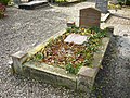 Graf Franciscus Cornelis Donders.jpg 3,264 × 2,448; 3.64 MB
-
 Graf Willem René van Tuyll van Serooskerken en vrouw1.jpg 3,264 × 2,448; 3.82 MB
-
 Graf Willem René van Tuyll van Serooskerken en vrouw2.jpg 3,056 × 2,272; 6.01 MB
-
 Rijksmonument384277.JPG 2,560 × 1,920; 989 KB
-
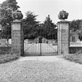 Toegangshek - Oud-Zuilen - 20180932 - RCE.jpg 1,192 × 1,200; 448 KB


