Category:Centre històric de Vistabella
| Object location | | View all coordinates using: OpenStreetMap |
|---|
locality   | |||||
| Upload media | |||||
| Instance of |
| ||||
|---|---|---|---|---|---|
| Location | La Secuita, Tarragonès, Tarragona Province, Catalonia | ||||
| Architectural style | |||||
| Heritage designation |
| ||||
| Elevation above sea level |
| ||||
 | |||||
Català: Centre històric de Vistabella
This is a category about a building indexed in the Catalan heritage register as Bé Cultural d'Interès Local (BCIL) under the reference IPA-12367. |
Media in category "Centre històric de Vistabella"
The following 2 files are in this category, out of 2 total.
-
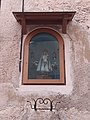 Capelleta a Vistabella.jpg 3,096 × 4,128; 2.24 MB
-
 Vistabella centreHistoric IPA-12367 1063 resize.jpg 800 × 1,200; 407 KB
