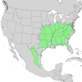
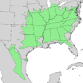
Category:Cercis canadensis range maps
Media in category "Cercis canadensis range maps"
The following 9 files are in this category, out of 9 total.
-
Cercis canadensis range map.png 659 × 693; 131 KB
-
Distribution.cercis.canadensis.png 1,357 × 628; 19 KB
-
Atlas of United States trees- volume 3. Minor western hardwoods (1314) (19722187834).jpg 2,866 × 3,566; 1.27 MB
-
Atlas of United States trees- volume 4. Minor eastern hardwoods (1342) (20344817815).jpg 2,840 × 3,562; 1.26 MB
-
Cercis canadensis range map 0.png 9,624 × 12,505; 1 MB
-
Cercis canadensis range map 1.png 6,132 × 6,132; 421 KB
-
Cercis canadensis range map 2.png 4,549 × 4,550; 273 KB
-
Cercis canadensis range map 3.png 3,837 × 3,836; 192 KB
-
Cercis canadensis range map.svg 2,000 × 2,000; 427 KB


