Category:Chapelle Saint-Barthélémy de Montluel
| Object location | | View all coordinates using: OpenStreetMap |
|---|
|
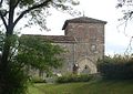
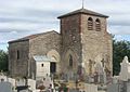
This building is inscrit au titre des monuments historiques de la France. It is indexed in the base Mérimée, a database of architectural heritage maintained by the French Ministry of Culture, under the reference PA00116432
|
|
Chapelle Saint-Barthélémy de Montluel has an entry on OpenStreetMap (show). |
chapel located in Ain, in France  | |||||
| Upload media | |||||
| Pronunciation audio | |||||
|---|---|---|---|---|---|
| Instance of | |||||
| Location | Montluel, Ain, Auvergne-Rhône-Alpes, Metropolitan France, France | ||||
| Heritage designation |
| ||||
| Adjacent building | |||||
 | |||||
Media in category "Chapelle Saint-Barthélémy de Montluel"
The following 29 files are in this category, out of 29 total.
-
 2016-WLM - Chapelle Saint-Barthélémy de Montluel (1).JPG 4,928 × 3,264; 4.74 MB
-
 2016-WLM - Chapelle Saint-Barthélémy de Montluel (11).JPG 4,928 × 3,264; 3.93 MB
-
 2016-WLM - Chapelle Saint-Barthélémy de Montluel (12).JPG 4,928 × 3,264; 3.96 MB
-
 2016-WLM - Chapelle Saint-Barthélémy de Montluel (13).JPG 4,928 × 3,264; 3.5 MB
-
 2016-WLM - Chapelle Saint-Barthélémy de Montluel (14).JPG 3,264 × 4,928; 3.95 MB
-
 2016-WLM - Chapelle Saint-Barthélémy de Montluel (15).JPG 3,264 × 4,928; 4.49 MB
-
 2016-WLM - Chapelle Saint-Barthélémy de Montluel (16).JPG 4,928 × 3,264; 3.97 MB
-
 2016-WLM - Chapelle Saint-Barthélémy de Montluel (2).JPG 3,264 × 4,415; 3.08 MB
-
 2016-WLM - Chapelle Saint-Barthélémy de Montluel (3).JPG 4,928 × 3,264; 3.82 MB
-
 2016-WLM - Chapelle Saint-Barthélémy de Montluel (4).JPG 4,928 × 3,264; 4.11 MB
-
 2016-WLM - Chapelle Saint-Barthélémy de Montluel (5).JPG 4,928 × 3,264; 3.5 MB
-
 2016-WLM - Chapelle Saint-Barthélémy de Montluel (6).JPG 4,928 × 3,264; 3.66 MB
-
 2016-WLM - Chapelle Saint-Barthélémy de Montluel (7).JPG 4,928 × 3,264; 3.96 MB
-
 2016-WLM - Chapelle Saint-Barthélémy de Montluel (8).JPG 3,264 × 4,928; 3.84 MB
-
 2016-WLM - Chapelle Saint-Barthélémy de Montluel (9).JPG 3,264 × 4,928; 4.02 MB
-
 Chapelle Montluel-27.JPG 1,180 × 850; 230 KB
-
 Chapelle Montluel-28.JPG 1,195 × 850; 302 KB
-
 Chapelle Montluel-30.JPG 660 × 850; 214 KB
-
 Chapelle Montluel-31.JPG 1,235 × 870; 249 KB
-
 Chapelle Montluel-39.JPG 1,250 × 880; 251 KB
-
 Chapelle Montluel-65.jpg 1,201 × 850; 358 KB
-
 Chapelle Montluel-66.jpg 1,201 × 850; 283 KB
-
 Chapelle Saint-Barthélémy de Montluel et statue de la vierge.jpg 2,816 × 2,112; 1.41 MB
-
 Chapelle Saint-Barthélémy de Montluel.JPG 2,048 × 1,536; 639 KB
-
 Cimetière de Montluel en 2016.jpg 11,492 × 3,048; 14.08 MB
-
 Côtière de l'Ain - 201807 0463 (50111333387).jpg 4,608 × 3,456; 4.83 MB
-
 Panneau Chapelle St Barthélémy Montluel.jpg 4,320 × 1,708; 1.95 MB
-
 Plaques sur la chapelle Saint-Barthélémy de Montluel.JPG 1,707 × 873; 463 KB
-

.JPG)
.JPG)
.JPG)
.JPG)
.JPG)
.JPG)
.JPG)
.JPG)
.JPG)
.JPG)
.JPG)
.JPG)
.JPG)
.JPG)
.JPG)


.jpg)

_au_second_plan_la_chapelle_Saint-Barth%C3%A9l%C3%A9my_de_Montluel.jpg)