Category:Chapelle Saint-Bernard (Wincrange)
| Object location | | View all coordinates using: OpenStreetMap |
|---|
 | |||||
| Upload media | |||||
| Instance of | |||||
|---|---|---|---|---|---|
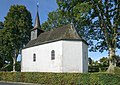
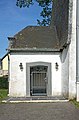
| Location | Wincrange, Canton of Clervaux, Luxembourg | ||||
 | |||||
Media in category "Chapelle Saint-Bernard (Wincrange)"
The following 3 files are in this category, out of 3 total.
-
 Kapelle Wincrange 01.jpg 2,576 × 1,830; 5.17 MB
-
 Kapelle Wincrange 02.jpg 2,584 × 1,825; 5.39 MB
-
 Kapelle Wincrange 03.jpg 1,760 × 2,674; 4.24 MB

