Category:Chapelle Saint-Clément de Donville
| Object location | | View all coordinates using: OpenStreetMap |
|---|
Français : La Chapelle Saint-Clément de Donville, une chapelle du XIIIe siècle, située au lieu-dit Donville, au nord de la commune de Méautis, à la limite sud-ouest de Carentan, dans la Manche, Basse-Normandie
English: The Chapel of Saint-Clément de Donville, a XIIIth Century chapel, located at the place called Donville, north of the commune de Méautis, just South West of the city of Carentan, Dpt of Manche, Normandy
chapel located in Manche, in France .JPG) | |||||
| Upload media | |||||
| Instance of | |||||
|---|---|---|---|---|---|
| Location | Méautis, Manche, Normandy, Metropolitan France, France | ||||
 | |||||
Media in category "Chapelle Saint-Clément de Donville"
The following 7 files are in this category, out of 7 total.
-
 Chapelle Saint-Clément de Donville (2).JPG 4,000 × 3,000; 4.15 MB
-
 Chapelle Saint-Clément de Donville (3).JPG 4,000 × 3,000; 2.5 MB
-
 Chapelle Saint-Clément de Donville - Maitre*autel.JPG 3,000 × 4,000; 1.69 MB
-
 Chapelle Saint-Clément de Donville - Nef.JPG 4,000 × 3,000; 2.26 MB
-
 Chapelle Saint-Clément de Donville - Statue de Saint Clément.JPG 3,000 × 4,000; 1.93 MB
-
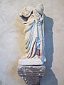 Chapelle Saint-Clément de Donville - Statue à identifier.jpg 3,000 × 4,000; 2.62 MB
-
 Chapelle Saint-Clément de Donville.JPG 4,000 × 3,000; 2.81 MB
.JPG)


