Category:Chapelle Saint-Hubert (Route de Denezy 3, Prévondavaux)
| Object location | | View all coordinates using: OpenStreetMap |
|---|
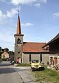
church building in Prévondavaux in the canton of Fribourg, Switzerland  | |||||
| Upload media | |||||
| Instance of | |||||
|---|---|---|---|---|---|
| Part of | |||||
| Location | Prévondavaux, Broye District, Canton of Fribourg, Switzerland | ||||
| Street address |
| ||||
| Heritage designation | |||||
 | |||||
Media in category "Chapelle Saint-Hubert (Route de Denezy 3, Prévondavaux)"
This category contains only the following file.
-
 Chapelle de Prévondavaux.JPG 2,186 × 3,050; 1.99 MB