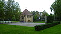
Category:Chapelle de Guillaume Tell (Esplanade Montbenon, allée Paul-Budry, Lausanne)
| Object location | | View all coordinates using: OpenStreetMap |
|---|
 | |||||
| Upload media | |||||
| Instance of | |||||
|---|---|---|---|---|---|
| Part of | |||||
| Location |
| ||||
| Street address |
| ||||
| Heritage designation | |||||
 | |||||
Media in category "Chapelle de Guillaume Tell (Esplanade Montbenon, allée Paul-Budry, Lausanne)"
This category contains only the following file.
-
 Chapelle de Guillaume Tell.JPG 4,320 × 2,432; 3.6 MB