Category:Chappel
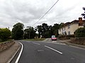
English: Chappel is a village in Essex which sits on the River Colne. It is famous for its Victorian viaduct that crosses the Colne valley. See also Wakes Colne.
village in United Kingdom  | |||||
| Upload media | |||||
| Instance of | |||||
|---|---|---|---|---|---|
| Location | Colchester, Essex, East of England, England | ||||
 | |||||
Subcategories
This category has the following 4 subcategories, out of 4 total.
C
- St Barnabas' church, Chappel (5 F)
- Chappel Viaduct (52 F)
R
- Rose Green, Essex (2 F)
S
- The Swan Inn, Chappel (2 F)
Media in category "Chappel"
The following 125 files are in this category, out of 125 total.
-
 A1124 Colchester Road ^ Chappel Viaduct - geograph.org.uk - 5898476.jpg 4,608 × 3,456; 3.87 MB
-
 A1124 Colchester Road, Chappel - geograph.org.uk - 5897750.jpg 4,608 × 3,456; 3.85 MB
-
 A1124 Colchester Road, Chappel - geograph.org.uk - 5897871.jpg 4,000 × 2,990; 3.63 MB
-
 A1124 Colchester Road, Chappel - geograph.org.uk - 5898484.jpg 4,608 × 3,456; 3.89 MB
-

-
 Approaching Chappel from the southwest. - geograph.org.uk - 3944874.jpg 770 × 1,024; 146 KB
-
 Bacons Farm - geograph.org.uk - 1899929.jpg 640 × 428; 82 KB
-
 Bacons Lane Postbox - geograph.org.uk - 5975461.jpg 4,608 × 3,456; 4.15 MB
-
 Bacons Lane Postbox - geograph.org.uk - 5975462.jpg 3,000 × 4,000; 5.84 MB
-
 Bacons Lane Postbox - geograph.org.uk - 5975483.jpg 2,958 × 3,944; 4.61 MB
-
 Bacons Lane Postbox - geograph.org.uk - 5976377.jpg 4,608 × 3,456; 4.17 MB
-
 Bacons Lane Postbox - geograph.org.uk - 5976378.jpg 2,958 × 3,944; 4.6 MB
-
 Bacons Lane sign - geograph.org.uk - 5975453.jpg 3,900 × 2,925; 5.23 MB
-
 Bacons Lane, Swan Street, Chappel - geograph.org.uk - 5975457.jpg 4,608 × 3,456; 4.1 MB
-
 Bacons Lane, Swan Street, Chappel - geograph.org.uk - 5975464.jpg 4,608 × 3,456; 4.04 MB
-
 Bacons Lane, Swan Street, Chappel - geograph.org.uk - 5975481.jpg 3,000 × 4,000; 3.05 MB
-
 Bridge on Vernon's Road, Rose Green - geograph.org.uk - 3441479.jpg 3,648 × 2,736; 4.45 MB
-
 Bridge on Vernons Road - geograph.org.uk - 5947352.jpg 4,608 × 3,456; 4 MB
-
 Chapel Hill, Wakes Colne - geograph.org.uk - 5900298.jpg 4,608 × 3,456; 3.84 MB
-
 Chappel anti tank obstacles 2.jpg 3,648 × 2,736; 4.37 MB
-
 Chappel anti tank obstacles.jpg 3,648 × 2,736; 4.26 MB
-
 Chappel Bridge on The Street - geograph.org.uk - 5974953.jpg 3,698 × 2,773; 2.56 MB
-
 Chappel Church of England Primary School - geograph.org.uk - 6288053.jpg 5,057 × 3,612; 4.74 MB
-
 Chappel Hill, Wakes Colne - geograph.org.uk - 5974963.jpg 4,608 × 3,456; 4.08 MB
-
 Chappel Hill, Wakes Colne - geograph.org.uk - 5974972.jpg 4,000 × 2,874; 2.62 MB
-
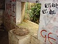
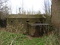 Chappel pillbox 1.jpg 3,648 × 2,736; 4.73 MB
-
 Chappel pillbox 2.jpg 3,648 × 2,736; 4.23 MB
-
 Chappel pillbox gun position.jpg 3,648 × 2,736; 4.64 MB
-
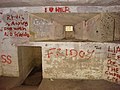 Chappel pillbox interior entrance.jpg 3,648 × 2,736; 4.27 MB
-
 Chappel pillbox interior gun position 2.jpg 3,648 × 2,736; 4.7 MB
-
 Chappel pillbox interior gun position.jpg 3,648 × 2,736; 4.41 MB
-
 Chappel Viaduct - geograph.org.uk - 5900291.jpg 3,842 × 2,881; 3.31 MB
-
 Chappel village from the viaduct.jpg 4,737 × 3,170; 16.09 MB
-
 Chappel Village Name sign - geograph.org.uk - 5897738.jpg 2,958 × 3,944; 5.15 MB
-
 Chappel Village, Essex - geograph.org.uk - 58918.jpg 640 × 480; 105 KB
-
 Colchester Road at Chappel - geograph.org.uk - 6183217.jpg 1,067 × 1,600; 327 KB
-
 Colne Valley - geograph.org.uk - 4722995.jpg 640 × 480; 114 KB
-
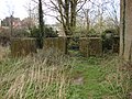
 Derelict building beside a footpath - geograph.org.uk - 3934732.jpg 783 × 587; 163 KB
-
 Entering Chappel on the A1124 Colchester Road - geograph.org.uk - 5897744.jpg 4,608 × 3,456; 3.78 MB
-
 Entering Swan Street on Swan Street - geograph.org.uk - 5975041.jpg 4,608 × 3,456; 4.04 MB
-
 Entering Swan Street on Swan Street - geograph.org.uk - 5975458.jpg 4,608 × 3,456; 3.81 MB
-
 Entering Wakes Colne on the A1124 Colchester Road - geograph.org.uk - 5899698.jpg 4,608 × 3,456; 3.84 MB
-
 Essex Way in Great Tey - geograph.org.uk - 1899969.jpg 428 × 640; 92 KB
-
 Farm Reservoir - geograph.org.uk - 2341115.jpg 640 × 428; 55 KB
-
 Feral Bunny - geograph.org.uk - 1900029.jpg 640 × 428; 72 KB
-
 Field Entrance off Vernons Road - geograph.org.uk - 5947385.jpg 4,608 × 3,456; 3.83 MB
-
 Fishing Lake Near Old Hall Farm - geograph.org.uk - 2341055.jpg 428 × 640; 80 KB
-
 Football Pitch at Chappel - geograph.org.uk - 2381338.jpg 800 × 531; 85 KB
-
 Footpath along oilseed rape field near Priory House, Chappel - geograph.org.uk - 4507422.jpg 3,648 × 2,432; 4.02 MB
-
 Footpath to Chalkney Wood - geograph.org.uk - 2341128.jpg 640 × 428; 59 KB
-
 Footpath to Oaklands - geograph.org.uk - 2341079.jpg 428 × 640; 124 KB
-
 Footpath to the A1124 Colchester Road - geograph.org.uk - 5947359.jpg 4,000 × 3,000; 3.87 MB
-
 Footpaths to Downs Spinney ^ Crepping Hall Road - geograph.org.uk - 5947348.jpg 3,000 × 4,000; 6.51 MB
-
 House in a dip on Chappel Road - geograph.org.uk - 736692.jpg 640 × 464; 119 KB
-
 House set back north of Chappel Road - geograph.org.uk - 736702.jpg 640 × 343; 61 KB
-

-

-

-
 Lost Lake - geograph.org.uk - 2344232.jpg 640 × 278; 44 KB
-
 Oak Road sign - geograph.org.uk - 5975599.jpg 4,608 × 3,456; 3.77 MB
-
 Oak Road sign - geograph.org.uk - 5976392.jpg 3,795 × 2,846; 3.93 MB
-
 Oak Road, Swan Street, Chappel - geograph.org.uk - 5975594.jpg 4,608 × 3,456; 4.15 MB
-
 Oak Road, Wakes Colne - geograph.org.uk - 5974966.jpg 4,608 × 3,456; 3.85 MB
-

-
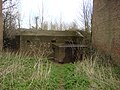
 Overgrown Pillbox - geograph.org.uk - 2381399.jpg 800 × 531; 209 KB
-

-

-

-
 Penlan Hall Lane - geograph.org.uk - 161389.jpg 640 × 426; 104 KB
-
 Pond near Chappel - geograph.org.uk - 2381391.jpg 800 × 531; 192 KB
-
 Popes Lane sign - geograph.org.uk - 5975003.jpg 4,608 × 3,456; 3.97 MB
-
 Roadside Illuminated Advertising Sign - geograph.org.uk - 542674.jpg 640 × 480; 149 KB
-
 Rose Green Postbox - geograph.org.uk - 5897917.jpg 4,608 × 3,456; 3.9 MB
-
 Rose Green Postbox - geograph.org.uk - 5898212.jpg 3,000 × 4,000; 4.07 MB
-
 Rose Green Postbox - geograph.org.uk - 5898449.jpg 4,608 × 3,456; 3.99 MB
-
 Rose Green Postbox - geograph.org.uk - 5898451.jpg 2,986 × 3,981; 3.46 MB
-

-
 South from the A1124 - geograph.org.uk - 161406.jpg 640 × 426; 126 KB
-
 Spring Gardens Road sign - geograph.org.uk - 5898460.jpg 4,608 × 3,456; 4.19 MB
-
 Spring Gardens Road ^ Rose Green Postbox - geograph.org.uk - 5897911.jpg 4,608 × 3,456; 3.77 MB
-
 Spring Gardens Road, Chappel - geograph.org.uk - 5898457.jpg 4,608 × 3,456; 4 MB
-
 Spring Gardens Road, Chappel - geograph.org.uk - 5898467.jpg 3,000 × 4,000; 5.85 MB
-
 Spring Gardens Road, Chappel - geograph.org.uk - 5898473.jpg 4,608 × 3,456; 3.96 MB
-
 St. Barnabas Church in Chappel - geograph.org.uk - 6288056.jpg 4,524 × 3,231; 4.68 MB
-
 Swan Street Village Name sign on Swan Street - geograph.org.uk - 5975468.jpg 2,944 × 3,926; 5.36 MB
-
 Swan Street Village Name sign on Swan Street - geograph.org.uk - 5976379.jpg 4,608 × 3,456; 4.03 MB
-
 Swan Street, Swan Street, Chappel - geograph.org.uk - 5974993.jpg 4,000 × 3,000; 2.94 MB
-
 Swan Street, Swan Street, Chappel - geograph.org.uk - 5975017.jpg 4,608 × 3,456; 4.02 MB
-
 Swan Street, Swan Street, Chappel - geograph.org.uk - 5975045.jpg 4,608 × 3,456; 3.98 MB
-
 Swan Street, Swan Street, Chappel - geograph.org.uk - 5975450.jpg 4,000 × 3,000; 3.31 MB
-
 Swan Street, Swan Street, Chappel - geograph.org.uk - 5975475.jpg 4,608 × 3,456; 3.98 MB
-
 Swan Street, Swan Street, Chappel - geograph.org.uk - 5975500.jpg 4,608 × 3,456; 4 MB
-
 Swan Street, Swan Street, Chappel - geograph.org.uk - 5975590.jpg 4,000 × 3,000; 3.17 MB
-
 Swan Street, Swan Street, Chappel - geograph.org.uk - 5975609.jpg 4,608 × 3,456; 4.44 MB
-
 Swanscombe Farm - geograph.org.uk - 3943348.jpg 848 × 636; 181 KB
-

-
 Thatched cottage, Swan Street - geograph.org.uk - 4960620.jpg 640 × 480; 126 KB
-
 Thatched Essex Cottages - geograph.org.uk - 42024.jpg 640 × 427; 86 KB
-
 The Colne valley - geograph.org.uk - 258556.jpg 640 × 480; 152 KB
-

-
 The Essex Way 107 - River Colne - geograph.org.uk - 2308128.jpg 640 × 426; 60 KB
-
 The River Colne at Chappel - geograph.org.uk - 1257074.jpg 640 × 480; 121 KB
-
 The Street ^ Chappel Bridge - geograph.org.uk - 5900338.jpg 4,608 × 3,456; 4.33 MB
-
 The Street, Wakes Colne - geograph.org.uk - 5900281.jpg 4,608 × 3,456; 3.87 MB
-
 The Swan Inn Public House sign - geograph.org.uk - 5900331.jpg 4,608 × 3,456; 3.78 MB
-
 The Swan Inn Public House, Wakes Colne - geograph.org.uk - 5900302.jpg 4,608 × 3,456; 4.07 MB
-
 The Swan Inn Public House, Wakes Colne - geograph.org.uk - 5974956.jpg 3,566 × 2,674; 2.46 MB
-
 Towards Bacons Farm - geograph.org.uk - 1899954.jpg 428 × 640; 103 KB
-
 United Reformed Church in Chappel - geograph.org.uk - 5947401.jpg 4,608 × 3,456; 3.81 MB
-
 Uphill footpath - geograph.org.uk - 4722976.jpg 640 × 480; 101 KB
-
 Vernons Road - geograph.org.uk - 5018123.jpg 640 × 480; 180 KB
-

-
 Vernons Road sign - geograph.org.uk - 5898464.jpg 3,892 × 2,919; 4.5 MB
-
 Vernons Road, Chappel - geograph.org.uk - 5947342.jpg 4,608 × 3,456; 3.89 MB
-
 Vernons Road, Chappel - geograph.org.uk - 5947373.jpg 4,608 × 3,456; 4.16 MB
-
 Vernons Road, Chappel - geograph.org.uk - 5947382.jpg 4,608 × 3,456; 4.12 MB
-
 View from Chappel Viaduct - geograph.org.uk - 2381704.jpg 800 × 531; 82 KB
-
 View from Chappel Viaduct - geograph.org.uk - 2381707.jpg 800 × 531; 79 KB
-

-
 Woodland at Chappel - geograph.org.uk - 2381373.jpg 800 × 531; 149 KB
-
 Woodland Stream - geograph.org.uk - 2341091.jpg 428 × 640; 114 KB
-
 A road junction along Oak Road - geograph.org.uk - 776232.jpg 640 × 480; 95 KB
-

-
 Houses along Spring Gardens Road - geograph.org.uk - 779670.jpg 640 × 446; 71 KB
-
 Norton Hall Farm - geograph.org.uk - 272597.jpg 640 × 427; 69 KB


_-_geograph.org.uk_-_3944925.jpg)


