Category:Charles Booth's Descriptive Map of London Poverty
Media in category "Charles Booth's Descriptive Map of London Poverty"
The following 38 files are in this category, out of 38 total.
-
 Armutskarte London.png 6,965 × 5,518; 85.07 MB
-
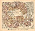
 Bloombsbury map (Charles Booth 1889).jpg 625 × 624; 287 KB
-
 Booth map of Whitechapel.jpg 417 × 432; 248 KB
-
 Booth poverty map colour key.jpg 380 × 107; 15 KB
-
 Booth Povery Map - Great Portland Street Extract 1888-9.JPG 498 × 307; 59 KB
-
 Booth Povery Map - Weymouth New Cavendish Streets Extract 1888-9.jpg 556 × 432; 152 KB
-
 Charles Booth 1889 map - detail showing Lillie Bridge.png 578 × 563; 264 KB
-
 Charles Booth, Life and labour in the people of London Wellcome L0027749.jpg 1,518 × 1,292; 1.27 MB
-
 Charles Booth, Life and labour of the people in London Wellcome L0027742.jpg 3,544 × 3,121; 5.48 MB
-
 Charles Booth, Life and labour of the people in London Wellcome L0027750.jpg 1,510 × 1,282; 1.19 MB
-
 Charles Booth, Life and labour of the people in London Wellcome L0029443.jpg 2,510 × 4,464; 5.43 MB
-
 Charles Booth, Life and labour of the people Wellcome L0027741.jpg 1,508 × 1,266; 1.28 MB
-
 Charles Booth, Life and labour of the people Wellcome L0029442.jpg 3,622 × 3,102; 5.77 MB
-
 Descriptive map of London Poverty in 1889 made by Charls Booth in Toynbee Hall.jpg 4,624 × 2,080; 5.58 MB
-
 Descriptive map of London poverty, 1889 Wellcome L0027751.jpg 5,035 × 3,727; 10.36 MB
-
 Descriptive map of London poverty, 1889 Wellcome L0074435.jpg 8,114 × 5,978; 17.48 MB
-
 Descriptive map of London poverty, 1889 Wellcome L0074436.jpg 6,320 × 5,732; 13.59 MB
-
 Descriptive map of London poverty, 1889 Wellcome L0074437.jpg 6,256 × 5,700; 12.71 MB
-
 Descriptive map of London poverty, 1889 Wellcome L0074438.jpg 6,176 × 5,659; 11.31 MB
-
 Descriptive map of London poverty, 1889. Wellcome L0074439.jpg 6,272 × 5,748; 13 MB
-
 Devonshire Close on Charles Booth's map 1889.jpg 1,158 × 1,080; 714 KB
-
 Finchley Road, Belsize Park, Frognal and Swiss Cottage in Hampstead.png 824 × 732; 1.25 MB
-
 Letter from Hubert Llewllyn Smith to Arthur Acland 1888.jpg 4,624 × 2,080; 4.99 MB
-
 Lillieonmap.jpeg 608 × 875; 294 KB
-
 London Wealth and Poverty 1898-1899 Grafton Square, Clapham Old Town.jpg 1,021 × 639; 156 KB
-
 Museum of London - Charles Booth's survey.JPG 3,264 × 2,448; 3.18 MB
-
 Poverty map old nichol 1889.jpg 556 × 417; 83 KB
-
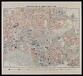
 Printed Map Descriptive of London Poverty 1898-1899. Sheet 10. South West District (22128198814).jpg 11,597 × 6,651; 13.09 MB
-

-

-

-

-
-

-

-

-
 Printed Map Descriptive of London Poverty. Sheet 13(?) covering Woolwich (22643234567).jpg 9,121 × 5,851; 43.79 MB
-
 The Fenian Barracks.png 1,111 × 1,012; 2.51 MB

.jpg)


.jpg)
.jpg)
.jpg)
_(Except).jpg)
.jpg)
.jpg)
.jpg)
_covering_Woolwich_(22643234567)_(cropped)_(cropped).jpg)
_covering_Woolwich_(22643234567)_(cropped).jpg)
_covering_Woolwich_(22643234567).jpg)
