Category:Charles River Bike Path
bicycle path in Boston, Massachusetts .jpg) | |||||
| Upload media | |||||
| Instance of | |||||
|---|---|---|---|---|---|
| Location | Boston, Suffolk County, Massachusetts | ||||
| Length |
| ||||
| Terminus | |||||
| |||||
Subcategories
This category has the following 3 subcategories, out of 3 total.
Media in category "Charles River Bike Path"
The following 11 files are in this category, out of 11 total.
-
 Beacon Park Yard aerial.JPG 6,000 × 3,805; 10.86 MB
-
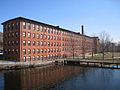 Boston Manufacturing Company mill complex, Waltham, MA - 2.JPG 3,264 × 2,448; 2.43 MB
-
 Boston University Bridge aerial.JPG 5,450 × 3,621; 7.47 MB
-
 Charles River - panoramio (9).jpg 4,592 × 3,056; 4.31 MB
-
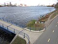 Charles River Basin and ramp to Harvard Bridge, November 2019.jpg 4,000 × 3,000; 3.04 MB
-
 Charles River Trail.jpg 1,080 × 1,920; 1.32 MB
-
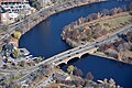 Eliot Bridge Aerial 2.JPG 6,000 × 4,000; 10.91 MB
-
 Grand Junction Railroad Bridge and trail underpass, December 2021.jpg 6,240 × 4,160; 10.24 MB
-
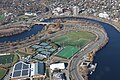 Harvard University Allston athletic fields aerial.JPG 5,332 × 3,552; 6.62 MB
-
 Memorial Drive Loop.jpg 4,083 × 2,717; 3.51 MB
-
 North Point Park Path.jpg 2,448 × 3,264; 3.14 MB


.jpg)


