Category:Charlton Abbots
village and former civil parish in Sudeley, Tewkesbury, Gloucestershire, England | |||||
| Upload media | |||||
| Instance of |
| ||||
|---|---|---|---|---|---|
| Location | Sudeley, Tewkesbury, Gloucestershire, South West England, England | ||||
 | |||||
Charlton Abbots is a village in Gloucestershire. It is part of Sudeley in the Borough of Tewkesbury.
Subcategories
This category has only the following subcategory.
M
Media in category "Charlton Abbots"
The following 30 files are in this category, out of 30 total.
-
 Charlton Abbots - geograph.org.uk - 3081789.jpg 4,320 × 3,240; 4.97 MB
-
 Collapsed wall, Charlton Abbots - geograph.org.uk - 1733585.jpg 640 × 426; 90 KB
-
 Combining oil-seed rape near Charlton Abbots - geograph.org.uk - 4094818.jpg 4,752 × 3,168; 2.75 MB
-

-
 Farm track near Charlton Abbots in July - geograph.org.uk - 1957982.jpg 3,008 × 2,000; 1.53 MB
-
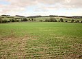 Farmland near Charlton Abbots - geograph.org.uk - 4228844.jpg 3,995 × 2,855; 1.83 MB
-
 Farmland near Charlton Abbots - geograph.org.uk - 4229232.jpg 1,920 × 1,141; 537 KB
-
 Field near Charlton Abbots - geograph.org.uk - 4229734.jpg 1,920 × 2,460; 1.24 MB
-
 Fields of barley near Charlton Abbots - geograph.org.uk - 1957986.jpg 3,008 × 2,000; 1.14 MB
-
 Grazing land near Charlton Abbots - geograph.org.uk - 1333499.jpg 640 × 426; 100 KB
-
 Lane into Charlton Abbots - geograph.org.uk - 4229300.jpg 1,920 × 1,440; 944 KB
-
 Manor House and Farm at Charlton Abbots - geograph.org.uk - 90173.jpg 640 × 426; 161 KB
-
 Map of Gloucestershire OS Map name 027-NE, Ordnance Survey, 1884-1894.jpg 5,354 × 3,575; 2.43 MB
-
 Map of Gloucestershire OS Map name 027-NE, Ordnance Survey, 1884-1894.tiff 5,354 × 3,575; 54.76 MB
-

-
 Pasture, Charlton Abbots - geograph.org.uk - 4229481.jpg 1,920 × 1,209; 737 KB
-
 Small quarry - geograph.org.uk - 1701739.jpg 4,000 × 3,000; 3.59 MB
-
 Timber beside Westwood Lane - geograph.org.uk - 1333513.jpg 640 × 426; 97 KB
-
 View at Charlton Abbots - geograph.org.uk - 4229447.jpg 1,920 × 1,156; 636 KB
-
 View from above Charlton Abbots - geograph.org.uk - 1733591.jpg 640 × 426; 70 KB
-
 West Down - geograph.org.uk - 1333563.jpg 640 × 426; 96 KB
-

-
 Charlton Pool, Charlton Abbots - geograph.org.uk - 160586.jpg 640 × 426; 165 KB
-
 Cotswold lane near Charlton Abbots - geograph.org.uk - 761617.jpg 640 × 426; 74 KB
-
 Dutch Barn near Charlton Abbots - geograph.org.uk - 160589.jpg 640 × 426; 106 KB
-

-
 Farmland near Charlton Abbots - geograph.org.uk - 762568.jpg 640 × 426; 71 KB
-

-
 Hillside near Charlton Abbots - geograph.org.uk - 616947.jpg 640 × 480; 116 KB
-
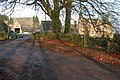
 Lane at Charlton Abbots - geograph.org.uk - 616948.jpg 640 × 480; 157 KB


