Category:Chat Moss
English: Chat Moss
peat bog in the City of Salford, Greater Manchester, England  | |||||
| Upload media | |||||
| Instance of | |||||
|---|---|---|---|---|---|
| Location | Salford, Greater Manchester, North West England, England | ||||
| Area |
| ||||
 | |||||
Subcategories
This category has the following 2 subcategories, out of 2 total.
G
- Glaze Brook (21 F)
L
- Little Woolden Moss (34 F)
Media in category "Chat Moss"
The following 132 files are in this category, out of 132 total.
-
 Boloto Chat.JPG 546 × 204; 24 KB
-
 Chatmoss.jpg 649 × 527; 192 KB
-

-
 Across the Moss - geograph.org.uk - 58370.jpg 640 × 480; 77 KB
-
 Allwood Farm, Moss Side - geograph.org.uk - 4789738.jpg 3,648 × 2,736; 4.11 MB
-
 Astley Moss, north - geograph.org.uk - 4789797.jpg 3,648 × 2,736; 4.57 MB
-
 Astley Moss, south - geograph.org.uk - 4789816.jpg 3,648 × 2,736; 4.78 MB
-
 Astley Road - geograph.org.uk - 4099267.jpg 1,024 × 768; 283 KB
-
 Astley Road - geograph.org.uk - 5474610.jpg 1,280 × 960; 566 KB
-
 Astley Road, Chat Moss - geograph.org.uk - 56446.jpg 640 × 480; 90 KB
-
 Astley Road, Four Lane Ends - geograph.org.uk - 3959819.jpg 640 × 481; 310 KB
-
 Barley field on Astley Moss - geograph.org.uk - 5908803.jpg 5,152 × 3,864; 7.73 MB
-
 Bedford Moss - geograph.org.uk - 5562711.jpg 5,152 × 3,864; 7.68 MB
-
 Bedford Moss to the railway - geograph.org.uk - 5562719.jpg 5,152 × 3,864; 7.72 MB
-
 Chat Moss - Flooded Peat Fields - geograph.org.uk - 3959783.jpg 640 × 481; 398 KB
-
 Chat Moss - geograph.org.uk - 2865521.jpg 4,000 × 3,000; 4.49 MB
-
 Chat Moss - geograph.org.uk - 2897837.jpg 4,591 × 3,056; 5.28 MB
-
 Chat Moss - geograph.org.uk - 50069.jpg 640 × 480; 56 KB
-
 Chat Moss - Not particularly inviting - geograph.org.uk - 2919462.jpg 4,592 × 3,056; 5.22 MB
-
 Chat Moss - Peat Marshes - geograph.org.uk - 3959781.jpg 640 × 481; 287 KB
-
 Chat Moss - The dance of the rushes - geograph.org.uk - 2897881.jpg 4,284 × 2,437; 5.69 MB
-
 Chat Moss - the drainage ditches are very deep - geograph.org.uk - 2898020.jpg 4,487 × 2,986; 5.72 MB
-
 Chat Moss - the right of way is straight ahead - geograph.org.uk - 2897931.jpg 4,300 × 2,861; 6.5 MB
-
 Chat moss map 1937.jpg 1,097 × 624; 165 KB
-
 Chat Moss Twelve Yards Road 1.jpg 3,840 × 2,160; 2.91 MB
-
 Chat Moss Twelve Yards Road 2.jpg 3,840 × 2,160; 4.13 MB
-

-
 Chat Moss, Medley Green - geograph.org.uk - 3959831.jpg 640 × 481; 301 KB
-
 Chat Moss, Red Challis Farm - geograph.org.uk - 3959828.jpg 640 × 481; 312 KB
-
 Chat Moss, Track near Rose Farm - geograph.org.uk - 3959657.jpg 640 × 481; 394 KB
-
 Chat Moss, Twelve Yards Road - geograph.org.uk - 3959799.jpg 640 × 481; 313 KB
-
 Chat moss.jpg 2,000 × 2,116; 6.09 MB
-
 ChatMoss3.jpg 1,091 × 673; 524 KB
-
 Circular footpath, Astley and Bedford Moss - geograph.org.uk - 5562725.jpg 5,152 × 3,864; 7.8 MB
-
 Closely mown grass near Oakfield Farm - geograph.org.uk - 4099335.jpg 1,024 × 768; 127 KB
-
 Corrugated Shed on Chat Moss - geograph.org.uk - 3959774.jpg 640 × 481; 276 KB
-
 Croxton's Peat Field, Chat Moss - geograph.org.uk - 3959745.jpg 640 × 481; 284 KB
-
 Danger, Keep Out - geograph.org.uk - 2961135.jpg 4,280 × 2,855; 7.88 MB
-
 Ditch, field boundary and oil seed rape - geograph.org.uk - 2962034.jpg 4,392 × 2,811; 7.6 MB
-
 Drainage Channel, Chat Moss - geograph.org.uk - 3959739.jpg 480 × 640; 309 KB
-
 Drainage Ditch - geograph.org.uk - 2865294.jpg 3,000 × 4,000; 3.99 MB
-
 Drainage Ditch in Peat Field - geograph.org.uk - 3959670.jpg 640 × 481; 280 KB
-
 Drainage Ditch, Chat Moss - geograph.org.uk - 3972728.jpg 640 × 481; 334 KB
-
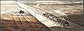
 DV307 no.52 Train at Chatmoss Nov,1857.png 1,510 × 524; 2.27 MB
-
 Elderberries on Rindle Road - geograph.org.uk - 5908780.jpg 5,152 × 3,864; 7.79 MB
-
 Entrance to Red Challis Farm on Astley Road - geograph.org.uk - 4099256.jpg 1,024 × 768; 190 KB
-
 Farm on Chat Moss - geograph.org.uk - 50074.jpg 640 × 480; 43 KB
-
 Farmland near Glazebrook - geograph.org.uk - 2681564.jpg 1,024 × 596; 59 KB
-
 Farmland, Astley Moss - geograph.org.uk - 4789780.jpg 3,648 × 2,736; 4.6 MB
-
 Farmtrack near Hephzibah Farm - geograph.org.uk - 4099320.jpg 1,024 × 768; 141 KB
-
 Fiddlers Lane across Chat Moss - geograph.org.uk - 2961247.jpg 4,592 × 2,715; 5.74 MB
-
 Fiddlers Lane runs between the fields of rape - geograph.org.uk - 2961214.jpg 4,592 × 3,056; 7.46 MB
-
 Flooded Peat Fields, Chat Moss - geograph.org.uk - 3959776.jpg 640 × 481; 238 KB
-
 Four Lane Ends - geograph.org.uk - 3959820.jpg 640 × 481; 332 KB
-
 Four Lane Ends Farm on Irlam Moss - geograph.org.uk - 4099276.jpg 1,024 × 768; 166 KB
-
 Four Lane Ends Farm, Irlam Moss - geograph.org.uk - 3959814.jpg 640 × 481; 319 KB
-
 Glaze Brook - geograph.org.uk - 33283.jpg 640 × 480; 111 KB
-
 Great Moss Road - geograph.org.uk - 4789729.jpg 3,648 × 2,736; 4.65 MB
-
 In need of some repair^ - geograph.org.uk - 50081.jpg 640 × 480; 97 KB
-
 Irlam Moss - geograph.org.uk - 3959808.jpg 640 × 481; 303 KB
-
 Irlam Moss, Astley Road - geograph.org.uk - 3959815.jpg 640 × 481; 377 KB
-
 Irlam Moss, Mosslands Farm - geograph.org.uk - 3959823.jpg 640 × 480; 332 KB
-
 IrlamMoss.jpg 640 × 480; 102 KB
-

-
 Land by the canal - geograph.org.uk - 1092308.jpg 640 × 480; 89 KB
-
 Liverpool line from Rindle Farm (1) - geograph.org.uk - 5562686.jpg 5,152 × 3,864; 7.11 MB
-
 Liverpool line from Rindle Farm (2) - geograph.org.uk - 5562688.jpg 5,152 × 3,864; 7.65 MB
-
 Liverpool line from Rindle Lane - geograph.org.uk - 5562702.jpg 5,152 × 3,864; 7.65 MB
-

-
 Moss Farm - geograph.org.uk - 3959793.jpg 640 × 480; 303 KB
-
 Moss Farm, Chat Moss - geograph.org.uk - 1909886.jpg 4,224 × 3,168; 5.37 MB
-
 Moss House Farm - geograph.org.uk - 2637779.jpg 3,872 × 2,592; 5.77 MB
-
 Moss House Farm - geograph.org.uk - 2919290.jpg 4,592 × 3,056; 7.33 MB
-
 Moss Lane - geograph.org.uk - 3959422.jpg 640 × 481; 389 KB
-
 Moss Lane - geograph.org.uk - 3959625.jpg 640 × 481; 321 KB
-
 Moss Lane - geograph.org.uk - 3960027.jpg 640 × 480; 340 KB
-

-
 Moss Pond - geograph.org.uk - 3959834.jpg 640 × 481; 427 KB
-
 Mossland - geograph.org.uk - 60379.jpg 640 × 480; 88 KB
-
 Mosslands Farm from Astley Road - geograph.org.uk - 4099270.jpg 1,024 × 768; 261 KB
-
 New Moss Wood - geograph.org.uk - 2329795.jpg 800 × 600; 420 KB
-

-
 Olive Mount Cottage, Chat Moss - geograph.org.uk - 3959826.jpg 640 × 481; 340 KB
-
 Overgrown footpath on Cadishead Moss - geograph.org.uk - 4099375.jpg 1,024 × 768; 242 KB
-
 Path in Windy Bank Wood - geograph.org.uk - 2748070.jpg 3,000 × 4,000; 3.96 MB
-
 Path into New Moss Wood - geograph.org.uk - 2329816.jpg 800 × 600; 329 KB
-
 Path into Windy Bank Wood - geograph.org.uk - 4028716.jpg 640 × 480; 402 KB
-
 Path junction on Chat Moss - geograph.org.uk - 5471917.jpg 1,280 × 960; 494 KB
-
 Path Through Windy Bank Wood - geograph.org.uk - 4028743.jpg 640 × 484; 430 KB
-
 Path to Beech Tree Cottage Farm, Astley Moss - geograph.org.uk - 4789760.jpg 3,648 × 2,736; 5.14 MB
-
 Peat Field on Chat Moss - geograph.org.uk - 3959658.jpg 640 × 481; 257 KB
-
 Peat Field, Chat Moss - geograph.org.uk - 3972695.jpg 640 × 481; 379 KB
-
 Peat Marshes, Chat Moss - geograph.org.uk - 3959780.jpg 640 × 480; 245 KB
-
 PeatWorkingsIrlam.jpg 640 × 480; 67 KB
-
 Pylons Across Chat Moss - geograph.org.uk - 3972712.jpg 482 × 640; 281 KB
-
 Railway at Astley Moss - geograph.org.uk - 4789753.jpg 3,648 × 2,736; 3.52 MB
-
 Raspberry Lane, Irlam Moss - geograph.org.uk - 3972681.jpg 640 × 481; 375 KB
-
 Rindle Farm, Astley Moss - geograph.org.uk - 4789751.jpg 3,648 × 2,736; 3.48 MB
-
 Road on Chat Moss - geograph.org.uk - 50079.jpg 640 × 480; 81 KB
-
 Roscoe Road joins Astley Road - geograph.org.uk - 4099297.jpg 1,024 × 768; 259 KB
-
 Rose Farm on Astley Road - geograph.org.uk - 4099381.jpg 1,024 × 768; 205 KB
-
 Sandy Lane, Moss Side - geograph.org.uk - 4789733.jpg 3,648 × 2,736; 4.74 MB
-

-

-
 The entrance to Birch View Farm - geograph.org.uk - 4099353.jpg 1,024 × 768; 328 KB
-
 The poplar lined drive to Larkhill Farm - geograph.org.uk - 4099286.jpg 1,024 × 768; 293 KB
-
-

-
 The track by Ebenezer Farm - geograph.org.uk - 2897483.jpg 4,317 × 2,882; 6.33 MB
-
 The track towards Astley Moss - geograph.org.uk - 2897759.jpg 4,384 × 2,917; 7.84 MB
-
 The Twelve Yards Road near Moss Farm - geograph.org.uk - 4099363.jpg 1,024 × 768; 212 KB
-
 This is what we've been waiting for - geograph.org.uk - 2919646.jpg 4,004 × 2,665; 5.84 MB
-
 This structure has seen better days - geograph.org.uk - 2898043.jpg 4,592 × 3,056; 5.31 MB
-

-
 Track across Irlam Moss - geograph.org.uk - 3959803.jpg 640 × 481; 292 KB
-
 Track at Windy Bank - geograph.org.uk - 4028732.jpg 640 × 480; 324 KB
-
 Track junction by Four Winds Farm - geograph.org.uk - 2919574.jpg 4,045 × 3,053; 5.95 MB
-
 Track on Astley Moss - geograph.org.uk - 3959855.jpg 640 × 481; 377 KB
-
 Track Towards Birch Farm - geograph.org.uk - 3959864.jpg 640 × 481; 344 KB
-
 Track Towards Birch Farm - geograph.org.uk - 3972732.jpg 640 × 480; 364 KB
-
 Track towards Woodbarn Farm - geograph.org.uk - 3959797.jpg 640 × 480; 320 KB
-
 Tractors at Moss Lodge Farm - geograph.org.uk - 2637666.jpg 3,872 × 2,592; 4.65 MB
-
 Train Crossing Chat Moss - geograph.org.uk - 4028693.jpg 640 × 480; 295 KB
-
 Turf being grown by Woolden View Farm - geograph.org.uk - 2635922.jpg 3,872 × 2,592; 4.32 MB
-
 Twelve Yards Road from the junction - geograph.org.uk - 2962056.jpg 4,592 × 3,056; 6 MB
-
 Twelve Yards Road, Chat Moss - geograph.org.uk - 3959784.jpg 640 × 481; 276 KB
-
 Vegetable production on Little Woolden Moss - geograph.org.uk - 2637616.jpg 3,872 × 2,592; 4.35 MB
-
 Wheat field near Little Woolden Hall - geograph.org.uk - 2637921.jpg 3,872 × 2,592; 5.71 MB
-
 White Gate Farm - geograph.org.uk - 2637686.jpg 3,872 × 2,592; 4.31 MB
-
 Birch Tree Farm and Moss Road - geograph.org.uk - 51791.jpg 640 × 480; 81 KB
-
 Irlam Moss - geograph.org.uk - 1757.jpg 640 × 480; 28 KB
-
 Peat - geograph.org.uk - 44659.jpg 640 × 480; 76 KB


_-_geograph.org.uk_-_5562686.jpg)
_-_geograph.org.uk_-_5562688.jpg)


