Category:Chawleigh
English: Chawleigh is a village in mid- Devon, England, situated just off the A377 between Crediton and Barnstaple.
village in the United Kingdom  | |||||
| Upload media | |||||
| Instance of | |||||
|---|---|---|---|---|---|
| Location | Mid Devon, Devon, South West England, England | ||||
| Said to be the same as | Chawleigh (Wikimedia duplicated page, civil parish) | ||||
 | |||||
Subcategories
This category has the following 4 subcategories, out of 4 total.
Media in category "Chawleigh"
The following 200 files are in this category, out of 286 total.
(previous page) (next page)-
 'Recycling Pavilion', Chawleigh - geograph.org.uk - 107291.jpg 640 × 426; 108 KB
-
 A377 about to enter Chenson - geograph.org.uk - 5524907.jpg 2,128 × 1,388; 1.63 MB
-
 A377 at Chenson - geograph.org.uk - 2331318.jpg 640 × 522; 103 KB
-
 A377 at Chenson - geograph.org.uk - 5211090.jpg 2,951 × 1,841; 841 KB
-
 A377 at Chenson - geograph.org.uk - 5305921.jpg 3,072 × 2,048; 1.14 MB
-
 A377 in Fox Covert - geograph.org.uk - 2331297.jpg 640 × 480; 134 KB
-
 A377 near Chenson - geograph.org.uk - 5211097.jpg 3,072 × 2,048; 1.28 MB
-
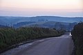
 A377 near Eggesford Barton - geograph.org.uk - 5551667.jpg 2,256 × 1,496; 1.86 MB
-
 A377 near Rashleigh - geograph.org.uk - 3701164.jpg 1,536 × 1,153; 1.11 MB
-
 A377 north of Eggesford - geograph.org.uk - 5551591.jpg 2,256 × 1,496; 1.93 MB
-
 A377 towards the Dart Bridge - geograph.org.uk - 5551595.jpg 2,256 × 1,496; 1.82 MB
-
 Access road into woodland east of Chawleigh - geograph.org.uk - 3509050.jpg 1,024 × 768; 207 KB
-
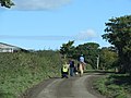
 Approach to Chawleigh - geograph.org.uk - 2120246.jpg 640 × 480; 72 KB
-
 At Southcott Farm - geograph.org.uk - 3587180.jpg 1,024 × 681; 159 KB
-
 Autumn colour in Eggesford Forest - geograph.org.uk - 1569679.jpg 640 × 480; 184 KB
-
 B3042 near Bearhill - geograph.org.uk - 2331121.jpg 640 × 407; 71 KB
-
 B3042 near Burridge Moor Cross - geograph.org.uk - 4707694.jpg 1,920 × 1,440; 565 KB
-
 B3042 on Burridge Moor - geograph.org.uk - 4707681.jpg 1,920 × 1,440; 901 KB
-
 Back Lane near Stone Mill Bridge - geograph.org.uk - 3509021.jpg 768 × 1,024; 197 KB
-
 Barn at Nethercott - geograph.org.uk - 3587164.jpg 1,024 × 768; 162 KB
-
 Bells Close, Chawleigh - geograph.org.uk - 3509099.jpg 1,024 × 768; 114 KB
-
 Bend in lane near Stone Mill Cottage - geograph.org.uk - 4708048.jpg 1,920 × 1,319; 807 KB
-
 Bend in lane near Stone Mill Cottage - geograph.org.uk - 4708059.jpg 2,491 × 1,878; 1.28 MB
-
 Bridge near Carpenter's Cross - geograph.org.uk - 2330436.jpg 640 × 480; 111 KB
-

-
 Bridleway at Handsford Farm - geograph.org.uk - 3853618.jpg 1,536 × 1,152; 1.42 MB
-
 Bridleway beside Handsford Farm, Lapford - geograph.org.uk - 107869.jpg 640 × 426; 172 KB
-
 Bridleway in the Taw valley - geograph.org.uk - 2331252.jpg 480 × 640; 96 KB
-
 Bridleway in the Taw valley - geograph.org.uk - 2331264.jpg 640 × 480; 111 KB
-
 Bridleway to Stone Barton - geograph.org.uk - 2120277.jpg 640 × 480; 121 KB
-
 Bridleway, Chenson - geograph.org.uk - 5213105.jpg 3,072 × 2,048; 1.48 MB
-
 Bungalows on the west of Chawleigh - geograph.org.uk - 3509096.jpg 1,024 × 768; 102 KB
-
 Burridge Camp - geograph.org.uk - 4083214.jpg 1,920 × 1,440; 1.02 MB
-
 Burridge Camp - geograph.org.uk - 4478283.jpg 1,920 × 1,440; 1.01 MB
-
 Chawleigh , B3042 - geograph.org.uk - 6039993.jpg 6,000 × 4,000; 6.94 MB
-
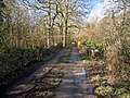
 Chawleigh - a lane by The Barton - geograph.org.uk - 1278153.jpg 640 × 498; 142 KB
-
 Chawleigh - Lane by The Barton - geograph.org.uk - 1278176.jpg 640 × 480; 141 KB
-
 Chawleigh goes digital - geograph.org.uk - 1278163.jpg 513 × 640; 117 KB
-
 Chawleigh Hill - geograph.org.uk - 3622395.jpg 640 × 480; 93 KB
-
 Chawleigh sewage works - geograph.org.uk - 3509054.jpg 768 × 1,024; 246 KB
-
 Chawleigh village hall - geograph.org.uk - 3509084.jpg 1,024 × 768; 152 KB
-
 Chawleigh village school - geograph.org.uk - 107864.jpg 640 × 426; 95 KB
-

-
 Chawleigh Week Cross - geograph.org.uk - 3622106.jpg 1,600 × 1,227; 1.36 MB
-
 Chawleigh Week Mill Cross - geograph.org.uk - 554643.jpg 640 × 480; 88 KB
-
 Chawleigh, street furniture - geograph.org.uk - 420134.jpg 640 × 427; 178 KB
-
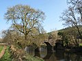
 Cheldon Bridge - geograph.org.uk - 249711.jpg 640 × 480; 174 KB
-
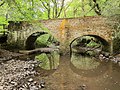 Cheldon Bridge - geograph.org.uk - 4478326.jpg 1,920 × 1,440; 1.07 MB
-
 Cheldon Bridge Cottage - geograph.org.uk - 4366074.jpg 4,000 × 3,000; 5.43 MB
-
 Cheldon Bridge on the Little Dart River - geograph.org.uk - 4368751.jpg 4,000 × 3,000; 4.8 MB
-

-

-
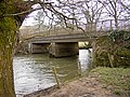
 Chenson Bridge - geograph.org.uk - 2331374.jpg 640 × 480; 110 KB
-
 Chenson Bridge - geograph.org.uk - 2331383.jpg 640 × 480; 117 KB
-
 Chenson Bridge on the river Taw - geograph.org.uk - 1856601.jpg 1,024 × 768; 297 KB
-
 Chenson Bridge on the river Taw - geograph.org.uk - 1856604.jpg 1,024 × 768; 320 KB
-

-
 Chenson woods - geograph.org.uk - 162519.jpg 640 × 480; 168 KB
-
 Chenson Woods Bluebells - geograph.org.uk - 1481879.jpg 640 × 480; 176 KB
-
-
-
 Chulmleigh Bridge over Little Dart River - geograph.org.uk - 4603963.jpg 1,600 × 1,200; 1.47 MB
-

-
 Church dustbin, Chawleigh - geograph.org.uk - 1278296.jpg 525 × 640; 150 KB
-
 Churchyard, Chawleigh - geograph.org.uk - 2330666.jpg 640 × 480; 146 KB
-
 Churchyard, Chawleigh - geograph.org.uk - 2330698.jpg 480 × 640; 140 KB
-
 Cloepark Lane - geograph.org.uk - 2330476.jpg 640 × 480; 90 KB
-
 Clover in a field at Wembworthy Down - geograph.org.uk - 249721.jpg 480 × 640; 178 KB
-
 Cottages near Stonemill Farm, Chawleigh - geograph.org.uk - 107293.jpg 640 × 426; 149 KB
-

-
 Direction Sign - Signpost in Chawleigh - geograph.org.uk - 6102338.jpg 640 × 523; 152 KB
-
 Disused Weighbridge - geograph.org.uk - 26094.jpg 640 × 480; 142 KB
-
 Driveway to Nutson Farm - geograph.org.uk - 107866.jpg 640 × 426; 98 KB
-
 Eggesford , Fox and Hounds Hotel - geograph.org.uk - 5069302.jpg 6,000 × 4,000; 6.53 MB
-
 Eggesford , Houses - geograph.org.uk - 6184974.jpg 3,648 × 2,736; 3.49 MB
-
 Eggesford , Houses - geograph.org.uk - 6184975.jpg 3,648 × 2,736; 4.25 MB
-
 Eggesford Church - geograph.org.uk - 3621662.jpg 506 × 640; 115 KB
-

-
 Eggesford Station - geograph.org.uk - 5550682.jpg 480 × 640; 76 KB
-
 Entering Eggesford on the A377 - geograph.org.uk - 5551581.jpg 2,213 × 1,467; 2.23 MB
-
 Entrance to Chawleigh - geograph.org.uk - 3280677.jpg 640 × 442; 45 KB
-
 Entrance to wheat field by Upcott Wood - geograph.org.uk - 3587162.jpg 1,024 × 768; 157 KB
-
 Farm buildings at Great Burridge - geograph.org.uk - 249703.jpg 640 × 480; 141 KB
-
 Farmyard, Mary Week - geograph.org.uk - 3622164.jpg 640 × 517; 107 KB
-
 Field access track and bridleway, near Handsford Farm - geograph.org.uk - 3853765.jpg 1,152 × 1,536; 1.14 MB
-
 Field at Chenson - geograph.org.uk - 5213232.jpg 3,072 × 2,048; 1.73 MB
-
 Field at Mounticombe Cross - geograph.org.uk - 4708697.jpg 1,920 × 1,420; 885 KB
-
 Field at Nutson - geograph.org.uk - 4082856.jpg 1,920 × 1,223; 557 KB
-
 Field beside the B3042 - geograph.org.uk - 249701.jpg 640 × 480; 130 KB
-
 Field near Handsford Farm - geograph.org.uk - 4082844.jpg 1,920 × 1,151; 569 KB
-
 Field of wheat beside Upcott Wood - geograph.org.uk - 3587158.jpg 1,024 × 768; 170 KB
-

-
 Footpath crossing the B3042 near Chawleigh - geograph.org.uk - 3588393.jpg 1,024 × 768; 166 KB
-
 Footpath in Homeland Wood - geograph.org.uk - 3587174.jpg 768 × 1,024; 278 KB
-
 Footpath in the woods at Eggesford - geograph.org.uk - 162525.jpg 640 × 480; 152 KB
-
 Footpath into Homeland Wood - geograph.org.uk - 3588492.jpg 1,024 × 768; 219 KB
-
 Footpath, Rodgemonts - geograph.org.uk - 3622242.jpg 504 × 640; 108 KB
-
 Ford Farm - geograph.org.uk - 103050.jpg 640 × 480; 73 KB
-
 Ford Moor Toll House - geograph.org.uk - 6115281.jpg 640 × 508; 156 KB
-
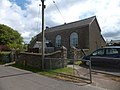
 Former Methodist church, Chawleigh - geograph.org.uk - 2330530.jpg 640 × 442; 87 KB
-
 Former Methodist Church, Chawleigh - geograph.org.uk - 3588422.jpg 1,024 × 768; 124 KB
-
 Hay bales at Great Burridge - geograph.org.uk - 249699.jpg 640 × 480; 113 KB
-
 Hilltown Cross - geograph.org.uk - 3587186.jpg 1,024 × 768; 115 KB
-
 Hollow Tree Cross - geograph.org.uk - 2330972.jpg 640 × 471; 88 KB
-
 Hollow Tree Cross, Chawleigh - geograph.org.uk - 3588397.jpg 1,024 × 768; 171 KB
-
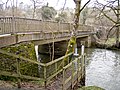
 Homeland Bridge - geograph.org.uk - 3588520.jpg 1,024 × 768; 237 KB
-
 Homeland Wood - geograph.org.uk - 453378.jpg 480 × 640; 137 KB
-
-
 Junction at Eggesford - geograph.org.uk - 2331184.jpg 640 × 480; 106 KB
-
 Labbett's Cross - geograph.org.uk - 3853600.jpg 1,536 × 1,152; 1.09 MB
-
 Lane past Toatley Farm - geograph.org.uk - 2330214.jpg 480 × 640; 123 KB
-
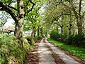
 Lane to Chawleigh - geograph.org.uk - 2330205.jpg 640 × 470; 82 KB
-
 Lane to Labbett's Cross - geograph.org.uk - 4477895.jpg 1,920 × 2,458; 1.05 MB
-
 Leigh Bridge on the Little Dart River - geograph.org.uk - 4368746.jpg 4,000 × 3,000; 4.57 MB
-
 Leigh Bridge, near Cheldon - geograph.org.uk - 126112.jpg 640 × 426; 157 KB
-
 Level Crossing at Chenson - geograph.org.uk - 79358.jpg 640 × 426; 155 KB
-
 Level crossing at Eggesford - geograph.org.uk - 5545757.jpg 640 × 480; 122 KB
-
 Level crossing at Eggesford Station - geograph.org.uk - 3960618.jpg 1,600 × 1,063; 538 KB
-
 Level Crossing Eggesford Station by A377 - geograph.org.uk - 5549603.jpg 640 × 480; 102 KB
-
 Level crossing, Chenson - geograph.org.uk - 2331369.jpg 640 × 480; 110 KB
-
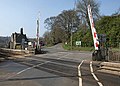 Level crossing, Eggesford - geograph.org.uk - 2331240.jpg 640 × 457; 90 KB
-
 Little Dart River from Stone Mill Bridge - geograph.org.uk - 3509034.jpg 1,024 × 768; 249 KB
-
 Little Dart Valley - geograph.org.uk - 3622325.jpg 640 × 456; 67 KB
-
 Lone tree west of White Gates Farm - geograph.org.uk - 3853565.jpg 1,536 × 1,536; 1.11 MB
-

-
 Looking down the Little Dart River from Cheldon Bridge - geograph.org.uk - 4368753.jpg 4,000 × 3,000; 4.85 MB
-
 Looking down the Little Dart River from Chulmleigh Bridge - geograph.org.uk - 4367910.jpg 4,000 × 3,000; 5.04 MB
-
 Looking down the Little Dart River from Stone Mill Bridge - geograph.org.uk - 4368254.jpg 4,000 × 3,000; 4.07 MB
-

-
 Looking up the Little Dart River from Cheldon Bridge - geograph.org.uk - 4368754.jpg 4,000 × 3,000; 4.6 MB
-
 Looking up the Little Dart River from Chulmleigh Bridge - geograph.org.uk - 4367915.jpg 4,000 × 3,000; 5.13 MB
-
 Looking up the Little Dart River from Dart Bridge - geograph.org.uk - 4367862.jpg 4,000 × 3,000; 4.72 MB
-
 Looking up the Little Dart River from Stone Mill Bridge - geograph.org.uk - 4368258.jpg 4,000 × 3,000; 4.44 MB
-

-
 Lych gate, Chawleigh, Devon - geograph.org.uk - 1725970.jpg 800 × 544; 196 KB
-
 Maize and barn in the mist - geograph.org.uk - 555541.jpg 640 × 480; 93 KB
-
 Marked Forest Trail, Eggesford - geograph.org.uk - 162524.jpg 640 × 480; 152 KB
-
 Marshy valley west of Chawleigh - geograph.org.uk - 3588384.jpg 1,024 × 768; 163 KB
-
 Meadow at Chenson - geograph.org.uk - 2331326.jpg 640 × 480; 99 KB
-
 Meadow by the Little Dart - geograph.org.uk - 4477983.jpg 1,920 × 1,468; 918 KB
-
 Mid Devon , B3042 Road - geograph.org.uk - 2800327.jpg 4,288 × 2,848; 5.38 MB
-
 Mid Devon , B3042 Road - geograph.org.uk - 2800335.jpg 4,288 × 2,848; 5.06 MB
-
 Mid Devon , B3042 Road - geograph.org.uk - 2800345.jpg 4,288 × 2,848; 4.72 MB
-
 Mid Devon , B3042 Road - geograph.org.uk - 2800357.jpg 4,288 × 2,848; 3.93 MB
-
 Mid Devon , Barn ^ Scenery - geograph.org.uk - 2800255.jpg 4,288 × 2,848; 4.34 MB
-
 Mid Devon , Chawleigh Hill B3096 - geograph.org.uk - 6184981.jpg 3,648 × 2,736; 6.11 MB
-
 Mid Devon , Chawleigh Week Cross - geograph.org.uk - 2800263.jpg 4,288 × 2,848; 6.14 MB
-
 Mid Devon , Chulmleigh Scenery - geograph.org.uk - 2800373.jpg 3,436 × 2,282; 1.79 MB
-
 Mid Devon , Country Lane - geograph.org.uk - 6184976.jpg 3,648 × 2,736; 7.85 MB
-
 Mid Devon , Country Lane - geograph.org.uk - 6184978.jpg 3,648 × 2,736; 5.28 MB
-
 Mid Devon , Country Road - geograph.org.uk - 2800273.jpg 4,288 × 2,848; 6.19 MB
-
 Mid Devon , Darky Lane - geograph.org.uk - 2800258.jpg 4,288 × 2,848; 6.65 MB
-
 Mid Devon , Darky Lane - geograph.org.uk - 6184980.jpg 3,648 × 2,736; 4.38 MB
-
 Mid Devon , Farm Track - geograph.org.uk - 2800242.jpg 4,288 × 2,848; 6.15 MB
-
 Mid Devon , Farm Track - geograph.org.uk - 2800248.jpg 4,288 × 2,848; 6.22 MB
-
 Mid Devon , Farm Track - geograph.org.uk - 2800268.jpg 4,288 × 2,848; 6.29 MB
-
 Mid Devon , Farm Track - geograph.org.uk - 2800372.jpg 4,288 × 2,848; 5.33 MB
-
 Mid Devon , Field Entrance - geograph.org.uk - 2800355.jpg 4,288 × 2,848; 4.12 MB
-
 Mid Devon , Field ^ Sunset - geograph.org.uk - 2800266.jpg 4,158 × 2,640; 3.83 MB
-
 Mid Devon , Field ^ Upcott Wood - geograph.org.uk - 2800284.jpg 4,166 × 2,652; 4.44 MB
-
 Mid Devon , Footpath Sign ^ Upcott Woods - geograph.org.uk - 2800319.jpg 4,288 × 2,848; 6.57 MB
-
 Mid Devon , Footpath ^ Field - geograph.org.uk - 2800294.jpg 2,848 × 4,288; 6.29 MB
-
 Mid Devon , Grassy Area - geograph.org.uk - 5739520.jpg 6,000 × 4,000; 6.04 MB
-
 Mid Devon , Grassy Field - geograph.org.uk - 2800275.jpg 4,188 × 2,688; 4.12 MB
-
 Mid Devon , Grassy Field - geograph.org.uk - 2800278.jpg 4,202 × 2,712; 4.42 MB
-
 Mid Devon , Grassy Field - geograph.org.uk - 2800315.jpg 4,288 × 2,848; 5.82 MB
-
 Mid Devon , Grassy Field - geograph.org.uk - 2800331.jpg 4,288 × 2,848; 4.11 MB
-
 Mid Devon , Grassy Field - geograph.org.uk - 2800337.jpg 4,288 × 2,848; 4.88 MB
-
 Mid Devon , Grassy Field - geograph.org.uk - 2800340.jpg 4,288 × 2,848; 5.02 MB
-
 Mid Devon , Grassy Field - geograph.org.uk - 2800347.jpg 4,288 × 2,848; 4.28 MB
-
 Mid Devon , Grassy Field ^ Tractor Track - geograph.org.uk - 2800359.jpg 4,288 × 2,848; 4.95 MB
-
 Mid Devon , Grassy Field ^ Tractor Track - geograph.org.uk - 2800361.jpg 4,288 × 2,848; 4.85 MB
-
 Mid Devon , Hollow Tree Cross - geograph.org.uk - 5739523.jpg 6,000 × 4,000; 5.25 MB
-
 Mid Devon , House ^ Tree - geograph.org.uk - 2800356.jpg 4,288 × 2,848; 5.57 MB
-
 Mid Devon , Little River Dart - geograph.org.uk - 2800233.jpg 4,288 × 2,848; 6.33 MB
-
 Mid Devon , Little River Dart - geograph.org.uk - 2800235.jpg 4,288 × 2,848; 6.24 MB
-
 Mid Devon , Little River Dart - geograph.org.uk - 2800237.jpg 4,288 × 2,848; 6.85 MB
-
 Mid Devon , Moortown Cottage - geograph.org.uk - 2800367.jpg 4,288 × 2,848; 3.83 MB
-
 Mid Devon , Muddy Field Entrance - geograph.org.uk - 2800349.jpg 4,288 × 2,848; 5.45 MB
-
 Mid Devon , Muddy Footpath - geograph.org.uk - 2800362.jpg 4,288 × 2,848; 5.51 MB
-
 Mid Devon , Muddy Footpath ^ Sign - geograph.org.uk - 2800363.jpg 4,288 × 2,848; 5.26 MB
-
 Mid Devon , Nethercott Farm - geograph.org.uk - 2800326.jpg 4,288 × 2,848; 5.42 MB
-
 Mid Devon , Nethercott Farm - geograph.org.uk - 2800329.jpg 4,288 × 2,848; 5.24 MB
-
 Mid Devon , Old Sawmill Bonfire - geograph.org.uk - 2800281.jpg 4,206 × 2,720; 3.07 MB
-
 Mid Devon , Path through Upcott Woods - geograph.org.uk - 2800313.jpg 4,288 × 2,848; 6.89 MB
-
 Mid Devon , Ploughed Field - geograph.org.uk - 2800352.jpg 4,288 × 2,848; 4.37 MB
-
 Mid Devon , Small Lane - geograph.org.uk - 5739521.jpg 6,000 × 4,000; 7.85 MB
-
 Mid Devon , Small Lane - geograph.org.uk - 5739522.jpg 6,000 × 4,000; 7.01 MB
-
 Mid Devon , Small Stream ^ Sunset - geograph.org.uk - 2800290.jpg 4,288 × 2,848; 4.85 MB
-
 Mid Devon , Snowdrops - geograph.org.uk - 2800370.jpg 4,288 × 2,848; 6.06 MB
-
 Mid Devon , Sunset Scene - geograph.org.uk - 2800251.jpg 4,288 × 2,848; 3.34 MB
-
 Mid Devon , The B3042 - geograph.org.uk - 6039994.jpg 6,000 × 4,000; 6.49 MB
-
 Mid Devon , The B3042 - geograph.org.uk - 6039996.jpg 6,000 × 4,000; 6.32 MB
-
 Mid Devon , The B3096 - geograph.org.uk - 2800364.jpg 4,288 × 2,848; 4.93 MB
-
 Mid Devon , The B3096 - geograph.org.uk - 2800365.jpg 4,288 × 2,848; 3.84 MB
-
 Mid Devon , The B3096 - geograph.org.uk - 2800371.jpg 4,288 × 2,848; 5.5 MB
-
 Mid Devon , Tractor Tracks in the Field - geograph.org.uk - 2800316.jpg 2,848 × 4,288; 5.59 MB
-
 Mid Devon , Trees ^ Fields - geograph.org.uk - 2800344.jpg 4,288 × 2,848; 4.94 MB
-
 Mid Devon , Turnpike Cottage - geograph.org.uk - 2800368.jpg 4,288 × 2,848; 4.99 MB
-
 Mid Devon , Upcott Wood - geograph.org.uk - 2800298.jpg 4,288 × 2,848; 6.27 MB


