Category:Che Kung Miu Road Playground
| Object location | | View all coordinates using: OpenStreetMap |
|---|
中文:車公廟路遊樂場
| Upload media | |||||
| Instance of | |||||
|---|---|---|---|---|---|
| Location | |||||
 | |||||
Media in category "Che Kung Miu Road Playground"
The following 7 files are in this category, out of 7 total.
-
 Che Kung Miu Road Playground 2023.jpg 4,032 × 3,024; 4.75 MB
-
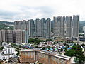
 Festival City 2018.jpg 1,600 × 1,200; 1.88 MB
-
 Hin Tin Swimming Pool 201706.jpg 1,600 × 1,200; 2.02 MB
-
 HK Festival City Overview 201208.jpg 2,272 × 1,704; 3 MB
-
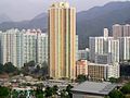 HK HinYiuEstate.JPG 1,280 × 960; 291 KB
-
 HKRoute8highway 1B Exit.JPG 1,280 × 960; 298 KB
-
 Tin Sum Tsuen 201208.jpg 1,488 × 849; 1.43 MB


